
Bikepacking de Bovec à Kranjska Gora
Personnalise ton propre itinéraire à partir de notre modèle ou découvre comment notre communauté préfère rouler de Bovec à Kranjska Gora.
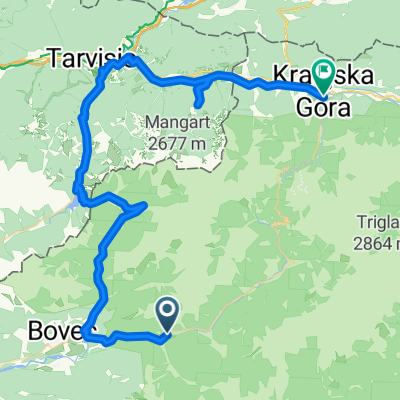
Modèle d’itinéraire
De Bovec à Kranjska Gora

- 15 h 30 min
- Durée
- 202,2 km
- Distance
- 7 793 m
- Montée
- 7 264 m
- Descente
- 13 km/h
- Vit. moyenne
- 1 197 m
- Altitude max.
This epic cycling journey takes you from the charming alpine town of Bovec to the popular outdoor hub of Kranjska Gora. Bovec, nestled in the stunning Soča Valley, is famous for its emerald river and adventure sports—think rafting, canyoning, and paragliding. The ride itself is no small feat: over 200 km with almost 8,000 meters of climbing! Expect a mix of quiet roads, forest tracks, and a healthy dose of unpaved sections—so bring your grit (and grippy tires).
You’ll pedal through jaw-dropping mountain views, quaint Slovenian villages, and thick forests, often with the Julian Alps as a backdrop. There are plenty of quiet stretches, and only a whisker of busy roads, so you’ll have lots of time to soak in the scenery. The route wraps up in Kranjska Gora, famous for its ski slopes, biking parks, and postcard-pretty lakes.
Plan for a long day—or better yet, split it up and savor the adventure. This is Slovenia at its best: dramatic, peaceful, and perfect for anyone who loves a real challenge.
Tours en bikepacking
Déjà découpé en étapes parfaites par notre communauté
 Tour
Tour
Communauté
Meilleurs utilisateurs dans cette région


De notre communauté
Les meilleurs itinéraires à vélo de Bovec à Kranjska Gora
Log pod Mangartom to Mangart
Itinéraire à vélo à Bovec, Občina Bovec, Slovénie
- 11,1 km
- Distance
- 1 291 m
- Montée
- 349 m
- Descente

Okoli triglavskega narodnega parka
Itinéraire à vélo à Bovec, Občina Bovec, Slovénie
- 243,1 km
- Distance
- 2 462 m
- Montée
- 2 513 m
- Descente
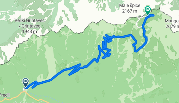
Mangart od odcepa pri mostu.
Itinéraire à vélo à Bovec, Občina Bovec, Slovénie
- 10,5 km
- Distance
- 1 420 m
- Montée
- 825 m
- Descente

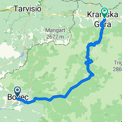
Bikeways from Bovec to Kranjska Gora, climbing the Vrsic.
Itinéraire à vélo à Bovec, Občina Bovec, Slovénie
- 55,1 km
- Distance
- 1 871 m
- Montée
- 1 518 m
- Descente

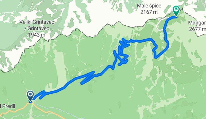
nr 7 Mangartsko sedlo 2055 m
Itinéraire à vélo à Bovec, Občina Bovec, Slovénie
- 26,6 km
- Distance
- 2 009 m
- Montée
- 415 m
- Descente

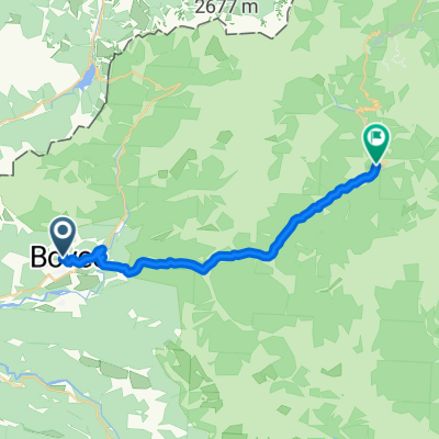
Bovec - Kranjska gora
Itinéraire à vélo à Bovec, Občina Bovec, Slovénie
- 47,6 km
- Distance
- 918 m
- Montée
- 589 m
- Descente

Tour4 Teil 1 Bovec - mangart 2014
Itinéraire à vélo à Bovec, Občina Bovec, Slovénie
- 26,4 km
- Distance
- 1 661 m
- Montée
- 59 m
- Descente

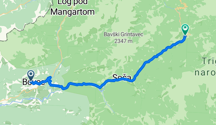
Soca - Kranjska Gora
Itinéraire à vélo à Bovec, Občina Bovec, Slovénie
- 57,8 km
- Distance
- 1 054 m
- Montée
- 697 m
- Descente

Bikemap smece
Itinéraire à vélo à Bovec, Občina Bovec, Slovénie
- 53,9 km
- Distance
- 1 694 m
- Montée
- 908 m
- Descente
2a. Etappe Bovec - Trenta per Bus
Itinéraire à vélo à Bovec, Občina Bovec, Slovénie
- 20,4 km
- Distance
- 389 m
- Montée
- 254 m
- Descente
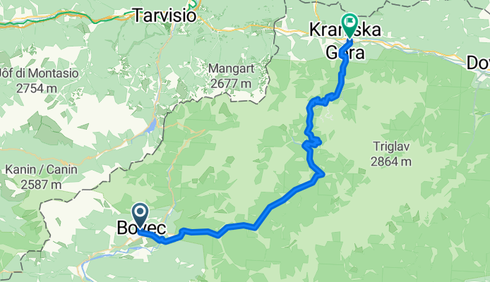
Bovec to Kranjska Gora
Itinéraire à vélo à Bovec, Občina Bovec, Slovénie
- 44,8 km
- Distance
- 1 189 m
- Montée
- 861 m
- Descente

Bovec - Mangart
Itinéraire à vélo à Bovec, Občina Bovec, Slovénie
- 27 km
- Distance
- 1 702 m
- Montée
- 99 m
- Descente
Découvrez plus d'itinéraires
 nr 7 Mangartsko sedlo 2055 m
- Distance
- 26,6 km
- Montée
- 2 009 m
- Descente
- 415 m
- Emplacement
- Bovec, Občina Bovec, Slovénie
 Bovec - Kranjska gora
- Distance
- 47,6 km
- Montée
- 918 m
- Descente
- 589 m
- Emplacement
- Bovec, Občina Bovec, Slovénie
 Tour4 Teil 1 Bovec - mangart 2014
- Distance
- 26,4 km
- Montée
- 1 661 m
- Descente
- 59 m
- Emplacement
- Bovec, Občina Bovec, Slovénie
 Soca - Kranjska Gora
- Distance
- 57,8 km
- Montée
- 1 054 m
- Descente
- 697 m
- Emplacement
- Bovec, Občina Bovec, Slovénie
 Bikemap smece
- Distance
- 53,9 km
- Montée
- 1 694 m
- Descente
- 908 m
- Emplacement
- Bovec, Občina Bovec, Slovénie
 2a. Etappe Bovec - Trenta per Bus
- Distance
- 20,4 km
- Montée
- 389 m
- Descente
- 254 m
- Emplacement
- Bovec, Občina Bovec, Slovénie
 Bovec to Kranjska Gora
- Distance
- 44,8 km
- Montée
- 1 189 m
- Descente
- 861 m
- Emplacement
- Bovec, Občina Bovec, Slovénie
 Bovec - Mangart
- Distance
- 27 km
- Montée
- 1 702 m
- Descente
- 99 m
- Emplacement
- Bovec, Občina Bovec, Slovénie
Itinéraires depuis Bovec
Excursion à vélo d’une journée de
Bovec à Tolmin
Excursion à vélo d’une journée de
Bovec à Kobarid
Itinéraires vers Kranjska Gora
Bikepacking de
Tolmin à Kranjska Gora
Excursion à vélo d’une journée de
Bohinjska Bistrica à Kranjska Gora
Excursion à vélo d’une journée de
Mojstrana à Kranjska Gora