
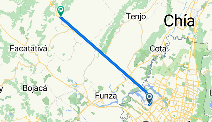
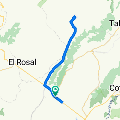
Modèle d’itinéraire
De Funza à El Rosal

- 2 h 35 min
- Durée
- 40,1 km
- Distance
- 779 m
- Montée
- 719 m
- Descente
- 15,6 km/h
- Vit. moyenne
- 3 100 m
- Altitude max.
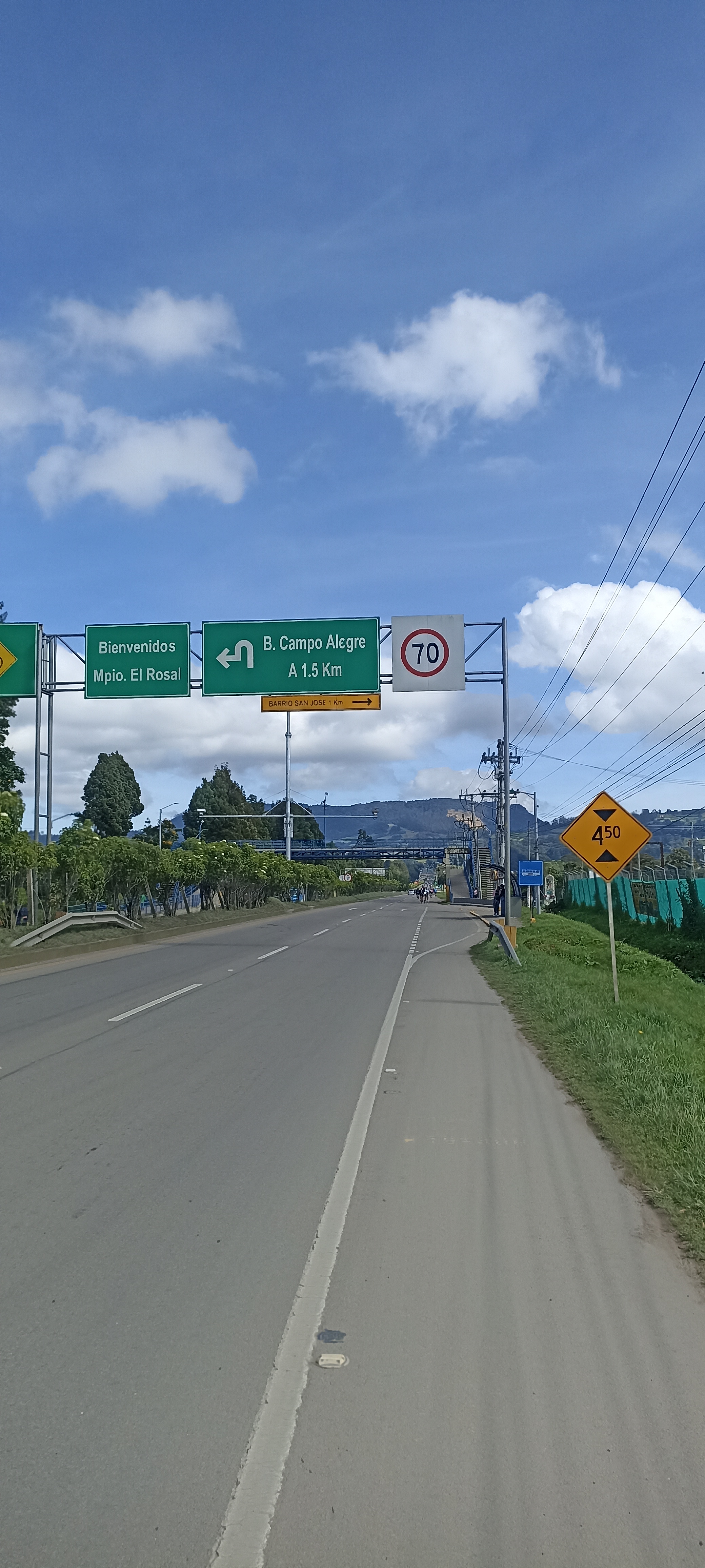
This scenic bike ride carries you from the lively town of Funza all the way up to the tranquil highland destination of El Rosal, nestled in the lush Cundinamarca countryside. Starting in Funza, known for its colonial history and as a gateway to rural Bogotá, you'll roll out on mostly quiet roads that quickly change from urban edge to sprawling green fields.
The route stretches just over 40 km, with a fair share of climbing—expect nearly 800 meters of elevation gain as you pedal toward a lofty max of 3,099 meters above sea level. The smoothest sections offer asphalt or paved surfaces, but keep your eyes peeled for quick hops onto unpaved or ground tracks, especially as you approach El Rosal.
You’ll enjoy a good chunk of the ride on peaceful backroads and even some cycleways, so it's perfect for soaking up the cool Andean air. El Rosal itself is a haven for flower farms and fresh mountain air—a sweet spot to grab a coffee and take in the quiet charm before heading back or onwards!
Communauté
Meilleurs utilisateurs dans cette région


De notre communauté
Les meilleurs itinéraires à vélo de Funza à El Rosal


De Calle 23 14-20, Mosquera a La Vega-El Rosal
Itinéraire à vélo à Funza, Cundinamarca, Colombie
- 31,5 km
- Distance
- 390 m
- Montée
- 95 m
- Descente

De Bogotá-La Vega, La Punta a Bogotá-La Vega, La Punta
Itinéraire à vélo à Funza, Cundinamarca, Colombie
- 39,8 km
- Distance
- 391 m
- Montée
- 383 m
- Descente

De Bogotá-La Vega, La Punta a Bogotá-La Vega, La Punta
Itinéraire à vélo à Funza, Cundinamarca, Colombie
- 40,1 km
- Distance
- 257 m
- Montée
- 262 m
- Descente

De Bogotá-La Vega, La Punta a Tenjo
Itinéraire à vélo à Funza, Cundinamarca, Colombie
- 45,1 km
- Distance
- 525 m
- Montée
- 530 m
- Descente

De Bogotá-La Vega, La Punta a Bogotá-La Vega, La Punta
Itinéraire à vélo à Funza, Cundinamarca, Colombie
- 40,7 km
- Distance
- 447 m
- Montée
- 444 m
- Descente

Avenida Calle 80 106-1–106-43, Bogotá a Tierra Grata, Facatativá
Itinéraire à vélo à Funza, Cundinamarca, Colombie
- 23,9 km
- Distance
- 115 m
- Montée
- 53 m
- Descente

De Bogotá-La Vega, La Punta a Bogotá-La Vega, La Punta
Itinéraire à vélo à Funza, Cundinamarca, Colombie
- 40,7 km
- Distance
- 347 m
- Montée
- 349 m
- Descente

De La Punta a Bogotá-La Vega, La Punta
Itinéraire à vélo à Funza, Cundinamarca, Colombie
- 40,3 km
- Distance
- 412 m
- Montée
- 397 m
- Descente

Carrera 114, Bogotá a Autopista Medellin - El Rosal - Puente Piedra, Facatativá
Itinéraire à vélo à Funza, Cundinamarca, Colombie
- 22,3 km
- Distance
- 164 m
- Montée
- 112 m
- Descente


De El Rosal-Bogotá a La Vega-El Rosal
Itinéraire à vélo à Funza, Cundinamarca, Colombie
- 25,1 km
- Distance
- 388 m
- Montée
- 67 m
- Descente
Découvrez plus d'itinéraires
 De Bogotá-La Vega, La Punta a Bogotá-La Vega, La Punta
- Distance
- 40,7 km
- Montée
- 447 m
- Descente
- 444 m
- Emplacement
- Funza, Cundinamarca, Colombie
 Avenida Calle 80 106-1–106-43, Bogotá a Tierra Grata, Facatativá
- Distance
- 23,9 km
- Montée
- 115 m
- Descente
- 53 m
- Emplacement
- Funza, Cundinamarca, Colombie
 De Bogotá-La Vega, La Punta a Bogotá-La Vega, La Punta
- Distance
- 40,7 km
- Montée
- 347 m
- Descente
- 349 m
- Emplacement
- Funza, Cundinamarca, Colombie
 De La Punta a Bogotá-La Vega, La Punta
- Distance
- 40,3 km
- Montée
- 412 m
- Descente
- 397 m
- Emplacement
- Funza, Cundinamarca, Colombie
- Ruta relajada
- Distance
- 28,2 km
- Montée
- 61 m
- Descente
- 48 m
- Emplacement
- Funza, Cundinamarca, Colombie
 Carrera 114, Bogotá a Autopista Medellin - El Rosal - Puente Piedra, Facatativá
- Distance
- 22,3 km
- Montée
- 164 m
- Descente
- 112 m
- Emplacement
- Funza, Cundinamarca, Colombie
 ruta 4 ida
- Distance
- 13,9 km
- Montée
- 55 m
- Descente
- 32 m
- Emplacement
- Funza, Cundinamarca, Colombie
 De El Rosal-Bogotá a La Vega-El Rosal
- Distance
- 25,1 km
- Montée
- 388 m
- Descente
- 67 m
- Emplacement
- Funza, Cundinamarca, Colombie
Itinéraires depuis Funza
Excursion à vélo d’une journée de
Funza à Barrio San Luis
Excursion à vélo d’une journée de
Funza à Bogota