
Excursion à vélo d’une journée de Talcahuano à Concepción
Personnalise ton propre itinéraire à partir de notre modèle ou découvre comment notre communauté préfère rouler de Talcahuano à Concepción.
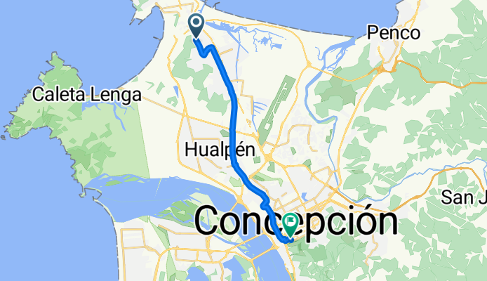
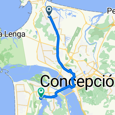
Modèle d’itinéraire
De Talcahuano à Concepción

- 1 h 27 min
- Durée
- 22,5 km
- Distance
- 95 m
- Montée
- 76 m
- Descente
- 15,5 km/h
- Vit. moyenne
- 65 m
- Altitude max.
This ride starts in the port city of Talcahuano, known for its strong maritime heritage and famous naval base, and heads southeast into the vibrant university city of Concepción. The route is around 22.5 km, mostly on paved surfaces, with the majority being dedicated cycleways or quiet roads—making it a relaxed trip for most skill levels.
You’ll cruise past the bay’s waterfront, then tackle a gradual 95-meter ascent. Along the way, you’ll get a taste of urban Chilean life while skirting industrial and residential pockets, and there are a few stretches where wayfinding may get creative due to incomplete surface data—so it pays to keep an eye on your map or GPS.
As you approach Concepción, you’ll notice the lively culture of this regional hub—a favorite for students and artists. Both cities were rebuilt after the 2010 earthquake, and you might spot some impressive public spaces and architecture along your journey. It’s a great mix of coastal views, cityscapes, and a touch of local flair!
Communauté
Meilleurs utilisateurs dans cette région


De notre communauté
Les meilleurs itinéraires à vélo de Talcahuano à Concepción

Conce - Ramuntcho
Itinéraire à vélo à Talcahuano, Región del Biobío, Chili
- 21,7 km
- Distance
- 218 m
- Montée
- 224 m
- Descente


Hospital Las Higueras, Talcahuano a Salas, Concepción
Itinéraire à vélo à Talcahuano, Región del Biobío, Chili
- 14,2 km
- Distance
- 114 m
- Montée
- 94 m
- Descente


casa a UCSC cancha
Itinéraire à vélo à Talcahuano, Región del Biobío, Chili
- 5,1 km
- Distance
- 57 m
- Montée
- 34 m
- Descente

De Gómez Carreño 3875, Talcahuano a Pasaje Dos 475, Talcahuano
Itinéraire à vélo à Talcahuano, Región del Biobío, Chili
- 4,2 km
- Distance
- 19 m
- Montée
- 23 m
- Descente

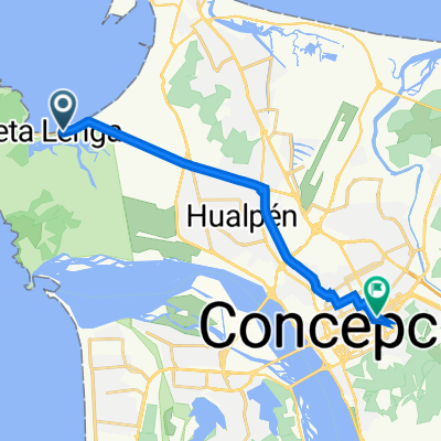
Cuatro Esquinas - Caleta Lenga 392, Hualpén a Freire 1291, Concepción
Itinéraire à vélo à Talcahuano, Región del Biobío, Chili
- 14,5 km
- Distance
- 125 m
- Montée
- 111 m
- Descente

la hice ctm
Itinéraire à vélo à Talcahuano, Región del Biobío, Chili
- 13,8 km
- Distance
- 101 m
- Montée
- 78 m
- Descente

luz de Luna - cosam
Itinéraire à vélo à Talcahuano, Región del Biobío, Chili
- 10 km
- Distance
- 22 m
- Montée
- 15 m
- Descente

al liceo
Itinéraire à vélo à Talcahuano, Región del Biobío, Chili
- 14,6 km
- Distance
- 51 m
- Montée
- 49 m
- Descente
Avenida Desiderio García, Talcahuano a Los Aragoneses, San Pedro de la Paz
Itinéraire à vélo à Talcahuano, Región del Biobío, Chili
- 18,1 km
- Distance
- 36 m
- Montée
- 36 m
- Descente

Avenida Colón 3184, Talcahuano a Cicarelli 8831, Hualpén
Itinéraire à vélo à Talcahuano, Región del Biobío, Chili
- 7,1 km
- Distance
- 33 m
- Montée
- 29 m
- Descente

Errázuriz 3061, Talcahuano a Avenida Costanera, Chiguayante
Itinéraire à vélo à Talcahuano, Región del Biobío, Chili
- 15,8 km
- Distance
- 37 m
- Montée
- 37 m
- Descente

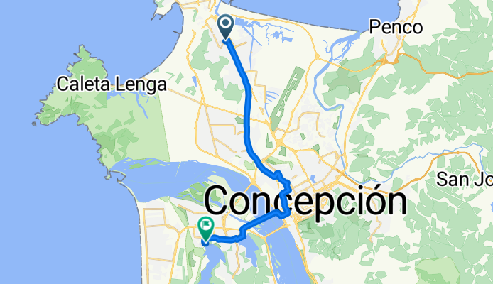
De Vicuña Mackenna 282, Talcahuano a Campus Deportivos Bellavista 587, Concepción
Itinéraire à vélo à Talcahuano, Región del Biobío, Chili
- 13,2 km
- Distance
- 83 m
- Montée
- 42 m
- Descente
Découvrez plus d'itinéraires
 Cuatro Esquinas - Caleta Lenga 392, Hualpén a Freire 1291, Concepción
- Distance
- 14,5 km
- Montée
- 125 m
- Descente
- 111 m
- Emplacement
- Talcahuano, Región del Biobío, Chili
 la hice ctm
- Distance
- 13,8 km
- Montée
- 101 m
- Descente
- 78 m
- Emplacement
- Talcahuano, Región del Biobío, Chili
 luz de Luna - cosam
- Distance
- 10 km
- Montée
- 22 m
- Descente
- 15 m
- Emplacement
- Talcahuano, Región del Biobío, Chili
 al liceo
- Distance
- 14,6 km
- Montée
- 51 m
- Descente
- 49 m
- Emplacement
- Talcahuano, Región del Biobío, Chili
 Avenida Desiderio García, Talcahuano a Los Aragoneses, San Pedro de la Paz
- Distance
- 18,1 km
- Montée
- 36 m
- Descente
- 36 m
- Emplacement
- Talcahuano, Región del Biobío, Chili
 Avenida Colón 3184, Talcahuano a Cicarelli 8831, Hualpén
- Distance
- 7,1 km
- Montée
- 33 m
- Descente
- 29 m
- Emplacement
- Talcahuano, Región del Biobío, Chili
 Errázuriz 3061, Talcahuano a Avenida Costanera, Chiguayante
- Distance
- 15,8 km
- Montée
- 37 m
- Descente
- 37 m
- Emplacement
- Talcahuano, Región del Biobío, Chili
 De Vicuña Mackenna 282, Talcahuano a Campus Deportivos Bellavista 587, Concepción
- Distance
- 13,2 km
- Montée
- 83 m
- Descente
- 42 m
- Emplacement
- Talcahuano, Región del Biobío, Chili
Itinéraires vers Concepción
Sortie rapide à vélo de
Chiguayante à Concepción