
Excursion à vélo d’une journée de Santiago à La Pintana
Personnalise ton propre itinéraire à partir de notre modèle ou découvre comment notre communauté préfère rouler de Santiago à La Pintana.
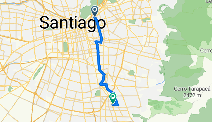
Modèle d’itinéraire
De Santiago à La Pintana

- 1 h 13 min
- Durée
- 21,7 km
- Distance
- 110 m
- Montée
- 34 m
- Descente
- 17,9 km/h
- Vit. moyenne
- 653 m
- Altitude max.
Get ready for a ride from the buzzing heart of Santiago to the quieter, residential vibe of La Pintana! Starting in downtown Santiago, you’ll be right in the mix of Chile’s capital—famous for its lively markets, historic architecture, and mountain views. You'll roll out heading south, with most of the 22 km route serving up smooth paved paths and cycleways. It’s a cyclist-friendly trip, with over half the journey dedicated to cycle paths, so you can just cruise and take in the sights.
As you head toward La Pintana, expect a chill ascent (nothing too dramatic), and the city slowly shifts into a more suburban and community-focused scene. La Pintana is known for its green parks and local food spots—definitely worth a stop for a snack!
Overall, this is a solid urban ride, great for commuters or anyone looking to see a different side of Santiago. Don’t forget some sunblock—the Chilean sun can be strong, even in the city!
Communauté
Meilleurs utilisateurs dans cette région


De notre communauté
Les meilleurs itinéraires à vélo de Santiago à La Pintana

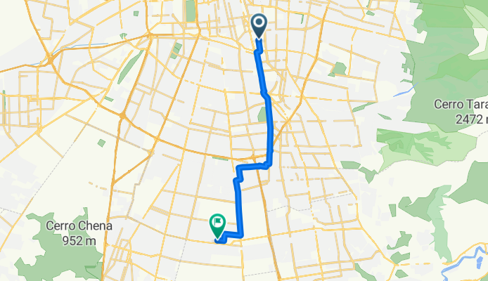
Merced 22, Santiago a El Pino 635, El Bosque
Itinéraire à vélo à Santiago, Santiago, Chili
- 14,5 km
- Distance
- 49 m
- Montée
- 48 m
- Descente

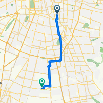
Ruta a Gabriela Poniente 1113, La Pintana
Itinéraire à vélo à Santiago, Santiago, Chili
- 15,5 km
- Distance
- 86 m
- Montée
- 322 m
- Descente

De José Ananías 383, Macul a Las Pataguas 13189, La Pintana
Itinéraire à vélo à Santiago, Santiago, Chili
- 15,8 km
- Distance
- 108 m
- Montée
- 674 m
- Descente

De Calle Tiltil 2711, Santiago a Gabriela Poniente 1113, La Pintana
Itinéraire à vélo à Santiago, Santiago, Chili
- 15,6 km
- Distance
- 163 m
- Montée
- 112 m
- Descente
De Avenida Providencia 1372 a Argentina 8555, La Florida
Itinéraire à vélo à Santiago, Santiago, Chili
- 15,1 km
- Distance
- 76 m
- Montée
- 75 m
- Descente

Ruta a Gabriela Poniente 1111, La Pintana
Itinéraire à vélo à Santiago, Santiago, Chili
- 15,7 km
- Distance
- 94 m
- Montée
- 544 m
- Descente

San Martín 664, Santiago a Esmeralda 7434–7470, La Cisterna
Itinéraire à vélo à Santiago, Santiago, Chili
- 11,6 km
- Distance
- 102 m
- Montée
- 29 m
- Descente
Ruta a Gabriela Poniente 1113, La Pintana
Itinéraire à vélo à Santiago, Santiago, Chili
- 15,7 km
- Distance
- 159 m
- Montée
- 108 m
- Descente

De Calle Tiltil 2592, Santiago a Gabriela Poniente 1113, La Pintana
Itinéraire à vélo à Santiago, Santiago, Chili
- 15,7 km
- Distance
- 86 m
- Montée
- 654 m
- Descente

De Avenida General Bustamante a Roma
Itinéraire à vélo à Santiago, Santiago, Chili
- 14,9 km
- Distance
- 100 m
- Montée
- 58 m
- Descente

De Til Til 2597, Macul a Gabriela Poniente 1111, La Pintana
Itinéraire à vélo à Santiago, Santiago, Chili
- 15,8 km
- Distance
- 122 m
- Montée
- 548 m
- Descente

De Til Til 2640, Macul a Avenida Gabriela 1115, La Pintana
Itinéraire à vélo à Santiago, Santiago, Chili
- 15,7 km
- Distance
- 378 m
- Montée
- 77 m
- Descente
Découvrez plus d'itinéraires
 De Avenida Providencia 1372 a Argentina 8555, La Florida
- Distance
- 15,1 km
- Montée
- 76 m
- Descente
- 75 m
- Emplacement
- Santiago, Santiago, Chili
 Ruta a Gabriela Poniente 1111, La Pintana
- Distance
- 15,7 km
- Montée
- 94 m
- Descente
- 544 m
- Emplacement
- Santiago, Santiago, Chili
 San Martín 664, Santiago a Esmeralda 7434–7470, La Cisterna
- Distance
- 11,6 km
- Montée
- 102 m
- Descente
- 29 m
- Emplacement
- Santiago, Santiago, Chili
 Ruta a Gabriela Poniente 1113, La Pintana
- Distance
- 15,7 km
- Montée
- 159 m
- Descente
- 108 m
- Emplacement
- Santiago, Santiago, Chili
 De Calle Tiltil 2592, Santiago a Gabriela Poniente 1113, La Pintana
- Distance
- 15,7 km
- Montée
- 86 m
- Descente
- 654 m
- Emplacement
- Santiago, Santiago, Chili
 De Avenida General Bustamante a Roma
- Distance
- 14,9 km
- Montée
- 100 m
- Descente
- 58 m
- Emplacement
- Santiago, Santiago, Chili
 De Til Til 2597, Macul a Gabriela Poniente 1111, La Pintana
- Distance
- 15,8 km
- Montée
- 122 m
- Descente
- 548 m
- Emplacement
- Santiago, Santiago, Chili
 De Til Til 2640, Macul a Avenida Gabriela 1115, La Pintana
- Distance
- 15,7 km
- Montée
- 378 m
- Descente
- 77 m
- Emplacement
- Santiago, Santiago, Chili
Itinéraires depuis Santiago
Excursion à vélo d’une journée de
Santiago à Puente Alto
Excursion à vélo d’une journée de
Santiago à San Bernardo
À vélo de
Santiago à Villa Presidente Frei
À vélo de
Santiago à Lo Prado
Itinéraires vers La Pintana
Excursion à vélo d’une journée de
Villa Presidente Frei à La Pintana
Excursion à vélo d’une journée de
Lo Prado à La Pintana
À vélo de
San Bernardo à La Pintana
À vélo de
Puente Alto à La Pintana