
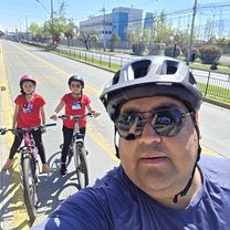
À vélo de Puente Alto à La Pintana
Personnalise ton propre itinéraire à partir de notre modèle ou découvre comment notre communauté préfère rouler de Puente Alto à La Pintana.
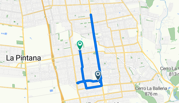
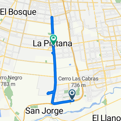
Modèle d’itinéraire
De Puente Alto à La Pintana

- 44 min
- Durée
- 13,2 km
- Distance
- 14 m
- Montée
- 84 m
- Descente
- 17,8 km/h
- Vit. moyenne
- 700 m
- Altitude max.
This ride takes you from Puente Alto, one of Santiago's largest and most lively communes, over to La Pintana, known for its community spirit and green spaces. You’ll roll about 13 km mostly on paved and concrete paths, making for a smooth and relaxed journey.
The route is friendly for cyclists, sticking mainly to dedicated cycleways and quiet roads—so you’ll avoid much of Santiago’s busy traffic. There’s a gentle descent most of the way, so expect an easy pedal without any major climbs.
Along the way, you’ll pass through residential neighborhoods, local markets, and catch sights of the Andes to the east. Once you reach La Pintana, take some time to explore one of the local parks or sample some street food. It’s a nice urban ride great for commuters or anyone looking to explore the southern side of the city by bike!
Communauté
Meilleurs utilisateurs dans cette région


De notre communauté
Les meilleurs itinéraires à vélo de Puente Alto à La Pintana


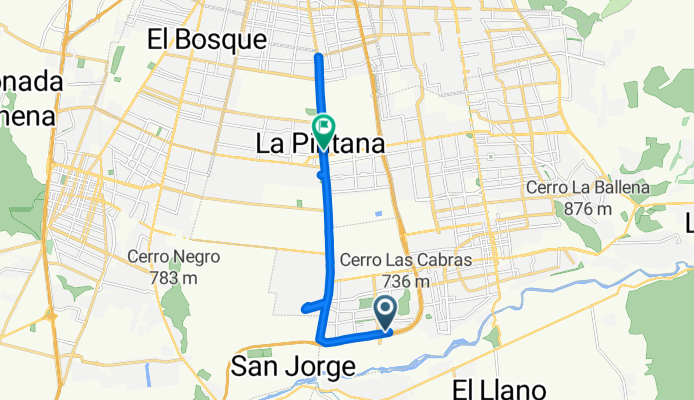
A casa de Daniela
Itinéraire à vélo à Puente Alto, Santiago, Chili
- 23,6 km
- Distance
- 224 m
- Montée
- 213 m
- Descente

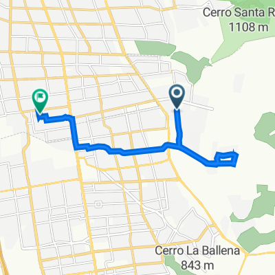
Puente el toyo
Itinéraire à vélo à Puente Alto, Santiago, Chili
- 72,6 km
- Distance
- 1 005 m
- Montée
- 1 017 m
- Descente

De Camino Santa Rosa del Peral 4516, Puente Alto a Igualdad 4503, Santiago
Itinéraire à vélo à Puente Alto, Santiago, Chili
- 10,4 km
- Distance
- 123 m
- Montée
- 169 m
- Descente

De Avenida Vicuña Mackenna Poniente 12529, Puente Alto a Los Copihues 490, La Florida
Itinéraire à vélo à Puente Alto, Santiago, Chili
- 12,1 km
- Distance
- 57 m
- Montée
- 86 m
- Descente


1 11498, La Florida a Igualdad 4561, La Florida
Itinéraire à vélo à Puente Alto, Santiago, Chili
- 26,9 km
- Distance
- 207 m
- Montée
- 215 m
- Descente

De Avenida Concha y Toro a Juan de Dios Malebrán
Itinéraire à vélo à Puente Alto, Santiago, Chili
- 18,1 km
- Distance
- 78 m
- Montée
- 124 m
- Descente

Ruta desde Valle Central 680, Puente Alto
Itinéraire à vélo à Puente Alto, Santiago, Chili
- 14,7 km
- Distance
- 80 m
- Montée
- 167 m
- Descente

Pista DH Técnica, La Florida a Cerro Caracol 780, La Florida
Itinéraire à vélo à Puente Alto, Santiago, Chili
- 10,7 km
- Distance
- 33 m
- Montée
- 362 m
- Descente

Avenida Santa Rosa, Puente Alto a Río Coya 611, Puente Alto
Itinéraire à vélo à Puente Alto, Santiago, Chili
- 4,3 km
- Distance
- 31 m
- Montée
- 12 m
- Descente
Découvrez plus d'itinéraires
 ble
ble- Distance
- 5,9 km
- Montée
- 18 m
- Descente
- 12 m
- Emplacement
- Puente Alto, Santiago, Chili
 1 11498, La Florida a Igualdad 4561, La Florida
- Distance
- 26,9 km
- Montée
- 207 m
- Descente
- 215 m
- Emplacement
- Puente Alto, Santiago, Chili
 De Avenida Concha y Toro a Juan de Dios Malebrán
- Distance
- 18,1 km
- Montée
- 78 m
- Descente
- 124 m
- Emplacement
- Puente Alto, Santiago, Chili
 Ruta desde Valle Central 680, Puente Alto
- Distance
- 14,7 km
- Montée
- 80 m
- Descente
- 167 m
- Emplacement
- Puente Alto, Santiago, Chili
 Pista DH Técnica, La Florida a Cerro Caracol 780, La Florida
- Distance
- 10,7 km
- Montée
- 33 m
- Descente
- 362 m
- Emplacement
- Puente Alto, Santiago, Chili
 Paseo lento
- Distance
- 15,7 km
- Montée
- 102 m
- Descente
- 102 m
- Emplacement
- Puente Alto, Santiago, Chili
 Paseo lento
- Distance
- 10,5 km
- Montée
- 162 m
- Descente
- 199 m
- Emplacement
- Puente Alto, Santiago, Chili
 Avenida Santa Rosa, Puente Alto a Río Coya 611, Puente Alto
- Distance
- 4,3 km
- Montée
- 31 m
- Descente
- 12 m
- Emplacement
- Puente Alto, Santiago, Chili
Itinéraires depuis Puente Alto
Excursion à vélo d’une journée de
Puente Alto à Santiago
Excursion à vélo d’une journée de
Puente Alto à Villa Presidente Frei
Itinéraires vers La Pintana
Excursion à vélo d’une journée de
Santiago à La Pintana
Excursion à vélo d’une journée de
Villa Presidente Frei à La Pintana
À vélo de
San Bernardo à La Pintana