
Modèle d’itinéraire
De Chicureo à Santiago

- 3 h
- Durée
- 50,7 km
- Distance
- 265 m
- Montée
- 271 m
- Descente
- 16,9 km/h
- Vit. moyenne
- 584 m
- Altitude max.
This ride takes you from the peaceful suburb of Chicureo down to the lively heart of Santiago, covering just over 50 kilometers. Starting in Chicureo, you’ll roll through the northern edge of Greater Santiago, trading wide-open views for city buzz as you go. The route is mostly on paved surfaces—so road bikes are a great choice—but expect some variety and the occasional spot with less-than-perfect pavement.
You’ll glide over some gentle hills, gaining and losing about 265 meters in elevation. There’s a good mix of cycleways and quieter roads, making it reasonably pleasant and safe for a longer ride. As you approach Santiago, watch the city skyline unfold—there’s nothing quite like wheeling into Chile’s capital on two wheels.
Chicureo is known for its country clubs and relaxed vibe, while Santiago is the cultural and political hub of the country, packed with museums, markets, and historic sites. After your ride, reward yourself with some local cuisine or a stroll through one of Santiago’s many parks. Enjoy the journey!
Communauté
Meilleurs utilisateurs dans cette région


De notre communauté
Les meilleurs itinéraires à vélo de Chicureo à Santiago
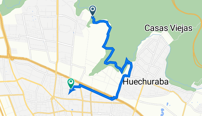
Huechuraba, Huechuraba a Pasaje Crisol 947, Conchalí
Itinéraire à vélo à Chicureo, Santiago, Chili
- 8,2 km
- Distance
- 75 m
- Montée
- 152 m
- Descente

Los Nísperos 580, Huechuraba a Avenida Brasil 842, Santiago
Itinéraire à vélo à Chicureo, Santiago, Chili
- 11,3 km
- Distance
- 57 m
- Montée
- 62 m
- Descente


Pasaje Los Agustinos Sur 1638, Huechuraba a Nueva 4 1091, Independencia
Itinéraire à vélo à Chicureo, Santiago, Chili
- 23,6 km
- Distance
- 143 m
- Montée
- 104 m
- Descente

José de San Martín 124, Colina a Avenida Dorsal, Conchalí
Itinéraire à vélo à Chicureo, Santiago, Chili
- 15,6 km
- Distance
- 160 m
- Montée
- 142 m
- Descente

Pasaje Punta Nogales 1349, Huechuraba a María del Pilar 3230, Recoleta
Itinéraire à vélo à Chicureo, Santiago, Chili
- 7,1 km
- Distance
- 41 m
- Montée
- 16 m
- Descente

Avenida Punta Nogales 1377–1381, Huechuraba a María del Pilar 3234, Recoleta
Itinéraire à vélo à Chicureo, Santiago, Chili
- 6,7 km
- Distance
- 21 m
- Montée
- 0 m
- Descente


De El Molino 2150, Quilicura a Manuel Mackenna 448-452, Providencia
Itinéraire à vélo à Chicureo, Santiago, Chili
- 10,9 km
- Distance
- 107 m
- Montée
- 18 m
- Descente

De El Molino 2150, Quilicura a Dominica 5, Recoleta
Itinéraire à vélo à Chicureo, Santiago, Chili
- 10,9 km
- Distance
- 140 m
- Montée
- 80 m
- Descente
Découvrez plus d'itinéraires
 José de San Martín 124, Colina a Avenida Dorsal, Conchalí
- Distance
- 15,6 km
- Montée
- 160 m
- Descente
- 142 m
- Emplacement
- Chicureo, Santiago, Chili
 Pasaje Punta Nogales 1349, Huechuraba a María del Pilar 3230, Recoleta
- Distance
- 7,1 km
- Montée
- 41 m
- Descente
- 16 m
- Emplacement
- Chicureo, Santiago, Chili
 Avenida Punta Nogales 1377–1381, Huechuraba a María del Pilar 3234, Recoleta
- Distance
- 6,7 km
- Montée
- 21 m
- Descente
- 0 m
- Emplacement
- Chicureo, Santiago, Chili
 pique futbol!
- Distance
- 13,4 km
- Montée
- 206 m
- Descente
- 184 m
- Emplacement
- Chicureo, Santiago, Chili
 Recovered Route
- Distance
- 27 km
- Montée
- 190 m
- Descente
- 136 m
- Emplacement
- Chicureo, Santiago, Chili
 Casa a la U
- Distance
- 19,4 km
- Montée
- 41 m
- Descente
- 390 m
- Emplacement
- Chicureo, Santiago, Chili
 De El Molino 2150, Quilicura a Manuel Mackenna 448-452, Providencia
- Distance
- 10,9 km
- Montée
- 107 m
- Descente
- 18 m
- Emplacement
- Chicureo, Santiago, Chili
 De El Molino 2150, Quilicura a Dominica 5, Recoleta
- Distance
- 10,9 km
- Montée
- 140 m
- Descente
- 80 m
- Emplacement
- Chicureo, Santiago, Chili
Itinéraires depuis Chicureo
Excursion à vélo d’une journée de
Chicureo à Lo Prado
Excursion à vélo d’une journée de
Chicureo à Villa Presidente Frei
Itinéraires vers Santiago
Excursion à vélo d’une journée de
La Pintana à Santiago
Excursion à vélo d’une journée de
San Bernardo à Santiago
Sortie rapide à vélo de
Lo Prado à Santiago
Sortie rapide à vélo de
Villa Presidente Frei à Santiago