
Excursion à vélo d’une journée de Long Island City à Queens
Personnalise ton propre itinéraire à partir de notre modèle ou découvre comment notre communauté préfère rouler de Long Island City à Queens.
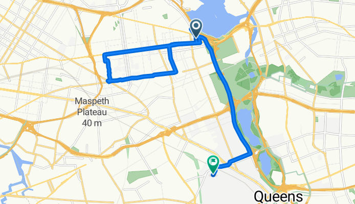
Modèle d’itinéraire
De Long Island City à Queens

- 1 h 11 min
- Durée
- 21 km
- Distance
- 53 m
- Montée
- 46 m
- Descente
- 17,8 km/h
- Vit. moyenne
- 32 m
- Altitude max.
This ride takes you from the heart of Long Island City, an artsy neighborhood just across the East River from Manhattan, to the lively Borough of Queens. Expect about 21 kilometers (13 miles) of mostly quiet roads—perfect for a relaxing city cruise. The route is pretty flat, with only a gentle ascent and descent, so you won’t be grinding up any killer hills.
Long Island City is known for its stunning waterfront parks, creative vibes, and the iconic Pepsi-Cola sign. As you weave east towards central Queens, you’ll dip into a variety of neighborhoods, catching glimpses of local bakeries, parks, and tree-lined streets along the way.
Most of your ride is on pavement or asphalt, but keep an eye out for stretches where the surface might change. The balance of quiet roads makes it an enjoyable and low-stress journey, with just a small section on official cycleways. Whether you’re just exploring or heading to meet friends, it’s an easy route that shows off a slice of real New York life on two wheels.
Communauté
Meilleurs utilisateurs dans cette région


De notre communauté
Les meilleurs itinéraires à vélo de Long Island City à Queens

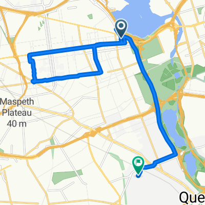
Rego Park from 59th St Bridge
Itinéraire à vélo à Long Island City, New York, États Unis
- 8,7 km
- Distance
- 76 m
- Montée
- 60 m
- Descente

Q53A Bus Route
Itinéraire à vélo à Long Island City, New York, États Unis
- 9 km
- Distance
- 55 m
- Montée
- 66 m
- Descente

Rego Park from 59th St Bridge #3
Itinéraire à vélo à Long Island City, New York, États Unis
- 7,5 km
- Distance
- 36 m
- Montée
- 32 m
- Descente

Rego Park from 59th St Bridge #2
Itinéraire à vélo à Long Island City, New York, États Unis
- 8,9 km
- Distance
- 36 m
- Montée
- 33 m
- Descente
Ditmars Boulevard 110-14 to Dartmouth Street 67-75
Itinéraire à vélo à Long Island City, New York, États Unis
- 15,7 km
- Distance
- 216 m
- Montée
- 187 m
- Descente

89-01–89-99 55th Ave, Nueva York a 102-02–102-98 Strong Ave, Nueva York
Itinéraire à vélo à Long Island City, New York, États Unis
- 2 km
- Distance
- 0 m
- Montée
- 6 m
- Descente

Short bike tour through New York
Itinéraire à vélo à Long Island City, New York, États Unis
- 7,9 km
- Distance
- 43 m
- Montée
- 44 m
- Descente

59-14 70th St, New York to 79-48 67th Rd, New York
Itinéraire à vélo à Long Island City, New York, États Unis
- 4 km
- Distance
- 9 m
- Montée
- 14 m
- Descente

Recovered Route
Itinéraire à vélo à Long Island City, New York, États Unis
- 27,8 km
- Distance
- 133 m
- Montée
- 134 m
- Descente

First day
Itinéraire à vélo à Long Island City, New York, États Unis
- 1 km
- Distance
- 31 m
- Montée
- 3 m
- Descente

216 Frost St, New York to 103-01–103-99 103rd Ave, New York
Itinéraire à vélo à Long Island City, New York, États Unis
- 12,2 km
- Distance
- 86 m
- Montée
- 80 m
- Descente

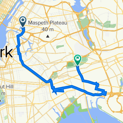
86-29 57th Rd, New York to 19 Markwood Rd, New York
Itinéraire à vélo à Long Island City, New York, États Unis
- 10,5 km
- Distance
- 121 m
- Montée
- 97 m
- Descente
Découvrez plus d'itinéraires
 Ditmars Boulevard 110-14 to Dartmouth Street 67-75
- Distance
- 15,7 km
- Montée
- 216 m
- Descente
- 187 m
- Emplacement
- Long Island City, New York, États Unis
 89-01–89-99 55th Ave, Nueva York a 102-02–102-98 Strong Ave, Nueva York
- Distance
- 2 km
- Montée
- 0 m
- Descente
- 6 m
- Emplacement
- Long Island City, New York, États Unis
 Short bike tour through New York
- Distance
- 7,9 km
- Montée
- 43 m
- Descente
- 44 m
- Emplacement
- Long Island City, New York, États Unis
 59-14 70th St, New York to 79-48 67th Rd, New York
- Distance
- 4 km
- Montée
- 9 m
- Descente
- 14 m
- Emplacement
- Long Island City, New York, États Unis
 Recovered Route
- Distance
- 27,8 km
- Montée
- 133 m
- Descente
- 134 m
- Emplacement
- Long Island City, New York, États Unis
 First day
- Distance
- 1 km
- Montée
- 31 m
- Descente
- 3 m
- Emplacement
- Long Island City, New York, États Unis
 216 Frost St, New York to 103-01–103-99 103rd Ave, New York
- Distance
- 12,2 km
- Montée
- 86 m
- Descente
- 80 m
- Emplacement
- Long Island City, New York, États Unis
 86-29 57th Rd, New York to 19 Markwood Rd, New York
- Distance
- 10,5 km
- Montée
- 121 m
- Descente
- 97 m
- Emplacement
- Long Island City, New York, États Unis
Itinéraires depuis Long Island City
Excursion à vélo d’une journée de
Long Island City à Jamaica
Excursion à vélo d’une journée de
Long Island City à Manhattan
Sortie rapide à vélo de
Long Island City à East New York
Sortie rapide à vélo de
Long Island City à Brooklyn
Itinéraires vers Queens
Sortie rapide à vélo de
East New York à Queens