
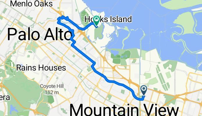
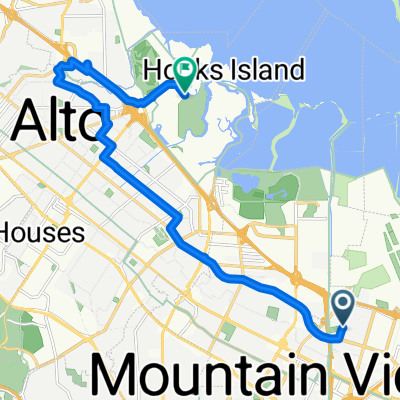
Sortie rapide à vélo de Mountain View à Palo Alto
Personnalise ton propre itinéraire à partir de notre modèle ou découvre comment notre communauté préfère rouler de Mountain View à Palo Alto.
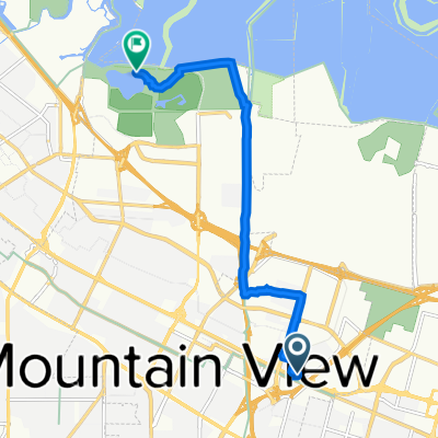
Modèle d’itinéraire
De Mountain View à Palo Alto

- 39 min
- Durée
- 11,6 km
- Distance
- 8 m
- Montée
- 31 m
- Descente
- 17,9 km/h
- Vit. moyenne
- 34 m
- Altitude max.
Hop on your bike and cruise from Mountain View to Palo Alto—two iconic Silicon Valley neighbors with tons of personality. This easy ride is just under 12 km and mostly flat, with a gentle descent as you head north—great for a casual outing or commuting without breaking a sweat.
You’ll mostly roll along quiet roads, dodging most of the busy traffic, and there’s a small stretch on a cycleway to make things even smoother. The route is largely paved, with classic Bay Area asphalt beneath your wheels—just be aware there are short sections where the surface info is missing, so a little caution never hurts.
Starting in Mountain View, you’re in Google’s backyard and just a stone’s throw from the Computer History Museum. Roll into Palo Alto, and you’ll find yourself in the heart of Stanford country, surrounded by leafy streets and cool cafes. In all, it’s a low-stress, suburban ride that’s as easy as it is scenic. Perfect for a breezy afternoon spin!
Communauté
Meilleurs utilisateurs dans cette région


De notre communauté
Les meilleurs itinéraires à vélo de Mountain View à Palo Alto
baylands
Itinéraire à vélo à Mountain View, Californie, États Unis
- 7,3 km
- Distance
- 14 m
- Montée
- 23 m
- Descente

Stevens Creek Trail (El Camino to Shoreline)
Itinéraire à vélo à Mountain View, Californie, États Unis
- 9 km
- Distance
- 7 m
- Montée
- 57 m
- Descente

google route
Itinéraire à vélo à Mountain View, Californie, États Unis
- 6,6 km
- Distance
- 5 m
- Montée
- 9 m
- Descente

TEST ROUTE 2311
Itinéraire à vélo à Mountain View, Californie, États Unis
- 2,3 km
- Distance
- 4 m
- Montée
- 11 m
- Descente
2146 Leghorn St, Mountain View to 895–899 Loma Verde Ave, Palo Alto
Itinéraire à vélo à Mountain View, Californie, États Unis
- 3,6 km
- Distance
- 0 m
- Montée
- 3 m
- Descente

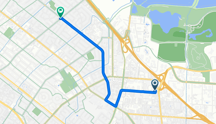
To work, Palo Alto
Itinéraire à vélo à Mountain View, Californie, États Unis
- 11,5 km
- Distance
- 28 m
- Montée
- 63 m
- Descente
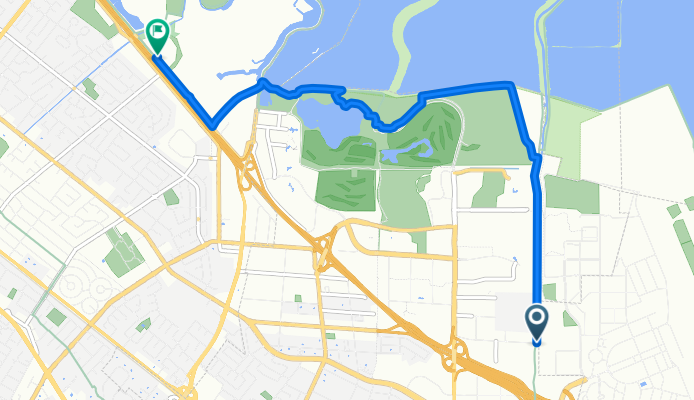
Walker Drive to Embarcadero Way
Itinéraire à vélo à Mountain View, Californie, États Unis
- 16,5 km
- Distance
- 54 m
- Montée
- 41 m
- Descente

429 Nicholas Dr, Mountain View to Shoreline Park Trail, Mountain View
Itinéraire à vélo à Mountain View, Californie, États Unis
- 8,9 km
- Distance
- 16 m
- Montée
- 43 m
- Descente

427 Nicholas Dr, Mountain View to Shoreline Park Trail, Mountain View
Itinéraire à vélo à Mountain View, Californie, États Unis
- 8,5 km
- Distance
- 17 m
- Montée
- 43 m
- Descente

429 Nicholas Dr, Mountain View to Shoreline Park Trail, Mountain View
Itinéraire à vélo à Mountain View, Californie, États Unis
- 8,4 km
- Distance
- 13 m
- Montée
- 39 m
- Descente

429 Nicholas Dr, Mountain View to Shoreline Park Trail, Mountain View
Itinéraire à vélo à Mountain View, Californie, États Unis
- 8,9 km
- Distance
- 6 m
- Montée
- 30 m
- Descente

505 Cypress Point Dr, Mountain View to Shoreline Park Trail, Mountain View
Itinéraire à vélo à Mountain View, Californie, États Unis
- 7,1 km
- Distance
- 26 m
- Montée
- 45 m
- Descente
Découvrez plus d'itinéraires
 2146 Leghorn St, Mountain View to 895–899 Loma Verde Ave, Palo Alto
- Distance
- 3,6 km
- Montée
- 0 m
- Descente
- 3 m
- Emplacement
- Mountain View, Californie, États Unis
 To work, Palo Alto
- Distance
- 11,5 km
- Montée
- 28 m
- Descente
- 63 m
- Emplacement
- Mountain View, Californie, États Unis
 Walker Drive to Embarcadero Way
- Distance
- 16,5 km
- Montée
- 54 m
- Descente
- 41 m
- Emplacement
- Mountain View, Californie, États Unis
 429 Nicholas Dr, Mountain View to Shoreline Park Trail, Mountain View
- Distance
- 8,9 km
- Montée
- 16 m
- Descente
- 43 m
- Emplacement
- Mountain View, Californie, États Unis
 427 Nicholas Dr, Mountain View to Shoreline Park Trail, Mountain View
- Distance
- 8,5 km
- Montée
- 17 m
- Descente
- 43 m
- Emplacement
- Mountain View, Californie, États Unis
 429 Nicholas Dr, Mountain View to Shoreline Park Trail, Mountain View
- Distance
- 8,4 km
- Montée
- 13 m
- Descente
- 39 m
- Emplacement
- Mountain View, Californie, États Unis
 429 Nicholas Dr, Mountain View to Shoreline Park Trail, Mountain View
- Distance
- 8,9 km
- Montée
- 6 m
- Descente
- 30 m
- Emplacement
- Mountain View, Californie, États Unis
 505 Cypress Point Dr, Mountain View to Shoreline Park Trail, Mountain View
- Distance
- 7,1 km
- Montée
- 26 m
- Descente
- 45 m
- Emplacement
- Mountain View, Californie, États Unis