

À vélo de Seattle à Clyde Hill
Personnalise ton propre itinéraire à partir de notre modèle ou découvre comment notre communauté préfère rouler de Seattle à Clyde Hill.
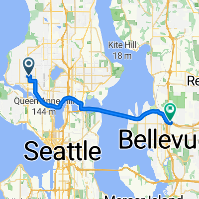
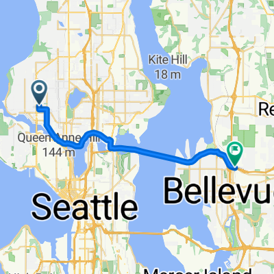
Modèle d’itinéraire
De Seattle à Clyde Hill
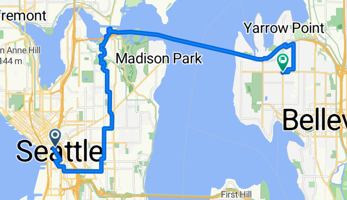
- 1 h 5 min
- Durée
- 18,7 km
- Distance
- 291 m
- Montée
- 267 m
- Descente
- 17,3 km/h
- Vit. moyenne
- 118 m
- Altitude max.
Roll out from downtown Seattle and head northeast toward the U District, picking up the Burke-Gilman Trail through Montlake. From there, hop on the SR 520 Trail and glide over Lake Washington—the Evergreen Point Floating Bridge you’ll cross is the longest floating bridge in the world. Expect great views of the skyline and, on a clear day, Mount Rainier.
On the Eastside, exit near Medina and weave through quiet, tree-lined streets to Clyde Hill. The finish packs a punch: you’ll rack up roughly 300 m of climbing overall, with a few short, steep ramps as you crest the hill.
It’s about 19 km, with roughly half on dedicated cycleways and most of the rest on calm neighborhood roads—almost entirely paved. Seattle’s a perfect launchpad with coffee and waterfront vibes; Clyde Hill is a serene, residential hilltop known for big views of Lake Washington and the Olympics. Bring lights for tunnel sections and enjoy the bridge breeze.
Communauté
Meilleurs utilisateurs dans cette région


De notre communauté
Les meilleurs itinéraires à vélo de Seattle à Clyde Hill

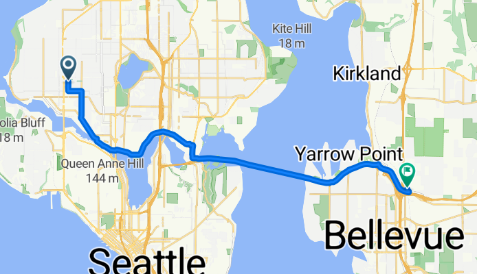
NW 64th St, Seattle to 116th Ave NE, Bellevue
Itinéraire à vélo à Seattle, Washington, États Unis
- 19,3 km
- Distance
- 151 m
- Montée
- 140 m
- Descente
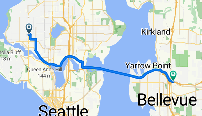
NW 64th St, Seattle to 116th Ave NE, Bellevue
Itinéraire à vélo à Seattle, Washington, États Unis
- 19,4 km
- Distance
- 162 m
- Montée
- 152 m
- Descente
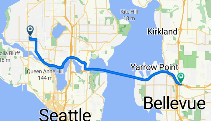
NW 64th St, Seattle to 116th Ave NE, Bellevue
Itinéraire à vélo à Seattle, Washington, États Unis
- 19,5 km
- Distance
- 162 m
- Montée
- 157 m
- Descente

NW 64th St, Seattle to 116th Ave NE, Bellevue
Itinéraire à vélo à Seattle, Washington, États Unis
- 19,3 km
- Distance
- 156 m
- Montée
- 146 m
- Descente

NW 64th St, Seattle to 116th Ave NE, Bellevue
Itinéraire à vélo à Seattle, Washington, États Unis
- 19,8 km
- Distance
- 178 m
- Montée
- 169 m
- Descente

NW 64th St, Seattle to 116th Ave NE, Bellevue
Itinéraire à vélo à Seattle, Washington, États Unis
- 19,2 km
- Distance
- 148 m
- Montée
- 140 m
- Descente

NW 64th St, Seattle to 116th Ave NE, Bellevue
Itinéraire à vélo à Seattle, Washington, États Unis
- 19,2 km
- Distance
- 142 m
- Montée
- 131 m
- Descente

NW 64th St, Seattle to 116th Ave NE, Bellevue
Itinéraire à vélo à Seattle, Washington, États Unis
- 19,2 km
- Distance
- 147 m
- Montée
- 140 m
- Descente

NW 64th St, Seattle to 116th Ave NE, Bellevue
Itinéraire à vélo à Seattle, Washington, États Unis
- 19,2 km
- Distance
- 150 m
- Montée
- 141 m
- Descente

NW 64th St, Seattle to 116th Ave NE, Bellevue
Itinéraire à vélo à Seattle, Washington, États Unis
- 19,3 km
- Distance
- 142 m
- Montée
- 131 m
- Descente

15th Ave NW, Seattle to 116th Ave NE, Bellevue
Itinéraire à vélo à Seattle, Washington, États Unis
- 19,3 km
- Distance
- 143 m
- Montée
- 135 m
- Descente
NW 64th St, Seattle to 116th Ave NE, Bellevue
Itinéraire à vélo à Seattle, Washington, États Unis
- 19,2 km
- Distance
- 139 m
- Montée
- 128 m
- Descente
Découvrez plus d'itinéraires
 NW 64th St, Seattle to 116th Ave NE, Bellevue
- Distance
- 19,8 km
- Montée
- 178 m
- Descente
- 169 m
- Emplacement
- Seattle, Washington, États Unis
 NW 64th St, Seattle to 116th Ave NE, Bellevue
- Distance
- 19,2 km
- Montée
- 148 m
- Descente
- 140 m
- Emplacement
- Seattle, Washington, États Unis
 NW 64th St, Seattle to 116th Ave NE, Bellevue
- Distance
- 19,2 km
- Montée
- 142 m
- Descente
- 131 m
- Emplacement
- Seattle, Washington, États Unis
 NW 64th St, Seattle to 116th Ave NE, Bellevue
- Distance
- 19,2 km
- Montée
- 147 m
- Descente
- 140 m
- Emplacement
- Seattle, Washington, États Unis
 NW 64th St, Seattle to 116th Ave NE, Bellevue
- Distance
- 19,2 km
- Montée
- 150 m
- Descente
- 141 m
- Emplacement
- Seattle, Washington, États Unis
 NW 64th St, Seattle to 116th Ave NE, Bellevue
- Distance
- 19,3 km
- Montée
- 142 m
- Descente
- 131 m
- Emplacement
- Seattle, Washington, États Unis
 15th Ave NW, Seattle to 116th Ave NE, Bellevue
- Distance
- 19,3 km
- Montée
- 143 m
- Descente
- 135 m
- Emplacement
- Seattle, Washington, États Unis
 NW 64th St, Seattle to 116th Ave NE, Bellevue
- Distance
- 19,2 km
- Montée
- 139 m
- Descente
- 128 m
- Emplacement
- Seattle, Washington, États Unis
Itinéraires depuis Seattle
Excursion à vélo d’une journée de
Seattle à Shoreline
À vélo de
Seattle à Yarrow Point
À vélo de
Seattle à Mercer Island