À quoi pourrait ressembler le cyclisme dans la Toronto.
À quoi pourrait ressembler le cyclisme dans la Etobicoke.

Excursion à vélo d’une journée de Toronto à Etobicoke

Personnalise ton propre itinéraire à partir de notre modèle ou découvre comment notre communauté préfère rouler de Toronto à Etobicoke.

Modèle d’itinéraire

De Toronto à Etobicoke

1 h 16 min
Durée
21,3 km
Distance
141 m
Montée
169 m
Descente
16,7 km/h
Vit. moyenne
186 m
Altitude max.

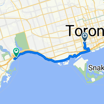
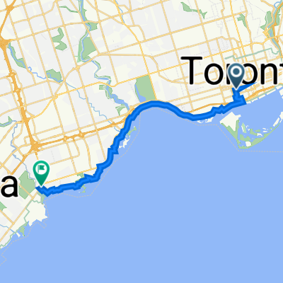
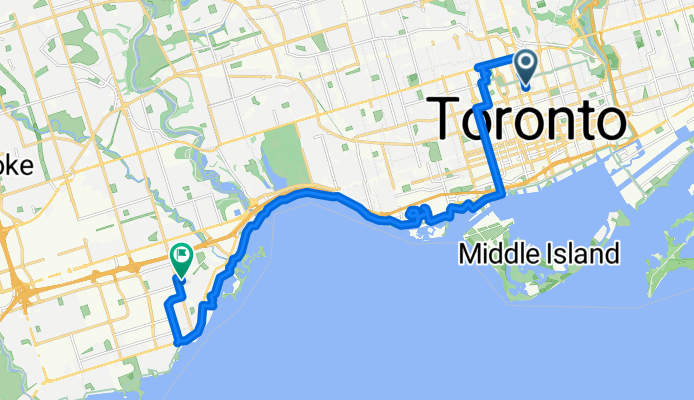
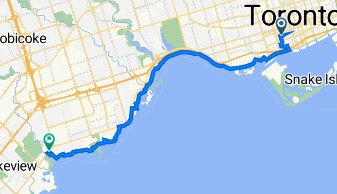
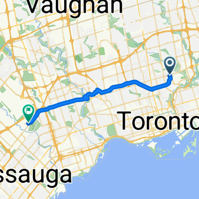
This ride takes you west from Toronto’s energetic heart to the suburban charm of Etobicoke, clocking in at just over 21 km. You’ll roll mostly on smooth pavement (hello, comfy tires!) and spend almost half the trip on dedicated cycleways and quiet roads—so you can soak in those lake breezes without white-knuckling the handlebars.

Toronto’s waterfront skyline fades as you pedal through lively neighbourhoods, parks, and plenty of coffee options. The route’s gentle climbs and descents keep things interesting but won’t leave your legs screaming. Look out for the Humber River trail section—a scenic highlight with city-meets-nature vibes.

Etobicoke awaits with its blend of retro motels, mom and pop diners, and big leafy streets. Fun fact: Etobicoke was its own city until 1998, when it became part of Toronto’s west end sprawl. At the end, you’ve earned a chill break in Centennial Park or by the lakeshore—your choice!

Communauté

Meilleurs utilisateurs dans cette région

De notre communauté

Les meilleurs itinéraires à vélo de Toronto à Etobicoke

Grosvenor St, Toronto to Royal York Rd, Toronto

Itinéraire à vélo à Toronto, Ontario, Canada

22,5 km
Distance
95 m
Montée
108 m
Descente

East York to Indian Line campground

Itinéraire à vélo à Toronto, Ontario, Canada

47,4 km
Distance
242 m
Montée
143 m
Descente
trail ride
Vélo de ville
maust 1999

trail ride

Itinéraire à vélo à Toronto, Ontario, Canada

22,7 km
Distance
132 m
Montée
112 m
Descente

Loop

Itinéraire à vélo à Toronto, Ontario, Canada

49,7 km
Distance
166 m
Montée
162 m
Descente

skymark

Itinéraire à vélo à Toronto, Ontario, Canada

skymark
24,3 km
Distance
154 m
Montée
129 m
Descente

Home - Hearthstone Option 2

Itinéraire à vélo à Toronto, Ontario, Canada

Unattempted, uses major bike routes, goes through  High Park
14,4 km
Distance
57 m
Montée
137 m
Descente

23-006 home - woodcreek park

Itinéraire à vélo à Toronto, Ontario, Canada

21,8 km
Distance
190 m
Montée
197 m
Descente

Toronto Island to Royal York Subway Station

Itinéraire à vélo à Toronto, Ontario, Canada

34,7 km
Distance
167 m
Montée
150 m
Descente
Dixon-Eglinton Loop
Vélo de route
Paul Velo

Dixon-Eglinton Loop

Itinéraire à vélo à Toronto, Ontario, Canada

33,9 km
Distance
115 m
Montée
68 m
Descente

40 Mercer St, Toronto to Great Lakes Waterfront Tr, Toronto

Itinéraire à vélo à Toronto, Ontario, Canada

9,2 km
Distance
17 m
Montée
26 m
Descente
Elijahs 100k route
Vélo de route

Elijahs 100k route

Itinéraire à vélo à Toronto, Ontario, Canada

basic outline for a 100k route going north.
16,1 km
Distance
80 m
Montée
79 m
Descente

42 Mercer St, Toronto to 91–99 41st St, Toronto

Itinéraire à vélo à Toronto, Ontario, Canada

19,3 km
Distance
27 m
Montée
113 m
Descente

Découvrez plus d'itinéraires