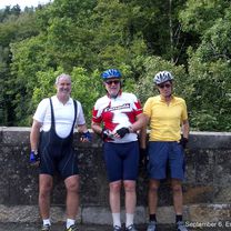
Day 6, 70 miles from Peebles to Carlisle
Un itinéraire vélo au départ de Peebles, Ecosse, Royaume-Uni.
Vue d'ensemble
À propos du circuit
6 septembre 2006. Aujourd'hui, le temps était presque parfait pour faire du vélo. Nous avons commencé depuis Peebles, une très belle petite ville, dans la brume écossaise et à environ 16 degrés, qui s'est réchauffée dans les basses vingtaines avec seulement des périodes de pluie légère très occasionnelles durant la journée. Le vent fort du sud-ouest s'était adouci et s'était déplacé davantage vers l'ouest et le nord pour nous aider. L'itinéraire de Peebles à Carlisle à travers le pays frontaliers (Écosse) et le Cumbrie (Angleterre) est très rural et nous avons pris suffisamment de barres de fruits pour nous nourrir si nous ne trouvions pas d'endroit pour le déjeuner. En fait, nous sommes arrivés au monastère bouddhiste juste après la fermeture de leur salon de thé, mais à temps pour manger avec les adhérents pour un don de 5 £. Pas de viande mais une nourriture très nourrissante, y compris une salade d'avocats. Nous avons décidé de nous arrêter après 67 miles et de nous faire conduire les 4 derniers miles à travers l'heure de pointe de Carlisle. Nous séjournons dans l'ancien hôtel ferroviaire victorien, le Crown and Mitre. Le super bonus est que les chambres ont de longues baignoires, que nous avons tous utilisées après toutes les collines d'aujourd'hui. Nous avons partagé l'immense salle à manger du premier étage avec 50 femmes joueuses de bowling, d'âge moyen de la population de boules.
- -:--
- Durée
- 112 km
- Distance
- 1 237 m
- Montée
- 1 374 m
- Descente
- ---
- Vit. moyenne
- 380 m
- Altitude max.
Photos de l’itinéraire
Qualité de l’itinéraire
Types de voies et surfaces le long de l’itinéraire
Types de routes
Route
23,5 km
(21 %)
Route tranquille
7,8 km
(7 %)
surfaces
Pavé
33,6 km
(30 %)
Asphalte
33,6 km
(30 %)
Indéfini
78,4 km
(70 %)
Continuer avec Bikemap
Utilise, modifie ou télécharge cet itinéraire vélo
Tu veux parcourir Day 6, 70 miles from Peebles to Carlisle ou l’adapter à ton propre voyage ? Voici ce que tu peux faire avec cet itinéraire Bikemap :
Fonctionnalités gratuites
- Enregistre cet itinéraire comme favori ou dans une collection
- Copie et planifie ta propre version de cet itinéraire
- Divise-le en étapes pour créer un tour sur plusieurs jours
- Synchronise ton itinéraire avec Garmin ou Wahoo
Fonctionnalités Premium
Essai gratuit de 3 jours, ou paiement unique. En savoir plus sur Bikemap Premium.
- Navigue sur cet itinéraire sur iOS et Android
- Exporter un fichier GPX / KML de cet itinéraire
- Crée ton impression personnalisée (essaie-la gratuitement)
- Télécharge cet itinéraire pour la navigation hors ligne
Découvre plus de fonctionnalités Premium.
Obtiens Bikemap PremiumDe notre communauté
Peebles : Autres itinéraires populaires qui commencent ici
 Peebles - Broughton - Drumelzier - Dawyk
- Distance
- 54,6 km
- Montée
- 348 m
- Descente
- 348 m
- Emplacement
- Peebles, Ecosse, Royaume-Uni
 Tour of the Borders 2015
- Distance
- 118,5 km
- Montée
- 852 m
- Descente
- 852 m
- Emplacement
- Peebles, Ecosse, Royaume-Uni
 Peebles - Romano Bridge - Leadburn Circular
- Distance
- 44,7 km
- Montée
- 199 m
- Descente
- 200 m
- Emplacement
- Peebles, Ecosse, Royaume-Uni
 Day 6, 70 miles from Peebles to Carlisle
- Distance
- 112 km
- Montée
- 1 237 m
- Descente
- 1 374 m
- Emplacement
- Peebles, Ecosse, Royaume-Uni
 Peebles to North Berwick via Innerleithen
- Distance
- 84,9 km
- Montée
- 549 m
- Descente
- 681 m
- Emplacement
- Peebles, Ecosse, Royaume-Uni
 Route from Kingsmeadows Road 3
- Distance
- 80,7 km
- Montée
- 503 m
- Descente
- 503 m
- Emplacement
- Peebles, Ecosse, Royaume-Uni
 england-10-peebles-lanark
- Distance
- 56,8 km
- Montée
- 459 m
- Descente
- 472 m
- Emplacement
- Peebles, Ecosse, Royaume-Uni
 Tour o' the Borders 2014
- Distance
- 125,8 km
- Montée
- 873 m
- Descente
- 876 m
- Emplacement
- Peebles, Ecosse, Royaume-Uni
Ouvre-la dans l’app


