

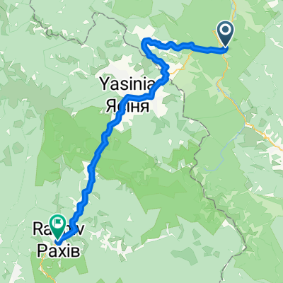
Carpathian Peaks. Route 1.
Un itinéraire vélo au départ de Tatariv, Oblast d'Ivano-Frankivsk, Ukraine.
Vue d'ensemble
À propos du circuit
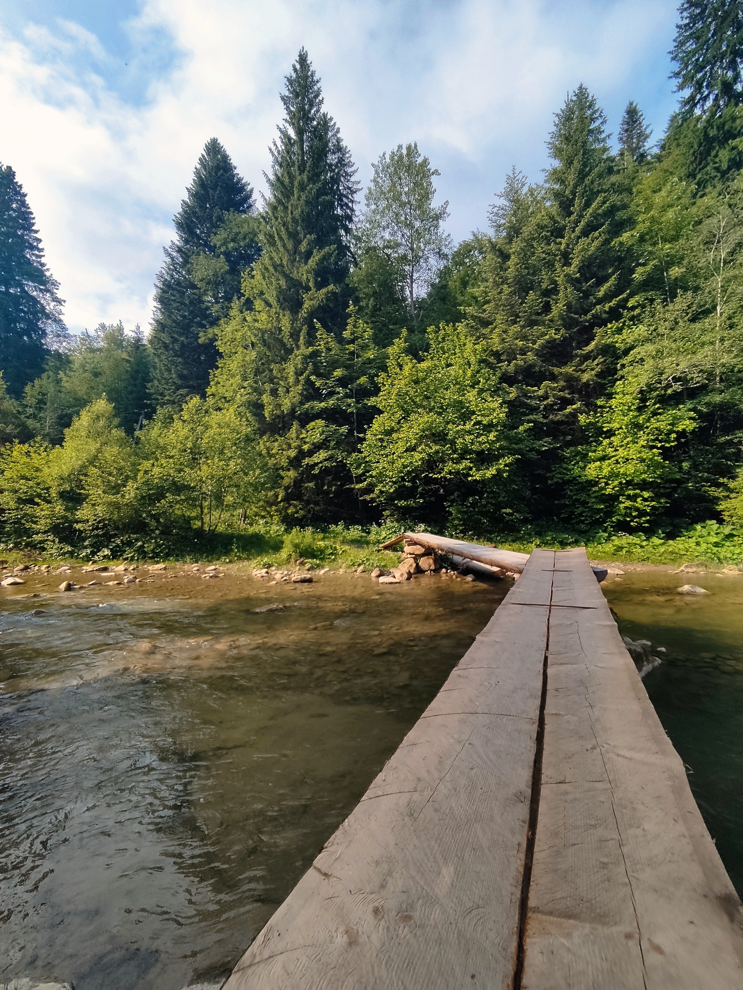
L'endroit le plus intéressant à Yaremche est la cascade de 8 m de haut "Probii" avec un pont piétonnier au-dessus de la rivière Prut. D'un côté du pont, il y a un marché de souvenirs avec les chefs-d'œuvre de l'artisanat hutsul. Depuis les périphéries du village, il est facile d'accéder aux rochers d'Oleksa Dovbush (énormes rochers et pierres rappelant des créatures mystérieuses) le long du sentier qui porte son nom.
- -:--
- Durée
- 26,4 km
- Distance
- 368 m
- Montée
- 369 m
- Descente
- ---
- Vit. moyenne
- ---
- Altitude max.

Points forts de l’itinéraire
Points d’intérêt le long de l’itinéraire

Point d'intérêt après 9,1 km
Probii waterfall - the 8m-high waterfall with a footbridge over the river Prut above it/

Point d'intérêt après 12,1 km
Girls' tears waterfall

Point d'intérêt après 18,3 km
Rocks of Dovbush. Group of rocks and cliffs up to 20m. With these rocks associated name of the head of peasant rebels-Oleksa Dovbush, who, according to popular legend, was hiding here for a while.
Continuer avec Bikemap
Utilise, modifie ou télécharge cet itinéraire vélo
Tu veux parcourir Carpathian Peaks. Route 1. ou l’adapter à ton propre voyage ? Voici ce que tu peux faire avec cet itinéraire Bikemap :
Fonctionnalités gratuites
- Enregistre cet itinéraire comme favori ou dans une collection
- Copie et planifie ta propre version de cet itinéraire
- Synchronise ton itinéraire avec Garmin ou Wahoo
Fonctionnalités Premium
Essai gratuit de 3 jours, ou paiement unique. En savoir plus sur Bikemap Premium.
- Navigue sur cet itinéraire sur iOS et Android
- Exporter un fichier GPX / KML de cet itinéraire
- Crée ton impression personnalisée (essaie-la gratuitement)
- Télécharge cet itinéraire pour la navigation hors ligne
Découvre plus de fonctionnalités Premium.
Obtiens Bikemap PremiumDe notre communauté
Tatariv : Autres itinéraires populaires qui commencent ici
 Татарів - Буковель - Бистриця - Надвірна
- Distance
- 74,3 km
- Montée
- 1 339 m
- Descente
- 1 590 m
- Emplacement
- Tatariv, Oblast d'Ivano-Frankivsk, Ukraine
 Сarpathian peaks. Route 2.
- Distance
- 60,1 km
- Montée
- 621 m
- Descente
- 621 m
- Emplacement
- Tatariv, Oblast d'Ivano-Frankivsk, Ukraine
 Татарів - Микуличин - Космач - Шепіт - Білоберізка
- Distance
- 86,2 km
- Montée
- 1 640 m
- Descente
- 1 869 m
- Emplacement
- Tatariv, Oblast d'Ivano-Frankivsk, Ukraine
 Carpathian Peaks. Route 1.
- Distance
- 26,4 km
- Montée
- 368 m
- Descente
- 369 m
- Emplacement
- Tatariv, Oblast d'Ivano-Frankivsk, Ukraine
 Микуличин-Явірник-Яремче
- Distance
- 19,5 km
- Montée
- 958 m
- Descente
- 1 031 m
- Emplacement
- Tatariv, Oblast d'Ivano-Frankivsk, Ukraine
 Пшк 2012-08-18 Микулич-Космач 40км
- Distance
- 39,8 km
- Montée
- 1 067 m
- Descente
- 1 040 m
- Emplacement
- Tatariv, Oblast d'Ivano-Frankivsk, Ukraine
 Татарів-Буковель-Рахів
- Distance
- 68,5 km
- Montée
- 508 m
- Descente
- 749 m
- Emplacement
- Tatariv, Oblast d'Ivano-Frankivsk, Ukraine
 Carpathian peaks. Mt.Lisniv - Mykulychyn
- Distance
- 41,7 km
- Montée
- 855 m
- Descente
- 1 501 m
- Emplacement
- Tatariv, Oblast d'Ivano-Frankivsk, Ukraine
Ouvre-la dans l’app