

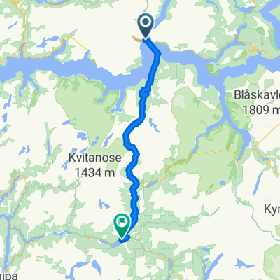
83. Dragsvik / Balestrand to Høyheimsvik
Un itinéraire vélo au départ de Balestrand, Sogn og Fjordane, Norvège.
Vue d'ensemble
À propos du circuit
- -:--
- Durée
- 74,9 km
- Distance
- 2 093 m
- Montée
- 2 061 m
- Descente
- ---
- Vit. moyenne
- 321 m
- Altitude max.

Qualité de l’itinéraire
Types de voies et surfaces le long de l’itinéraire
Types de routes
Piste cyclable
39 km
(52 %)
Route tranquille
5,2 km
(7 %)
surfaces
Pavé
65,2 km
(87 %)
Non pavé
3,7 km
(5 %)
Asphalte
65,2 km
(87 %)
Gravier
2,2 km
(3 %)
Points forts de l’itinéraire
Points d’intérêt le long de l’itinéraire
Hébergement après 0 km
Kviknes Hotel
Point d'intérêt après 0,1 km
Kræklingentunnelen Length: 337m Lighting: Yes Comments : I live here, and I've never been cycling through this tunnel due to the beautiful alternative route. Alternative route : There is a beautiful alternative at the narrow old road Villaveien.
Hébergement après 0,1 km
Midtnes Hotel
Point d'intérêt après 0,1 km
St. Olaf's Church - The English Church
Hébergement après 0,1 km
Kringsjå Hotell
Hébergement après 0,1 km
Balestrand Hotel
Point d'intérêt après 0,5 km
Ferry to Hella via Dragsvik 30 min M-F 0720 only
Hébergement après 1,9 km
Dragsvik Fjordhotel ? 2 night minimum
Hébergement après 2 km
Veganeset Camping cabins
Point d'intérêt après 2,4 km
Dragsvik to Hella ferry 10 min 0605 0655 0740 0810 0900 0930 1000 1025 1100 then 1/2 hourly
Point d'intérêt après 23,9 km
Bjørgahaug

Point d'intérêt après 24,8 km
Fatlatunnelen Length: 2200m Lighting: Comments : Alternative route : Go via the old road around the tunnel on National Cycle route 6.

Point d'intérêt après 35,7 km
Stedjebergtunnelen Length: 2100m Lighting: Yes Comments : Alternative route : Follow the National cycle route 6 signed cycle path that goes along the fjord shore.
Eau potable après 42,7 km
Dampskipskaien Cafe , Bar Restaurant
Point d'intérêt après 49,4 km
Årøytunnelen Length: 430m Lighting: Yes Comments : It is possible but not fun. Little space. Alternative route : Use the small road east of 55.
Point d'intérêt après 52,5 km
Stupshølentunnelen Length: 77m Lighting: None. Comments : Short easy tunnel.
Eau potable après 55,9 km
Lustraporten AS Restaurant
Point d'intérêt après 57,3 km
Solvorn kyrkje
Eau potable après 57,3 km
Kvitabui Matnaust og Galleri Restaurant
Hébergement après 58,3 km
Hafslo Guesthouse
Hébergement après 59 km
BesteBakken
Point d'intérêt après 64,1 km
Fet kyrkje
Eau potable après 64,8 km
Livdtun cafe
Point d'intérêt après 67,3 km
Røneidtunnelen Length: 657m Lighting: Yes Comments : This tunnel is totally upgraded in 2018/2019. New lights, it even got these buttons on the outside where you can push to warn cars about cyclists the in tunnel. The old road by the fjord is also fully upgraded, with asphalt, and absolutely NO cars. Watch out for falling ice and rocks in the spring, it is not recommended to ride outside the tunnel from december to april. Alternative route : The old road by the fjord. Upgraded i 2017.
Point d'intérêt après 70,9 km
Råumtunnelen Length: 514m Lighting: Yes Comments : This tunnel is fully upgraded in 2019. New and very good lightning. You can see through the entire tunnel. New signs, Syklist i tunnel, press the button and use them. Alternative route : The old road is in poor condition. It is rideable on MTB, gravel or CX. The scenery is nice though.
Point d'intérêt après 74,9 km
Nes kyrkje
Hébergement après 74,9 km
Nes Gard
Continuer avec Bikemap
Utilise, modifie ou télécharge cet itinéraire vélo
Tu veux parcourir 83. Dragsvik / Balestrand to Høyheimsvik ou l’adapter à ton propre voyage ? Voici ce que tu peux faire avec cet itinéraire Bikemap :
Fonctionnalités gratuites
- Enregistre cet itinéraire comme favori ou dans une collection
- Copie et planifie ta propre version de cet itinéraire
- Synchronise ton itinéraire avec Garmin ou Wahoo
Fonctionnalités Premium
Essai gratuit de 3 jours, ou paiement unique. En savoir plus sur Bikemap Premium.
- Navigue sur cet itinéraire sur iOS et Android
- Exporter un fichier GPX / KML de cet itinéraire
- Crée ton impression personnalisée (essaie-la gratuitement)
- Télécharge cet itinéraire pour la navigation hors ligne
Découvre plus de fonctionnalités Premium.
Obtiens Bikemap PremiumDe notre communauté
Balestrand : Autres itinéraires populaires qui commencent ici
 Noorwegen trip route 5: Balestrand - Lustrafjorden
- Distance
- 72,6 km
- Montée
- 1 207 m
- Descente
- 1 244 m
- Emplacement
- Balestrand, Sogn og Fjordane, Norvège
 NOR 051: Dragsvik - Balestrand - Dragsvik
- Distance
- 21,5 km
- Montée
- 0 m
- Descente
- 0 m
- Emplacement
- Balestrand, Sogn og Fjordane, Norvège
 RNK 33
- Distance
- 89,1 km
- Montée
- 1 226 m
- Descente
- 1 166 m
- Emplacement
- Balestrand, Sogn og Fjordane, Norvège
 83. Dragsvik / Balestrand to Høyheimsvik
- Distance
- 74,9 km
- Montée
- 2 093 m
- Descente
- 2 061 m
- Emplacement
- Balestrand, Sogn og Fjordane, Norvège
 1b flam fjoird tagesausflug?
- Distance
- 35 km
- Montée
- 996 m
- Descente
- 1 034 m
- Emplacement
- Balestrand, Sogn og Fjordane, Norvège
 8 . Hella - Vågåmo (route options)
- Distance
- 205,6 km
- Montée
- 0 m
- Descente
- 0 m
- Emplacement
- Balestrand, Sogn og Fjordane, Norvège
 Balestrand - Hol
- Distance
- 233,6 km
- Montée
- 4 756 m
- Descente
- 4 221 m
- Emplacement
- Balestrand, Sogn og Fjordane, Norvège
 Day 1
Day 1- Distance
- 54,7 km
- Montée
- 1 592 m
- Descente
- 1 183 m
- Emplacement
- Balestrand, Sogn og Fjordane, Norvège
Ouvre-la dans l’app