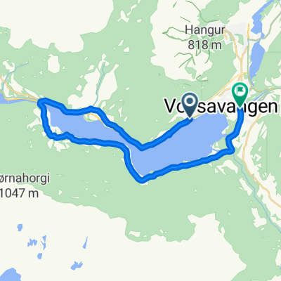
87A. Vossevangen to Norheimsund via ferries
Un itinéraire vélo au départ de Voss, Hordaland, Norvège.
Vue d'ensemble
À propos du circuit
39 km jusqu'au ferry de Kvanndal 36 km jusqu'au ferry de Jondal 14 km jusqu'à Norheimsund ... total 89 km de cyclisme
- -:--
- Durée
- 98,9 km
- Distance
- 2 076 m
- Montée
- 2 134 m
- Descente
- ---
- Vit. moyenne
- 277 m
- Altitude max.
Qualité de l’itinéraire
Types de voies et surfaces le long de l’itinéraire
Types de routes
Piste cyclable
33,6 km
(34 %)
Route
6,9 km
(7 %)
surfaces
Pavé
54,4 km
(55 %)
Asphalte
54,4 km
(55 %)
Indéfini
44,5 km
(45 %)
Points forts de l’itinéraire
Points d’intérêt le long de l’itinéraire
Hébergement après 0 km
Scandic Voss
Hébergement après 0,1 km
Fleischer's Hotel
Point d'intérêt après 0,3 km
Vangskyrkja Voss
Eau potable après 0,7 km
Vangen Café
Eau potable après 0,8 km
VossaBakst AS Bakery
Point d'intérêt après 15,6 km
Tunsbergtunnelen Length: 4080m Lighting: Yes Comments : Closed to cyclists. The cycle route just sticks to the old road, down or up the hairpins by the waterfalls, there are a few signposts for the cycle route, but they aren't completely clear. If heading south, there's a road sign to 'Seim'. Going north, there's a cycle-path sign to Voss, but someone's swivelled it round so it points 180-degrees in the wrong direction!. Alternative route : Use the old RV13 road through the valley.
Point d'intérêt après 18,1 km
Skjervsfossen Waterfall
Point d'intérêt après 18,1 km
Skorvofossen
Point d'intérêt après 28,9 km
Gullhammartunnelen Length: 194m Lighting: Yes Comments : Closed to cyclist, but alternative road. Alternative route : Cycle road on the west side of the lake, very quiet, with a very good road layer, see more info.
Hébergement après 30,5 km
Jaunsen Gjestgjevarstad AS
Point d'intérêt après 30,5 km
Coop Marked Granvin
Hébergement après 30,7 km
Heradshuset
Point d'intérêt après 34,8 km
Folkedalstunnelen Length: 1370m Lighting: Yes Comments : Opened December 2015. Well lit modern tunnel with mostly low traffic.
Point d'intérêt après 39,8 km
Kvanndal to Utne ferry M-F 0740 then hourly from 0900 Journey 20 min Sa hourly from 0700 Su hourly from 0800
Point d'intérêt après 44,3 km
Hardanger Folk Museum
Point d'intérêt après 66 km
Samlen
Point d'intérêt après 66,3 km
Rock-pictures
Eau potable après 67 km
Meieriet Restaurant
Eau potable après 67,1 km
Herand Groceries
Point d'intérêt après 78,5 km
Jonatunnelen Length: 731m Lighting: Yes Comments : Not much traffic, easy to cycle
Point d'intérêt après 79,2 km
Monsatunnelen Length: 137m Lighting: Yes Comments : Short, not much traffic, easy to cycle.
Eau potable après 80,1 km
Coop
Point d'intérêt après 80,2 km
Jondal to Tørvikbygd ferry 20 min Hourly at 20 past the hour
Point d'intérêt après 89,5 km
Vangdalsbergetunnelen Length: 430m Lighting: ? Comments : Last I checked it was made legal to use this tunnel. I believe they closed the old road outside due to rock fall risk. Speed was reduced and warning signs of cyclist in tunnel was set up.
Point d'intérêt après 90,6 km
Salthammeren Stone Age Carvings
Point d'intérêt après 95,7 km
Vikøy kyrkje
Point d'intérêt après 98 km
Hardanger Maritime Centre
Hébergement après 98,9 km
Thon Hotel Sandven
Continuer avec Bikemap
Utilise, modifie ou télécharge cet itinéraire vélo
Tu veux parcourir 87A. Vossevangen to Norheimsund via ferries ou l’adapter à ton propre voyage ? Voici ce que tu peux faire avec cet itinéraire Bikemap :
Fonctionnalités gratuites
- Enregistre cet itinéraire comme favori ou dans une collection
- Copie et planifie ta propre version de cet itinéraire
- Divise-le en étapes pour créer un tour sur plusieurs jours
- Synchronise ton itinéraire avec Garmin ou Wahoo
Fonctionnalités Premium
Essai gratuit de 3 jours, ou paiement unique. En savoir plus sur Bikemap Premium.
- Navigue sur cet itinéraire sur iOS et Android
- Exporter un fichier GPX / KML de cet itinéraire
- Crée ton impression personnalisée (essaie-la gratuitement)
- Télécharge cet itinéraire pour la navigation hors ligne
Découvre plus de fonctionnalités Premium.
Obtiens Bikemap PremiumDe notre communauté
Voss : Autres itinéraires populaires qui commencent ici
 Day 2, Voss - Ulvik
- Distance
- 43,3 km
- Montée
- 871 m
- Descente
- 911 m
- Emplacement
- Voss, Hordaland, Norvège
 Da Evangervegen 15 a Evangervegen 9
- Distance
- 24,1 km
- Montée
- 417 m
- Descente
- 410 m
- Emplacement
- Voss, Hordaland, Norvège
 87. Vossevangen to Norheimsund
- Distance
- 78,5 km
- Montée
- 2 260 m
- Descente
- 2 319 m
- Emplacement
- Voss, Hordaland, Norvège
 Flatlandsmo-Kløve-rundt Vangsvatnet
- Distance
- 60,5 km
- Montée
- 712 m
- Descente
- 737 m
- Emplacement
- Voss, Hordaland, Norvège
 Hardangerfjord route Voss - Rosendal - Sunde - Leirvik
- Distance
- 228 km
- Montée
- 0 m
- Descente
- 0 m
- Emplacement
- Voss, Hordaland, Norvège
 NOR 050: Runde bei Voss
- Distance
- 14,2 km
- Montée
- 0 m
- Descente
- 0 m
- Emplacement
- Voss, Hordaland, Norvège
 Voss-Geilo 2013
- Distance
- 162,1 km
- Montée
- 2 741 m
- Descente
- 2 000 m
- Emplacement
- Voss, Hordaland, Norvège
 Vangsvatnet uten sentrum
- Distance
- 20,4 km
- Montée
- 265 m
- Descente
- 266 m
- Emplacement
- Voss, Hordaland, Norvège
Ouvre-la dans l’app


