

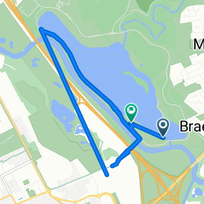
The Ladywell Way - Motherwell to Hillend Reservoir
Un itinéraire vélo au départ de Motherwell, Ecosse, Royaume-Uni.
Vue d'ensemble
À propos du circuit
- -:--
- Durée
- 33 km
- Distance
- 340 m
- Montée
- 339 m
- Descente
- ---
- Vit. moyenne
- 267 m
- Altitude max.

Qualité de l’itinéraire
Types de voies et surfaces le long de l’itinéraire
Types de routes
Route tranquille
7,3 km
(22 %)
Piste cyclable
4,3 km
(13 %)
surfaces
Pavé
5,3 km
(16 %)
Non pavé
1,6 km
(5 %)
Asphalte
3,3 km
(10 %)
Pavé (non défini)
2 km
(6 %)
Points forts de l’itinéraire
Points d’intérêt le long de l’itinéraire
Point d'intérêt après 3,3 km
Carfin Grotto 100 Newarthill Road, Motherwell, United Kingdom 01698 263308
Point d'intérêt après 11,3 km
Former Quarry
Point d'intérêt après 14 km
Joins quiet tarmac road
Point d'intérêt après 16,4 km
Lilly Loch
Continuer avec Bikemap
Utilise, modifie ou télécharge cet itinéraire vélo
Tu veux parcourir The Ladywell Way - Motherwell to Hillend Reservoir ou l’adapter à ton propre voyage ? Voici ce que tu peux faire avec cet itinéraire Bikemap :
Fonctionnalités gratuites
- Enregistre cet itinéraire comme favori ou dans une collection
- Copie et planifie ta propre version de cet itinéraire
- Synchronise ton itinéraire avec Garmin ou Wahoo
Fonctionnalités Premium
Essai gratuit de 3 jours, ou paiement unique. En savoir plus sur Bikemap Premium.
- Navigue sur cet itinéraire sur iOS et Android
- Exporter un fichier GPX / KML de cet itinéraire
- Crée ton impression personnalisée (essaie-la gratuitement)
- Télécharge cet itinéraire pour la navigation hors ligne
Découvre plus de fonctionnalités Premium.
Obtiens Bikemap PremiumDe notre communauté
Motherwell : Autres itinéraires populaires qui commencent ici
 The Ladywell Way - Motherwell to Hillend Reservoir
- Distance
- 33 km
- Montée
- 340 m
- Descente
- 339 m
- Emplacement
- Motherwell, Ecosse, Royaume-Uni
 Solo JOGLE Day 5
- Distance
- 123,1 km
- Montée
- 550 m
- Descente
- 525 m
- Emplacement
- Motherwell, Ecosse, Royaume-Uni
 North Lodge Avenue 5 to Clyde Valley Avenue 1
- Distance
- 0,1 km
- Montée
- 0 m
- Descente
- 0 m
- Emplacement
- Motherwell, Ecosse, Royaume-Uni
 Woodlands Road 31 to M74
- Distance
- 9,7 km
- Montée
- 92 m
- Descente
- 144 m
- Emplacement
- Motherwell, Ecosse, Royaume-Uni
 Hamilton Road 366, Bellshill to Unnamed Road, Bellshill
- Distance
- 10,2 km
- Montée
- 41 m
- Descente
- 41 m
- Emplacement
- Motherwell, Ecosse, Royaume-Uni
 Recovered Route
- Distance
- 11 km
- Montée
- 211 m
- Descente
- 223 m
- Emplacement
- Motherwell, Ecosse, Royaume-Uni
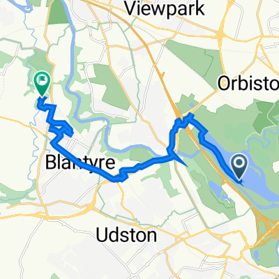
 The Ladywell Way - Motherwell to Hillend Reservoir
- Distance
- 17,3 km
- Montée
- 268 m
- Descente
- 147 m
- Emplacement
- Motherwell, Ecosse, Royaume-Uni
 Motherwell West Ward, North Lanarkshire to 72 Kirkwall Ave, Glasgow
- Distance
- 10,9 km
- Montée
- 90 m
- Descente
- 78 m
- Emplacement
- Motherwell, Ecosse, Royaume-Uni
Ouvre-la dans l’app