

Lockport NY to Hamburg NY
Un itinéraire vélo au départ de South Lockport, New York, États Unis.
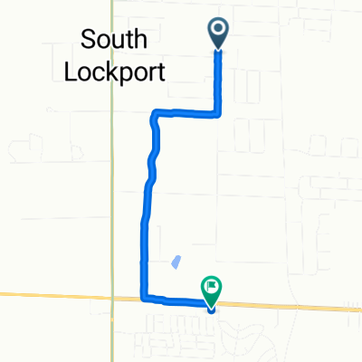
Vue d'ensemble
À propos du circuit
What was just a ride to get through the big city of Buffalo turned into a very interesting one.
The first part of the ride was along or close to the Erie Canal. All of the path was paved, though some parts were better paved than other parts. While the canal had little water in it four days prior when we were last alongside it, it was now full. Much more impressive when it's full. Along the route, we saw some pretty nice docks that people have built. We'd see some docks on previous days, but they were pretty rudimentary and normally not kept up well. Those we saw today were most much nicer and in better condition.
The second part, which was relatively short, was a rails-to-trails section that essentially went from near the start of the canal to a few miles south.
The third part and remainder of the ride was solely through parts of Buffalo. While most of our riding in metropolitan areas this trip has been through middle class or better neighborhoods, this ride took us along some roads with a lot of variance in economics. Especially along Fillmore, we saw numerous minorities including a number that had clearly immigrated in recent years. One place that had a pretty good name that was a play on an expression was "Black by Request". Would have been nice to stop as a sign of the specials said that that they had three of something (tostados?) for $3.50. Sad it wasn't time to stop for a meal.
Going thorgh these Buffalo neighborhoods was not scenic, but we found it particularly interesting. To us, it was the most integrated area that we'd seen...ever. We also saw a number of major impressive chirches in these areas and later as we got farther south.
Despite the sometimes gale force headwinds, this was a very iunexpectedly interesting ride.
- 4 h 59 min
- Durée
- 63,8 km
- Distance
- 208 m
- Montée
- 163 m
- Descente
- 12,8 km/h
- Vit. moyenne
- 235 m
- Altitude max.

Qualité de l’itinéraire
Types de voies et surfaces le long de l’itinéraire
Types de routes
Piste cyclable
29,7 km
(46 %)
Route fréquentée
11,5 km
(18 %)
surfaces
Pavé
34,6 km
(54 %)
Asphalte
33,2 km
(52 %)
Pavé (non défini)
0,9 km
(1 %)
Continuer avec Bikemap
Utilise, modifie ou télécharge cet itinéraire vélo
Tu veux parcourir Lockport NY to Hamburg NY ou l’adapter à ton propre voyage ? Voici ce que tu peux faire avec cet itinéraire Bikemap :
Fonctionnalités gratuites
- Enregistre cet itinéraire comme favori ou dans une collection
- Copie et planifie ta propre version de cet itinéraire
- Synchronise ton itinéraire avec Garmin ou Wahoo
Fonctionnalités Premium
Essai gratuit de 3 jours, ou paiement unique. En savoir plus sur Bikemap Premium.
- Navigue sur cet itinéraire sur iOS et Android
- Exporter un fichier GPX / KML de cet itinéraire
- Crée ton impression personnalisée (essaie-la gratuitement)
- Télécharge cet itinéraire pour la navigation hors ligne
Découvre plus de fonctionnalités Premium.
Obtiens Bikemap PremiumDe notre communauté
South Lockport : Autres itinéraires populaires qui commencent ici
 Slow ride in Lockport
- Distance
- 3,2 km
- Montée
- 9 m
- Descente
- 19 m
- Emplacement
- South Lockport, New York, États Unis
 Lockport NY to Hamburg NY
- Distance
- 63,8 km
- Montée
- 208 m
- Descente
- 163 m
- Emplacement
- South Lockport, New York, États Unis
 6596 Campbell Blvd, Lockport to 6596 Campbell Blvd, Lockport
- Distance
- 59 km
- Montée
- 0 m
- Descente
- 0 m
- Emplacement
- South Lockport, New York, États Unis
 Pendleton Park ride
- Distance
- 31,3 km
- Montée
- 46 m
- Descente
- 44 m
- Emplacement
- South Lockport, New York, États Unis
 Nia Falls Blvd
- Distance
- 29,4 km
- Montée
- 206 m
- Descente
- 206 m
- Emplacement
- South Lockport, New York, États Unis
 Canal trip
- Distance
- 354,9 km
- Montée
- 108 m
- Descente
- 166 m
- Emplacement
- South Lockport, New York, États Unis
 LAFC to Beaman Park
- Distance
- 34,7 km
- Montée
- 16 m
- Descente
- 15 m
- Emplacement
- South Lockport, New York, États Unis
 Everything is Terrible
- Distance
- 31,5 km
- Montée
- 167 m
- Descente
- 167 m
- Emplacement
- South Lockport, New York, États Unis
Ouvre-la dans l’app