

CYCLING THE RHINE: Route 14A.alt
Un itinéraire vélo au départ de Oppenheim, Rhénanie-Palatinat, Allemagne.
Vue d'ensemble
À propos du circuit
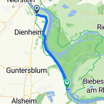
Ceci est une section alternative de la Route 14A, qui voyage plus près du Rhin que l'itinéraire décrit dans le livre papier, d'Oppenheim à Gimbsheim. Veuillez noter : je n'ai pas eu l'occasion de parcourir toute cette section, donc j'ai dû me fier à des sources en ligne pour mapper des parties de cet itinéraire. Au fil des ans, je m'attends à ce que cette section ait été améliorée et ne soit plus aussi sujette aux inondations qu'auparavant.
- -:--
- Durée
- 10,4 km
- Distance
- 38 m
- Montée
- 38 m
- Descente
- ---
- Vit. moyenne
- ---
- Altitude max.
Qualité de l’itinéraire
Types de voies et surfaces le long de l’itinéraire
Types de routes
Route forestière
9,1 km
(87 %)
Route tranquille
0,8 km
(8 %)
Route d'accès
0,5 km
(5 %)
surfaces
Pavé
1,4 km
(13 %)
Non pavé
7,1 km
(68 %)
Gravier
7,1 km
(68 %)
Asphalte
0,8 km
(8 %)
Points forts de l’itinéraire
Points d’intérêt le long de l’itinéraire
Point d'intérêt après 0 km
Continue straight on at this point for the alternative to the described route (Route 14A). This alternative route travels closer to the Rhine, all the way to Gimbsheim.
Point d'intérêt après 0 km
The described route (Route 14A) continues in this direction.
Point d'intérêt après 10,3 km
Rejoin the described route (Route 14A) at this point.
Continuer avec Bikemap
Utilise, modifie ou télécharge cet itinéraire vélo
Tu veux parcourir CYCLING THE RHINE: Route 14A.alt ou l’adapter à ton propre voyage ? Voici ce que tu peux faire avec cet itinéraire Bikemap :
Fonctionnalités gratuites
- Enregistre cet itinéraire comme favori ou dans une collection
- Copie et planifie ta propre version de cet itinéraire
- Synchronise ton itinéraire avec Garmin ou Wahoo
Fonctionnalités Premium
Essai gratuit de 3 jours, ou paiement unique. En savoir plus sur Bikemap Premium.
- Navigue sur cet itinéraire sur iOS et Android
- Exporter un fichier GPX / KML de cet itinéraire
- Crée ton impression personnalisée (essaie-la gratuitement)
- Télécharge cet itinéraire pour la navigation hors ligne
Découvre plus de fonctionnalités Premium.
Obtiens Bikemap PremiumDe notre communauté
Oppenheim : Autres itinéraires populaires qui commencent ici
 Mittlere Rheinrunde
- Distance
- 35,2 km
- Montée
- 163 m
- Descente
- 162 m
- Emplacement
- Oppenheim, Rhénanie-Palatinat, Allemagne
 The Hell (Der Echte Wadenzwicker)
- Distance
- 138,1 km
- Montée
- 888 m
- Descente
- 886 m
- Emplacement
- Oppenheim, Rhénanie-Palatinat, Allemagne
 Oppenheim-Ried-Gernsheim-Oppenheim
- Distance
- 49,2 km
- Montée
- 44 m
- Descente
- 44 m
- Emplacement
- Oppenheim, Rhénanie-Palatinat, Allemagne
 Auf der Morgenweide 7, Oppenheim nach Auf der Morgenweide 7, Oppenheim
- Distance
- 47,1 km
- Montée
- 413 m
- Descente
- 460 m
- Emplacement
- Oppenheim, Rhénanie-Palatinat, Allemagne
 Rheintour Etappe 11
- Distance
- 111,5 km
- Montée
- 380 m
- Descente
- 391 m
- Emplacement
- Oppenheim, Rhénanie-Palatinat, Allemagne
 CYCLING THE RHINE: Route 14A.alt
- Distance
- 10,4 km
- Montée
- 38 m
- Descente
- 38 m
- Emplacement
- Oppenheim, Rhénanie-Palatinat, Allemagne
 Touren
- Distance
- 2,7 km
- Montée
- 6 m
- Descente
- 8 m
- Emplacement
- Oppenheim, Rhénanie-Palatinat, Allemagne
 Runde ab Riedsee 45
- Distance
- 45,3 km
- Montée
- 41 m
- Descente
- 41 m
- Emplacement
- Oppenheim, Rhénanie-Palatinat, Allemagne
Ouvre-la dans l’app