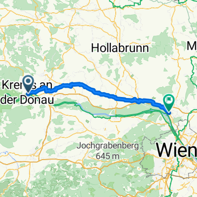
L06KremsTulln
Un itinéraire vélo au départ de Krems an der Donau, Basse-Autriche, Autriche.
Vue d'ensemble
À propos du circuit
De la ville médiévale à la ville des jardins et de l'art / La visite d'aujourd'hui vous emmène le long de la rive nord et de la rive sud du Danube et hors de la Wachau et de sa campagne façonnée par la main de l'homme. Vous commencez à Krems le long du Danube, un charmant centre de commerce et de culture, et pédalez le long de la piste cyclable du Danube jusqu'à Tulln, une ville du Danube connue pour ses jardins et son art. Altenwörth et Zwentendorf font partie des villes que vous traversez avant d'arriver à votre destination sur la rive sud du fleuve. / AVIS IMPORTANT : / De février 2020 à la fin de 2021, le sentier cyclable du Danube sera détourné dans la zone de Höhe Ringstraße à Krems, en raison de travaux de pipeline nécessaires. De plus, le Treppelweg le long du Danube est en cours de rénovation jusqu'à la fin juin. Veuillez suivre les panneaux de déviation dans la zone de la ville de Krems. / En raison des travaux de construction, toute la section entre Krems et Tulln sur la rive nord sera fermée d'avril 2020 à décembre 2021. Nous demandons à tous les cyclistes voyageant de Krems à Tulln ou vice versa d'utiliser la piste cyclable sur la rive sud. La déviation est indiquée. / Krems an der Donau – Altenworth (affluent Traisen) nous traversons la rivière vers la rive droite - Zwentendorf an der Donau – Kleinschonbichl - Pischelsdorf - Langenschonbichl - Tulln ob Donavi (41 km, 20 m)
- -:--
- Durée
- 42,6 km
- Distance
- 87 m
- Montée
- 108 m
- Descente
- ---
- Vit. moyenne
- 203 m
- Altitude max.
Qualité de l’itinéraire
Types de voies et surfaces le long de l’itinéraire
Types de routes
Route forestière
27,7 km
(65 %)
Route tranquille
6,4 km
(15 %)
surfaces
Pavé
40,9 km
(96 %)
Non pavé
1,7 km
(4 %)
Asphalte
40,9 km
(96 %)
Non pavé (non défini)
1,7 km
(4 %)
Continuer avec Bikemap
Utilise, modifie ou télécharge cet itinéraire vélo
Tu veux parcourir L06KremsTulln ou l’adapter à ton propre voyage ? Voici ce que tu peux faire avec cet itinéraire Bikemap :
Fonctionnalités gratuites
- Enregistre cet itinéraire comme favori ou dans une collection
- Copie et planifie ta propre version de cet itinéraire
- Synchronise ton itinéraire avec Garmin ou Wahoo
Fonctionnalités Premium
Essai gratuit de 3 jours, ou paiement unique. En savoir plus sur Bikemap Premium.
- Navigue sur cet itinéraire sur iOS et Android
- Exporter un fichier GPX / KML de cet itinéraire
- Crée ton impression personnalisée (essaie-la gratuitement)
- Télécharge cet itinéraire pour la navigation hors ligne
Découvre plus de fonctionnalités Premium.
Obtiens Bikemap PremiumDe notre communauté
Krems an der Donau : Autres itinéraires populaires qui commencent ici
 Krems to Spitz in Wachau
- Distance
- 20,9 km
- Montée
- 249 m
- Descente
- 218 m
- Emplacement
- Krems an der Donau, Basse-Autriche, Autriche
 Krems-Altenwörth-Krems
- Distance
- 43,2 km
- Montée
- 51 m
- Descente
- 50 m
- Emplacement
- Krems an der Donau, Basse-Autriche, Autriche
 Austria-Krems am der Donau (31.05.2021, 12:34:15)
- Distance
- 78,4 km
- Montée
- 765 m
- Descente
- 774 m
- Emplacement
- Krems an der Donau, Basse-Autriche, Autriche
 Unbenannte Route
- Distance
- 71,1 km
- Montée
- 179 m
- Descente
- 206 m
- Emplacement
- Krems an der Donau, Basse-Autriche, Autriche
 Rohrendorf - Gasthof zur schönen Aussicht - Rohrendorf
- Distance
- 31 km
- Montée
- 376 m
- Descente
- 374 m
- Emplacement
- Krems an der Donau, Basse-Autriche, Autriche
 Girolibero: Il Danubio e la Wachau wellness
- Distance
- 380,1 km
- Montée
- 885 m
- Descente
- 880 m
- Emplacement
- Krems an der Donau, Basse-Autriche, Autriche
 Kleine Bergrunde
- Distance
- 11,6 km
- Montée
- 221 m
- Descente
- 221 m
- Emplacement
- Krems an der Donau, Basse-Autriche, Autriche
 Krems-Fuglau
- Distance
- 87,3 km
- Montée
- 961 m
- Descente
- 961 m
- Emplacement
- Krems an der Donau, Basse-Autriche, Autriche
Ouvre-la dans l’app


