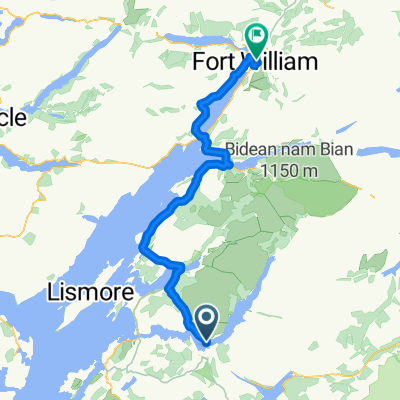
LEJO'G 20 Oban to Fort William
Un itinéraire vélo au départ de Oban, Ecosse, Royaume-Uni.
Vue d'ensemble
À propos du circuit
61 km jusqu'au ferry de Corran + 17 km jusqu'à Camusnagaul.
Dernier ferry à 16h35 (ou +25 km autour du lac). Dépend des conditions météo et des marées.
10 km de moins en suivant la A82 côté est (sans ferry).
- -:--
- Durée
- 81,1 km
- Distance
- 788 m
- Montée
- 808 m
- Descente
- ---
- Vit. moyenne
- 113 m
- Altitude max.
Qualité de l’itinéraire
Types de voies et surfaces le long de l’itinéraire
Types de routes
Piste cyclable
43 km
(53 %)
Route tranquille
8,1 km
(10 %)
surfaces
Pavé
60,9 km
(75 %)
Asphalte
46,3 km
(57 %)
Pavé (non défini)
14,6 km
(18 %)
Indéfini
20,3 km
(25 %)
Points forts de l’itinéraire
Points d’intérêt le long de l’itinéraire
Hébergement après 0 km
Ardmor Seaview
Point d'intérêt après 53,9 km
Last Clansman Memorial On this rocky knoll above the loch an innocent man was hanged for a famous crime. Known as the Appin Murder, it intrigued Robert Louis Stevenson and inspired him to write Kidnapped. Known as Red Fox, Colin Campbell of Glenure had, following the defeat at Culloden, been appointed factor of the forfeited estates of the Appin Stewarts. On the morning of 14 May 1752, he had crossed the narrows at Ballachulish by ferry. With Campbell were a man servant, a sheriff officer, and an Edinburgh lawyer. When they reached the woods at Lettermore, a shot rang out. Hit in the back, perhaps through the heart, Campbell fell to the ground fatally wounded. Despite being able to convincingly show he had been nowhere near the woods that day, James Stewart's alibi was dismissed. On the 8th November 1752, on this knoll known as Cnoc Chaolais Mhic Phadraig, James Stewart was hung and his body left to hang there for eighteen months, a blunt warning against sedition and armed rebellion that no traveller across the narrows at Ballachulish would miss.
Eau potable après 54,1 km
Loch Leven Hotel
Point d'intérêt après 54,1 km
F.W.Holroyd Art Gallery
Point d'intérêt après 60,9 km
Corran to Ardgour Ferry 0630 - 0850 every 20 min 0915 - 2045 every 30 min * 10km shorter following A82 along east side - no ferries.
Eau potable après 61,5 km
Nomad Cafe closes 1500
Eau potable après 61,6 km
The Inn at Ardgour
Eau potable après 62,6 km
Ardgour Ales Brewery ref Miriam Margolyes
Point d'intérêt après 67,2 km
Watercolour Music Recording studio ref Miriam Margolyes....
Point d'intérêt après 67,3 km
Viewpoint
Point d'intérêt après 67,3 km
Glenfinnan Viewpoint
Point d'intérêt après 67,3 km
Glenfinnan Viaduct Train crosses 1045 & 1500
Point d'intérêt après 78,5 km
Camousnagaul Ferry 0815 1015 1230 1635 ₤3.30 no service Sundays weather and tides permitting
Point d'intérêt après 80,4 km
Fort William Pier Promenade
Point d'intérêt après 80,6 km
The Old Fort of Fort William
Point d'intérêt après 80,8 km
West Coast Railways Jacobite Steam Train - Hogwarts Express Train Dep 1015 & 1250 Arr 1603 & 1852
Point d'intérêt après 81 km
Train photo opportunity Incoming 1555 & 1845 Outgoing 1015 & 1250
Point d'intérêt après 81 km
Fort William Shinty Club
Point d'intérêt après 81,1 km
Ben Nevis
Point d'intérêt après 81,1 km
Ben Nevis Distillery
Point d'intérêt après 81,1 km
Old Inverlochy Castle Ruined 13th-century castle on the banks of River Lochy, that was backdrop for Inverlochy battles.
Point d'intérêt après 81,1 km
Cow Hill Viewpoint
Hébergement après 81,1 km
MacLean Guest House
Continuer avec Bikemap
Utilise, modifie ou télécharge cet itinéraire vélo
Tu veux parcourir LEJO'G 20 Oban to Fort William ou l’adapter à ton propre voyage ? Voici ce que tu peux faire avec cet itinéraire Bikemap :
Fonctionnalités gratuites
- Enregistre cet itinéraire comme favori ou dans une collection
- Copie et planifie ta propre version de cet itinéraire
- Divise-le en étapes pour créer un tour sur plusieurs jours
- Synchronise ton itinéraire avec Garmin ou Wahoo
Fonctionnalités Premium
Essai gratuit de 3 jours, ou paiement unique. En savoir plus sur Bikemap Premium.
- Navigue sur cet itinéraire sur iOS et Android
- Exporter un fichier GPX / KML de cet itinéraire
- Crée ton impression personnalisée (essaie-la gratuitement)
- Télécharge cet itinéraire pour la navigation hors ligne
Découvre plus de fonctionnalités Premium.
Obtiens Bikemap PremiumDe notre communauté
Oban : Autres itinéraires populaires qui commencent ici
 St Columba's Way - Taynuilt to Dalmally St Columba's way-Taynuilt to Dalmally
- Distance
- 34,2 km
- Montée
- 728 m
- Descente
- 706 m
- Emplacement
- Oban, Ecosse, Royaume-Uni
 Bonawe to Fort William
- Distance
- 70 km
- Montée
- 406 m
- Descente
- 412 m
- Emplacement
- Oban, Ecosse, Royaume-Uni
 Scotland 2020 Day 07
- Distance
- 34,9 km
- Montée
- 226 m
- Descente
- 225 m
- Emplacement
- Oban, Ecosse, Royaume-Uni
 JOGLE Day 4
- Distance
- 126,4 km
- Montée
- 907 m
- Descente
- 906 m
- Emplacement
- Oban, Ecosse, Royaume-Uni
 Girolibero: Scozia e il canale di Caledonia
- Distance
- 397 km
- Montée
- 943 m
- Descente
- 947 m
- Emplacement
- Oban, Ecosse, Royaume-Uni
 Oban ardnamurchan mull circle
- Distance
- 237,6 km
- Montée
- 962 m
- Descente
- 967 m
- Emplacement
- Oban, Ecosse, Royaume-Uni
 Oban Fort William
- Distance
- 80,7 km
- Montée
- 285 m
- Descente
- 286 m
- Emplacement
- Oban, Ecosse, Royaume-Uni
 H3-Oban-Mull-Iona-Tobermory-Mallaig 220Km
- Distance
- 222,4 km
- Montée
- 981 m
- Descente
- 964 m
- Emplacement
- Oban, Ecosse, Royaume-Uni
Ouvre-la dans l’app


