

Arthurs Creek
Un itinéraire vélo au départ de Ashwood, Victoria, Australia.
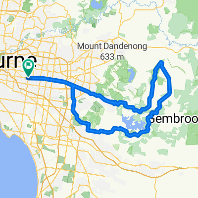
Vue d'ensemble
À propos du circuit
Arthurs Creek is a classic “rouler” ride taking in the hills of north east Melbourne. Consisting of two different loops this ride can be shortened, if needed. The first loop from Warrandyte passes Kangaroo Ground, Hurstbridge, Arthurs Creek & Panton Hill. The second loop around Panton Hill is via Watsons Creek & Smith’s Gully which includes the highest climb of the day; Clintons Rd. Although the climbs are not particular daunting rest assured that by days end you will know you have completed another gruelling 6am-er classic ride.
Ride Founder: Kevin "Murph" Murphy
- -:--
- Durée
- 109,7 km
- Distance
- 812 m
- Montée
- 812 m
- Descente
- ---
- Vit. moyenne
- ---
- Altitude max.

Continuer avec Bikemap
Utilise, modifie ou télécharge cet itinéraire vélo
Tu veux parcourir Arthurs Creek ou l’adapter à ton propre voyage ? Voici ce que tu peux faire avec cet itinéraire Bikemap :
Fonctionnalités gratuites
- Enregistre cet itinéraire comme favori ou dans une collection
- Copie et planifie ta propre version de cet itinéraire
- Divise-le en étapes pour créer un tour sur plusieurs jours
- Synchronise ton itinéraire avec Garmin ou Wahoo
Fonctionnalités Premium
Essai gratuit de 3 jours, ou paiement unique. En savoir plus sur Bikemap Premium.
- Navigue sur cet itinéraire sur iOS et Android
- Exporter un fichier GPX / KML de cet itinéraire
- Crée ton impression personnalisée (essaie-la gratuitement)
- Télécharge cet itinéraire pour la navigation hors ligne
Découvre plus de fonctionnalités Premium.
Obtiens Bikemap PremiumDe notre communauté
Ashwood : Autres itinéraires populaires qui commencent ici
 Hurtbox Tuesday
- Distance
- 49,8 km
- Montée
- 96 m
- Descente
- 175 m
- Emplacement
- Ashwood, Victoria, Australia
 Gruyere De Grande
- Distance
- 109,3 km
- Montée
- 927 m
- Descente
- 928 m
- Emplacement
- Ashwood, Victoria, Australia
 Pav-Macca
- Distance
- 124,5 km
- Montée
- 876 m
- Descente
- 877 m
- Emplacement
- Ashwood, Victoria, Australia
 Mount Waverley to Federation Square
- Distance
- 25,1 km
- Montée
- 133 m
- Descente
- 238 m
- Emplacement
- Ashwood, Victoria, Australia
 Rhonda Van Readie
- Distance
- 108,3 km
- Montée
- 972 m
- Descente
- 973 m
- Emplacement
- Ashwood, Victoria, Australia
 Kinglake via Flat Rock
- Distance
- 120,6 km
- Montée
- 1 039 m
- Descente
- 1 040 m
- Emplacement
- Ashwood, Victoria, Australia
 Toolangi
- Distance
- 142,8 km
- Montée
- 931 m
- Descente
- 931 m
- Emplacement
- Ashwood, Victoria, Australia
 Flat to Ferns
- Distance
- 120,9 km
- Montée
- 864 m
- Descente
- 864 m
- Emplacement
- Ashwood, Victoria, Australia
Ouvre-la dans l’app