

Mooloolaba to Mt Coolum
Un itinéraire vélo au départ de Mooloolaba, State of Queensland, Australie.
Vue d'ensemble
À propos du circuit
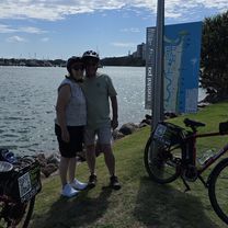
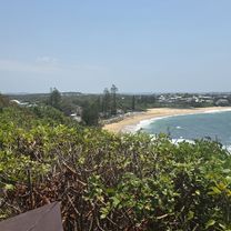
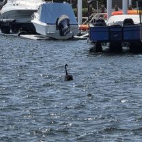
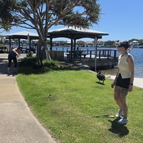
e-bike ride from Mooloolaba to Mt Coolum as we approached Mt Coolum, the road turnes inland towards Mount Coolum National Park. Even though we left the Coastal Pathway at Tanah St West (there were traffic lights with a pedestrian crossing that helped us negotiate the David Low Way), the path was still excellent all the way to the carpark at the bottom of the mountain. The e-bikes’ electric-assist made it easy for everyone to tackle the 23km ride, leaving us fresh for our climb to the summit of Mt Coolum. The top of this volcanic dome gave us panoramic views of the surrounding area, including the ocean, the hinterland, and the Glass House Mountains. Stunning!
- -:--
- Durée
- 52,4 km
- Distance
- 187 m
- Montée
- 187 m
- Descente
- ---
- Vit. moyenne
- 34 m
- Altitude max.

Qualité de l’itinéraire
Types de voies et surfaces le long de l’itinéraire
Types de routes
Piste cyclable
44 km
(84 %)
Route tranquille
3,7 km
(7 %)
surfaces
Pavé
47,2 km
(90 %)
Béton
38,8 km
(74 %)
Asphalte
4,7 km
(9 %)
Continuer avec Bikemap
Utilise, modifie ou télécharge cet itinéraire vélo
Tu veux parcourir Mooloolaba to Mt Coolum ou l’adapter à ton propre voyage ? Voici ce que tu peux faire avec cet itinéraire Bikemap :
Fonctionnalités gratuites
- Enregistre cet itinéraire comme favori ou dans une collection
- Copie et planifie ta propre version de cet itinéraire
- Synchronise ton itinéraire avec Garmin ou Wahoo
Fonctionnalités Premium
Essai gratuit de 3 jours, ou paiement unique. En savoir plus sur Bikemap Premium.
- Navigue sur cet itinéraire sur iOS et Android
- Exporter un fichier GPX / KML de cet itinéraire
- Crée ton impression personnalisée (essaie-la gratuitement)
- Télécharge cet itinéraire pour la navigation hors ligne
Découvre plus de fonctionnalités Premium.
Obtiens Bikemap PremiumDe notre communauté
Mooloolaba : Autres itinéraires populaires qui commencent ici
 La Balsa Park, Buddina to Happy Valley, Caloundra
- Distance
- 44,2 km
- Montée
- 188 m
- Descente
- 190 m
- Emplacement
- Mooloolaba, State of Queensland, Australie
 Harbour Parade to Harbour Parade
- Distance
- 41,5 km
- Montée
- 105 m
- Descente
- 154 m
- Emplacement
- Mooloolaba, State of Queensland, Australie
 Harbour Parade to Harbour Parade
- Distance
- 41,2 km
- Montée
- 125 m
- Descente
- 178 m
- Emplacement
- Mooloolaba, State of Queensland, Australie
 Harbour Parade to Harbour Parade
- Distance
- 42,1 km
- Montée
- 137 m
- Descente
- 180 m
- Emplacement
- Mooloolaba, State of Queensland, Australie
 Mooloolaba to Moffat Beach
- Distance
- 46,5 km
- Montée
- 49 m
- Descente
- 50 m
- Emplacement
- Mooloolaba, State of Queensland, Australie
 Pt Cartwright to Moffet Beach e-Bike Tour
- Distance
- 41,1 km
- Montée
- 182 m
- Descente
- 231 m
- Emplacement
- Mooloolaba, State of Queensland, Australie
 Harbour Parade to Harbour Parade
- Distance
- 42,5 km
- Montée
- 120 m
- Descente
- 171 m
- Emplacement
- Mooloolaba, State of Queensland, Australie
 Harbour Parade to Harbour Parade
- Distance
- 41,3 km
- Montée
- 140 m
- Descente
- 190 m
- Emplacement
- Mooloolaba, State of Queensland, Australie
Ouvre-la dans l’app