

Moab to Mineral Bottom Road
Un itinéraire vélo au départ de Moab, Utah, États Unis.
Vue d'ensemble
À propos du circuit
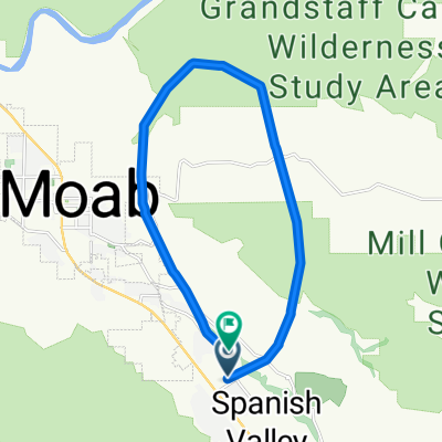
Le chemin de Moab à Mineral Bottom est une balade sûre et amusante qui suit la piste cyclable jusqu'à la route 313.
La piste cyclable, située juste au nord de Moab sur le côté nord du fleuve Colorado, est nouvelle et en excellent état. Vous suivez le chemin en passant devant l'entrée du parc national Arches et en montant la colline qui sort de la vallée de Moab. Cette colline atteint une pente d'environ 6 % et éloigne les cyclistes de la route bruyante. Après quelques miles, le chemin revient vers l'ouest, passe sous la route (US191) et continue jusqu'à la Utah 313.
À ce point, vous traversez la route et vous dirigez vers l'ouest, tournant lentement vers le sud, sur une large route avec une bonne bande d'arrêt. Bien que la 313 mène au parc d'État Dead Horse et au parc national Canyonlands, elle n'est pas très fréquentée. Vous la suivez à travers le canyon de Nine Mile alors qu'elle se rétrécit, puis vous faites quelques lacets plus raides (7%-8%) pour atteindre les hautes plaines près de Moab et des Monitor Buttes. Continuez avec un terrain vallonné mais généralement ascendant (avec une pente très faible). La Mineral Bottom Road est à 23 miles. Arrivez-y et revenez en arrière.
Vous voudrez faire cela lorsque le vent est minimal... il souffle fort au-dessus des lacets sur la 313. Apportez beaucoup d'eau car il n'y a pas d'installations. La distance totale est de 46 miles avec environ 2300 pieds de dénivelé. Si vous êtes juste en visite et que vous n'avez pas de vélo, Poison Spider Bicycles au nord de Moab (sur la 191) propose d'excellents vélos de route à louer.
- -:--
- Durée
- 75,4 km
- Distance
- 688 m
- Montée
- 690 m
- Descente
- ---
- Vit. moyenne
- ---
- Altitude max.
Continuer avec Bikemap
Utilise, modifie ou télécharge cet itinéraire vélo
Tu veux parcourir Moab to Mineral Bottom Road ou l’adapter à ton propre voyage ? Voici ce que tu peux faire avec cet itinéraire Bikemap :
Fonctionnalités gratuites
- Enregistre cet itinéraire comme favori ou dans une collection
- Copie et planifie ta propre version de cet itinéraire
- Synchronise ton itinéraire avec Garmin ou Wahoo
Fonctionnalités Premium
Essai gratuit de 3 jours, ou paiement unique. En savoir plus sur Bikemap Premium.
- Navigue sur cet itinéraire sur iOS et Android
- Exporter un fichier GPX / KML de cet itinéraire
- Crée ton impression personnalisée (essaie-la gratuitement)
- Télécharge cet itinéraire pour la navigation hors ligne
Découvre plus de fonctionnalités Premium.
Obtiens Bikemap PremiumDe notre communauté
Moab : Autres itinéraires populaires qui commencent ici
 USA_2016_Arches-Bryce Canyon-Las Vegas
- Distance
- 924,4 km
- Montée
- 3 861 m
- Descente
- 4 733 m
- Emplacement
- Moab, Utah, États Unis
 Salt Wash-DAV
- Distance
- 11,9 km
- Montée
- 469 m
- Descente
- 356 m
- Emplacement
- Moab, Utah, États Unis
 Moab 100
- Distance
- 159,6 km
- Montée
- 957 m
- Descente
- 957 m
- Emplacement
- Moab, Utah, États Unis
 Moab - Runde
- Distance
- 76,8 km
- Montée
- 1 470 m
- Descente
- 1 484 m
- Emplacement
- Moab, Utah, États Unis
 Moab to Mineral Bottom Road
- Distance
- 75,4 km
- Montée
- 688 m
- Descente
- 690 m
- Emplacement
- Moab, Utah, États Unis
 Moab Gran Fondo Loop
- Distance
- 94,5 km
- Montée
- 1 824 m
- Descente
- 1 675 m
- Emplacement
- Moab, Utah, États Unis
 Portal Long Canyon Mag7 Portal
- Distance
- 72,7 km
- Montée
- 1 754 m
- Descente
- 1 750 m
- Emplacement
- Moab, Utah, États Unis
 Moab
Moab- Distance
- 17,3 km
- Montée
- 691 m
- Descente
- 708 m
- Emplacement
- Moab, Utah, États Unis
Ouvre-la dans l’app