

Elizabeth East to Hilton South Australia
Un itinéraire vélo au départ de Elizabeth, Australie-Méridionale, Australie.
Vue d'ensemble
À propos du circuit
J'utilise cela comme mon itinéraire de trajet. Je pourrais emprunter la Salisbury Hwy, mais il n'y a pas de connexion "sûre" avec la Churchill Rd North depuis l'intersection de Port Wakefield Rd. Il y a de nombreux semi-remorques ici.
La portion de l'itinéraire qui longe l'aéroport de Parafield est un chemin partagé. Il n'est pas éclairé la nuit et les arbres envahissent. La surface est bitumée, cependant, à l'extrémité sud près de l'échangeur de Mawson Lakes, il y a des gravillons et un pont en bois à cadre en acier à traverser.
Les feux de circulation au coin de Port Rd et de James Congdon Drive sont adaptés aux cyclistes avec des boutons et des zones de refuge sûres.
L'itinéraire peut se poursuivre jusqu'à l'aéroport d'Adélaïde, West Beach et soit à gauche sur Tapleys Hill Rd vers Glenelg, soit vers la côte puis à droite vers Semaphore et d'autres banlieues.
- -:--
- Durée
- 30,5 km
- Distance
- 48 m
- Montée
- 91 m
- Descente
- ---
- Vit. moyenne
- ---
- Altitude max.
Continuer avec Bikemap
Utilise, modifie ou télécharge cet itinéraire vélo
Tu veux parcourir Elizabeth East to Hilton South Australia ou l’adapter à ton propre voyage ? Voici ce que tu peux faire avec cet itinéraire Bikemap :
Fonctionnalités gratuites
- Enregistre cet itinéraire comme favori ou dans une collection
- Copie et planifie ta propre version de cet itinéraire
- Synchronise ton itinéraire avec Garmin ou Wahoo
Fonctionnalités Premium
Essai gratuit de 3 jours, ou paiement unique. En savoir plus sur Bikemap Premium.
- Navigue sur cet itinéraire sur iOS et Android
- Exporter un fichier GPX / KML de cet itinéraire
- Crée ton impression personnalisée (essaie-la gratuitement)
- Télécharge cet itinéraire pour la navigation hors ligne
Découvre plus de fonctionnalités Premium.
Obtiens Bikemap PremiumDe notre communauté
Elizabeth : Autres itinéraires populaires qui commencent ici
 Star Cycles Inglewood-COP-Kersbrook
- Distance
- 64 km
- Montée
- 717 m
- Descente
- 717 m
- Emplacement
- Elizabeth, Australie-Méridionale, Australie
 Star Cycles - Sandy Creek - hillier rd
- Distance
- 59,8 km
- Montée
- 196 m
- Descente
- 196 m
- Emplacement
- Elizabeth, Australie-Méridionale, Australie
 Little Para River Trl, Salisbury Park to 12 Main St, Mawson Lakes
- Distance
- 12,3 km
- Montée
- 30 m
- Descente
- 70 m
- Emplacement
- Elizabeth, Australie-Méridionale, Australie
 Elizabeth East to Hilton South Australia
- Distance
- 30,5 km
- Montée
- 48 m
- Descente
- 91 m
- Emplacement
- Elizabeth, Australie-Méridionale, Australie
 Elizabeth - Nuriootpa
- Distance
- 134,8 km
- Montée
- 960 m
- Descente
- 722 m
- Emplacement
- Elizabeth, Australie-Méridionale, Australie
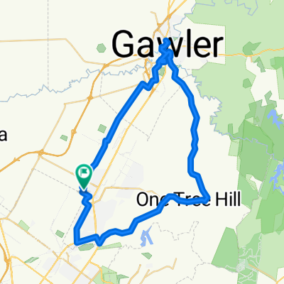 One Tree Hill Scenic route Gawler
- Distance
- 57,1 km
- Montée
- 330 m
- Descente
- 330 m
- Emplacement
- Elizabeth, Australie-Méridionale, Australie
 Elizabeth to Keswick (BikeSA) via Torrens River Trail
- Distance
- 42,3 km
- Montée
- 275 m
- Descente
- 327 m
- Emplacement
- Elizabeth, Australie-Méridionale, Australie
 Angaston to Handorf
- Distance
- 234,1 km
- Montée
- 1 334 m
- Descente
- 1 333 m
- Emplacement
- Elizabeth, Australie-Méridionale, Australie
Ouvre-la dans l’app