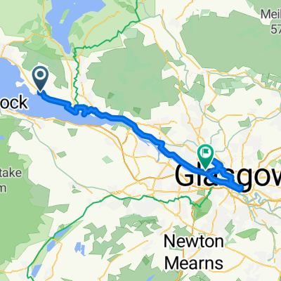
Short hilly route from Cardross
Un itinéraire vélo au départ de Cardross, Ecosse, Royaume-Uni.
Vue d'ensemble
À propos du circuit
Commencez à la gare de Cardross, montez la colline Carman jusqu'à Renton, tournez à gauche et longez le pont d'Alexandria sur la rivière Leven, puis tournez à droite, puis la deuxième à gauche, montez Papert Hill et continuez tout le long de la côte à 12 % jusqu'au rond-point, puis tournez à droite pour revenir vers le pont d'Alexandria, mais continuez tout droit jusqu'à Jamestown, juste après le garage, tournez à droite, montez la colline puis descendez jusqu'à la A811 et tournez à gauche pour revenir au rond-point, tournez à gauche de nouveau en traversant Jamestown jusqu'au pont, tournez à droite puis à gauche sur le sens unique et à gauche en traversant Renton jusqu'à Dalreoch, tournez à droite sur la A814 et revenez sur 3 miles jusqu'à Cardross. Un parcours court, raide et vallonné. Un peu plus d'une heure si vous allez bien.
- -:--
- Durée
- 28,7 km
- Distance
- 325 m
- Montée
- 325 m
- Descente
- ---
- Vit. moyenne
- ---
- Altitude max.
Continuer avec Bikemap
Utilise, modifie ou télécharge cet itinéraire vélo
Tu veux parcourir Short hilly route from Cardross ou l’adapter à ton propre voyage ? Voici ce que tu peux faire avec cet itinéraire Bikemap :
Fonctionnalités gratuites
- Enregistre cet itinéraire comme favori ou dans une collection
- Copie et planifie ta propre version de cet itinéraire
- Synchronise ton itinéraire avec Garmin ou Wahoo
Fonctionnalités Premium
Essai gratuit de 3 jours, ou paiement unique. En savoir plus sur Bikemap Premium.
- Navigue sur cet itinéraire sur iOS et Android
- Exporter un fichier GPX / KML de cet itinéraire
- Crée ton impression personnalisée (essaie-la gratuitement)
- Télécharge cet itinéraire pour la navigation hors ligne
Découvre plus de fonctionnalités Premium.
Obtiens Bikemap PremiumDe notre communauté
Cardross : Autres itinéraires populaires qui commencent ici
 Cardross to Balloch
- Distance
- 9,9 km
- Montée
- 224 m
- Descente
- 218 m
- Emplacement
- Cardross, Ecosse, Royaume-Uni
 Cardross to Glasgow side trip
- Distance
- 46,5 km
- Montée
- 132 m
- Descente
- 128 m
- Emplacement
- Cardross, Ecosse, Royaume-Uni
 Cardross to Wemyss Bay
- Distance
- 66 km
- Montée
- 497 m
- Descente
- 498 m
- Emplacement
- Cardross, Ecosse, Royaume-Uni
 9.Crow rd twice and roof of world both ways
- Distance
- 137,7 km
- Montée
- 1 082 m
- Descente
- 1 088 m
- Emplacement
- Cardross, Ecosse, Royaume-Uni
 Cardross to Glasgow via museums and historical sites
- Distance
- 43,2 km
- Montée
- 212 m
- Descente
- 208 m
- Emplacement
- Cardross, Ecosse, Royaume-Uni
 11. Rhu Hotel and back (TT route)
- Distance
- 21,8 km
- Montée
- 91 m
- Descente
- 91 m
- Emplacement
- Cardross, Ecosse, Royaume-Uni
 4. Rhu and Smugglers Way
- Distance
- 24,4 km
- Montée
- 125 m
- Descente
- 125 m
- Emplacement
- Cardross, Ecosse, Royaume-Uni
 10. Callander via Dukes Pass
- Distance
- 121,1 km
- Montée
- 814 m
- Descente
- 813 m
- Emplacement
- Cardross, Ecosse, Royaume-Uni
Ouvre-la dans l’app

