

Zum Brudertour
Un itinéraire vélo au départ de Biglen, Canton de Berne, Suisse.
Vue d'ensemble
À propos du circuit
- -:--
- Durée
- 179,6 km
- Distance
- 1 246 m
- Montée
- 1 559 m
- Descente
- ---
- Vit. moyenne
- ---
- Altitude max.
Points forts de l’itinéraire
Points d’intérêt le long de l’itinéraire
Point d'intérêt après 9,2 km
Point d'intérêt après 10,9 km
Point d'intérêt après 10,9 km
Continuer avec Bikemap
Utilise, modifie ou télécharge cet itinéraire vélo
Tu veux parcourir Zum Brudertour ou l’adapter à ton propre voyage ? Voici ce que tu peux faire avec cet itinéraire Bikemap :
Fonctionnalités gratuites
- Enregistre cet itinéraire comme favori ou dans une collection
- Copie et planifie ta propre version de cet itinéraire
- Divise-le en étapes pour créer un tour sur plusieurs jours
- Synchronise ton itinéraire avec Garmin ou Wahoo
Fonctionnalités Premium
Essai gratuit de 3 jours, ou paiement unique. En savoir plus sur Bikemap Premium.
- Navigue sur cet itinéraire sur iOS et Android
- Exporter un fichier GPX / KML de cet itinéraire
- Crée ton impression personnalisée (essaie-la gratuitement)
- Télécharge cet itinéraire pour la navigation hors ligne
Découvre plus de fonctionnalités Premium.
Obtiens Bikemap PremiumDe notre communauté
Biglen : Autres itinéraires populaires qui commencent ici
 1 Tag / Arni - Soloturn
- Distance
- 45,1 km
- Montée
- 50 m
- Descente
- 474 m
- Emplacement
- Biglen, Canton de Berne, Suisse
 BikeRouteBiglen
- Distance
- 15,5 km
- Montée
- 483 m
- Descente
- 483 m
- Emplacement
- Biglen, Canton de Berne, Suisse
 Rothackerstrasse 16, Biglen nach Köniztalstrasse 18, Köniz
- Distance
- 26,5 km
- Montée
- 271 m
- Descente
- 445 m
- Emplacement
- Biglen, Canton de Berne, Suisse
 Gässli 365, Biglen nach Schlosswilstrasse, Schlosswil
- Distance
- 4,3 km
- Montée
- 26 m
- Descente
- 130 m
- Emplacement
- Biglen, Canton de Berne, Suisse
 b2bw: Schlosswil - Sumiwald
- Distance
- 49,4 km
- Montée
- 1 206 m
- Descente
- 1 236 m
- Emplacement
- Biglen, Canton de Berne, Suisse
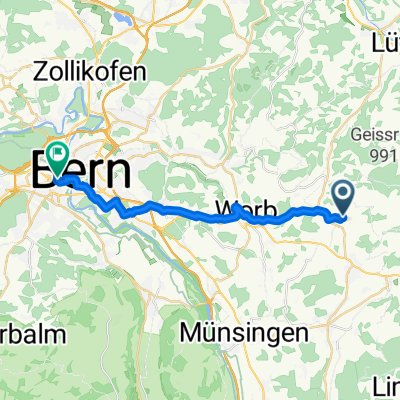 Biglen - Bern 2
- Distance
- 19,3 km
- Montée
- 112 m
- Descente
- 329 m
- Emplacement
- Biglen, Canton de Berne, Suisse
 Schlosswil-Häutligen-Wrach. 16km, 300hm
- Distance
- 9,1 km
- Montée
- 165 m
- Descente
- 198 m
- Emplacement
- Biglen, Canton de Berne, Suisse
 Arni-Trubschachen Moosegg-Arni
- Distance
- 42,6 km
- Montée
- 648 m
- Descente
- 643 m
- Emplacement
- Biglen, Canton de Berne, Suisse
Ouvre-la dans l’app