

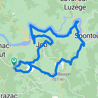
Ride Day 37—19 Oct 2005—19220 St-Julien-aux-Bois to 24200 Sarlat-La-Canéda
Un itinéraire vélo au départ de Saint-Privat, Nouvelle-Aquitaine, France.
Vue d'ensemble
À propos du circuit
Nous avons passé du temps sur d'excellentes routes de campagne, jusqu'à ce que nous atteignions des zones peuplées le long de la rivière Cère, lorsque la terre s'est aplanie et que nous avons accéléré le long d'une route relativement principale qui avait généralement peu de circulation. Ce n'est que dans les 25 kilomètres environ avant Souillac que nous avons dû gravir un plateau où il y avait quelques collines douces avant une longue descente vers Souillac. Après la montée initiale vers le plateau, où nous nous sommes arrêtés pour un second déjeuner, ma femme a décidé que c'était "Sarlat ou rien". Donc, malgré l'heure relativement tardive et les 30 miles environ restants à parcourir, nous nous sommes dépêchés et sommes arrivés à temps juste avant 18h30. C'était notre vitesse moyenne la plus élevée du voyage à plus de 10 mph. Comme tout le monde peut l'apprécier, nous n'allons donc nulle part très vite.
Contexte : Ma femme et moi faisons des circuits autogérés en Europe de l'Ouest (principalement en France) depuis 1993. Cette série de parcours couvre notre itinéraire de 2 mois à travers certaines parties de la France en 2005. Notre point de départ et d'arrivée est près de Chadurie (au sud d'Angoulême) où nos amis ont une ferme avec des Gîtes et des Chambres d'Hôtes. Nous avons roulé avec nos vélos de tourisme Dawes achetés en 1993, lourdement chargés avec des pneus 700Cx32. Nos promenades se déroulaient entièrement sur des routes pavées, principalement avec très peu de circulation.
Si vous avez des questions, n'hésitez pas à m'envoyer un e-mail à jeffkadet@netdiving.com.
Jeff
- -:--
- Durée
- 114,8 km
- Distance
- 633 m
- Montée
- 1 067 m
- Descente
- ---
- Vit. moyenne
- ---
- Altitude max.

Qualité de l’itinéraire
Types de voies et surfaces le long de l’itinéraire
Types de routes
Route
12,6 km
(11 %)
Route tranquille
9,2 km
(8 %)
surfaces
Pavé
57,4 km
(50 %)
Asphalte
57,4 km
(50 %)
Indéfini
57,4 km
(50 %)
Continuer avec Bikemap
Utilise, modifie ou télécharge cet itinéraire vélo
Tu veux parcourir Ride Day 37—19 Oct 2005—19220 St-Julien-aux-Bois to 24200 Sarlat-La-Canéda ou l’adapter à ton propre voyage ? Voici ce que tu peux faire avec cet itinéraire Bikemap :
Fonctionnalités gratuites
- Enregistre cet itinéraire comme favori ou dans une collection
- Copie et planifie ta propre version de cet itinéraire
- Divise-le en étapes pour créer un tour sur plusieurs jours
- Synchronise ton itinéraire avec Garmin ou Wahoo
Fonctionnalités Premium
Essai gratuit de 3 jours, ou paiement unique. En savoir plus sur Bikemap Premium.
- Navigue sur cet itinéraire sur iOS et Android
- Exporter un fichier GPX / KML de cet itinéraire
- Crée ton impression personnalisée (essaie-la gratuitement)
- Télécharge cet itinéraire pour la navigation hors ligne
Découvre plus de fonctionnalités Premium.
Obtiens Bikemap PremiumDe notre communauté
Saint-Privat : Autres itinéraires populaires qui commencent ici
 Running Bassignac
- Distance
- 5,2 km
- Montée
- 66 m
- Descente
- 58 m
- Emplacement
- Saint-Privat, Nouvelle-Aquitaine, France
 Ride Day 37—19 Oct 2005—19220 St-Julien-aux-Bois to 24200 Sarlat-La-Canéda
- Distance
- 114,8 km
- Montée
- 633 m
- Descente
- 1 067 m
- Emplacement
- Saint-Privat, Nouvelle-Aquitaine, France
 Viaduc Rocher noir
- Distance
- 35,1 km
- Montée
- 535 m
- Descente
- 537 m
- Emplacement
- Saint-Privat, Nouvelle-Aquitaine, France
 Téléthon Auriac
- Distance
- 90,6 km
- Montée
- 808 m
- Descente
- 808 m
- Emplacement
- Saint-Privat, Nouvelle-Aquitaine, France
 3 Lafont, Saint-Privat à 1 Lafont, Saint-Privat
- Distance
- 59 km
- Montée
- 1 525 m
- Descente
- 1 522 m
- Emplacement
- Saint-Privat, Nouvelle-Aquitaine, France
 Jour 5 Saint-Geniez-Lac d'Enchanet
- Distance
- 32,1 km
- Montée
- 383 m
- Descente
- 408 m
- Emplacement
- Saint-Privat, Nouvelle-Aquitaine, France
 Untitled route
- Distance
- 29,2 km
- Montée
- 925 m
- Descente
- 924 m
- Emplacement
- Saint-Privat, Nouvelle-Aquitaine, France
 Téléthon 2ème boucle
- Distance
- 29,5 km
- Montée
- 336 m
- Descente
- 333 m
- Emplacement
- Saint-Privat, Nouvelle-Aquitaine, France
Ouvre-la dans l’app