

Tallinn Bike Tour
Un itinéraire vélo au départ de Tallinn, Harju, Estonie.
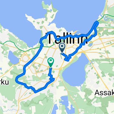
Vue d'ensemble
À propos du circuit
A bike tour from the Central Tallinn District to the Northern Tallinn District and back to the city (from 10.00 to 14.00 including a lunch break at the Telliskivi Creative City). We are more than happy to show you some of the most interesting ongoing public space and bike infrastructure projects in the city of Tallinn of recent years (the pop-up bike paths of Central Tallinn; the Old Harbour tramline, the new biodiverse public space along the coastline of Tallinn.
- -:--
- Durée
- 14,1 km
- Distance
- 56 m
- Montée
- 55 m
- Descente
- ---
- Vit. moyenne
- 35 m
- Altitude max.
Points forts de l’itinéraire
Points d’intérêt le long de l’itinéraire
Point d'intérêt après 0 km
Start of tour in front of Tallinn City Government, 7 Vabaduse Square
Point d'intérêt après 0 km
Vabaduse bus stop
Point d'intérêt après 1,6 km
Tallinn high street (Peatänav)
Point d'intérêt après 2,2 km
pop-up bikelanes of Tallinn
Point d'intérêt après 4,6 km
Reidi tee promenade
Point d'intérêt après 5,8 km
Cruise Terminal Building
Point d'intérêt après 6,4 km
Harbour tramline construction site
Point d'intérêt après 7 km
City Hall Development Site
Point d'intérêt après 7,5 km
Kalaranna promenade
Point d'intérêt après 9,3 km
Noblessner Development AREA
Point d'intérêt après 10,4 km
Viewing Platform of Vana-Kalamaja Street
Point d'intérêt après 11 km
Kalamaja Square
Point d'intérêt après 11,9 km
Pollinator Highway (Kopli cargo station)
Point d'intérêt après 13,3 km
pop-up bikelanes of Tallinn
Continuer avec Bikemap
Utilise, modifie ou télécharge cet itinéraire vélo
Tu veux parcourir Tallinn Bike Tour ou l’adapter à ton propre voyage ? Voici ce que tu peux faire avec cet itinéraire Bikemap :
Fonctionnalités gratuites
- Enregistre cet itinéraire comme favori ou dans une collection
- Copie et planifie ta propre version de cet itinéraire
- Synchronise ton itinéraire avec Garmin ou Wahoo
Fonctionnalités Premium
Essai gratuit de 3 jours, ou paiement unique. En savoir plus sur Bikemap Premium.
- Navigue sur cet itinéraire sur iOS et Android
- Exporter un fichier GPX / KML de cet itinéraire
- Crée ton impression personnalisée (essaie-la gratuitement)
- Télécharge cet itinéraire pour la navigation hors ligne
Découvre plus de fonctionnalités Premium.
Obtiens Bikemap PremiumDe notre communauté
Tallinn : Autres itinéraires populaires qui commencent ici
 best route But go to Pärnu
- Distance
- 369,1 km
- Montée
- 1 144 m
- Descente
- 1 168 m
- Emplacement
- Tallinn, Harju, Estonie
 Pirita-Õismäe-Nõmme (GRV)
- Distance
- 36,2 km
- Montée
- 155 m
- Descente
- 144 m
- Emplacement
- Tallinn, Harju, Estonie
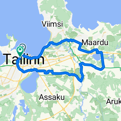 Pirita-Maardu-Lagedi (GRV)
- Distance
- 51,2 km
- Montée
- 144 m
- Descente
- 145 m
- Emplacement
- Tallinn, Harju, Estonie
 Умеренный маршрут в Таллинн
- Distance
- 10,5 km
- Montée
- 0 m
- Descente
- 6 m
- Emplacement
- Tallinn, Harju, Estonie
 От Paldiski maantee до Paldiski maantee
- Distance
- 49,4 km
- Montée
- 188 m
- Descente
- 188 m
- Emplacement
- Tallinn, Harju, Estonie
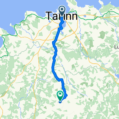
 Lõime, Tallinn to Valingu-Jõgisoo tee, Tutermaa
- Distance
- 28,2 km
- Montée
- 108 m
- Descente
- 83 m
- Emplacement
- Tallinn, Harju, Estonie
 80rowerów.pl krajami bałtyckimi
- Distance
- 972,1 km
- Montée
- 457 m
- Descente
- 475 m
- Emplacement
- Tallinn, Harju, Estonie
 Day 1 - Biking the Baltics
- Distance
- 67,2 km
- Montée
- 232 m
- Descente
- 193 m
- Emplacement
- Tallinn, Harju, Estonie
Ouvre-la dans l’app