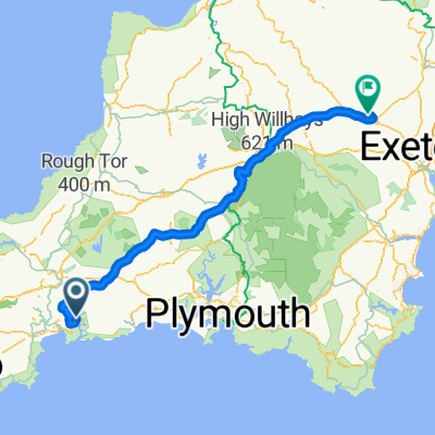
Fowey - St Mawes
Un itinéraire vélo au départ de Fowey, Angleterre, Royaume-Uni.
Vue d'ensemble
À propos du circuit
C'est une belle promenade de Fowey à la rivière Fal. Ce n'est pas un trajet plat, mais il évite la plupart des routes principales et offre de beaux paysages.
Lorsque vous arrivez à St Mawes, vous pouvez vous connecter au réseau Fal River Links avec des services réguliers vers Place, Falmouth, Trelissick, Tolverne et Truro. Tous ces services acceptent les vélos.
Veuillez noter : Vous devrez porter votre vélo à bord en descendant quelques marches en pierre, ce qui peut être délicat à marée basse. Veuillez retirer les sacoches avant l'embarquement. Les tarifs pour les vélos varient de £1 à £2 l'aller simple.
- -:--
- Durée
- 48 km
- Distance
- 508 m
- Montée
- 503 m
- Descente
- ---
- Vit. moyenne
- ---
- Altitude max.
Qualité de l’itinéraire
Types de voies et surfaces le long de l’itinéraire
Types de routes
Route
13 km
(27 %)
Route tranquille
4,8 km
(10 %)
surfaces
Pavé
32,6 km
(68 %)
Asphalte
32,6 km
(68 %)
Indéfini
15,4 km
(32 %)
Points forts de l’itinéraire
Points d’intérêt le long de l’itinéraire
Point d'intérêt après 0 km
Some great Cafes in Fowey, this is our top pick: http://www.pinkymurphys.com
Point d'intérêt après 13,5 km
Point d'intérêt après 18,3 km
Caution: Very steep drop down into Pentewan.
Point d'intérêt après 19,2 km
Alternative Route: Follow the coast Road through Mevagissey, Gorran Haven, Caerhays & Veryan. Re join original route near Ruan High Lanes.
Point d'intérêt après 21,7 km
If your looking for a coffee stop, try Heligan Gardens
Point d'intérêt après 40,5 km
Alternative Route: Beautiful ride through Gerrans and on to St Anthony Head with amazing views over the river. You can then catch the Place Ferry from Place Creek to St Mawes.
Continuer avec Bikemap
Utilise, modifie ou télécharge cet itinéraire vélo
Tu veux parcourir Fowey - St Mawes ou l’adapter à ton propre voyage ? Voici ce que tu peux faire avec cet itinéraire Bikemap :
Fonctionnalités gratuites
- Enregistre cet itinéraire comme favori ou dans une collection
- Copie et planifie ta propre version de cet itinéraire
- Synchronise ton itinéraire avec Garmin ou Wahoo
Fonctionnalités Premium
Essai gratuit de 3 jours, ou paiement unique. En savoir plus sur Bikemap Premium.
- Navigue sur cet itinéraire sur iOS et Android
- Exporter un fichier GPX / KML de cet itinéraire
- Crée ton impression personnalisée (essaie-la gratuitement)
- Télécharge cet itinéraire pour la navigation hors ligne
Découvre plus de fonctionnalités Premium.
Obtiens Bikemap PremiumDe notre communauté
Fowey : Autres itinéraires populaires qui commencent ici
 Day 2 - Golant to Crediton
- Distance
- 110,2 km
- Montée
- 929 m
- Descente
- 909 m
- Emplacement
- Fowey, Angleterre, Royaume-Uni
 Fowey to Polperro
- Distance
- 19,2 km
- Montée
- 411 m
- Descente
- 437 m
- Emplacement
- Fowey, Angleterre, Royaume-Uni
 Club Mix to Padstow
- Distance
- 85,6 km
- Montée
- 1 309 m
- Descente
- 1 309 m
- Emplacement
- Fowey, Angleterre, Royaume-Uni
 Day 2
Day 2- Distance
- 96,2 km
- Montée
- 1 298 m
- Descente
- 1 071 m
- Emplacement
- Fowey, Angleterre, Royaume-Uni
 2 Station Road, Fowey to 33–39 Court St, Moretonhampstead, Newton Abbot
- Distance
- 1 784,3 km
- Montée
- 1 435 m
- Descente
- 1 436 m
- Emplacement
- Fowey, Angleterre, Royaume-Uni
 LeJog - Day 2
- Distance
- 116,7 km
- Montée
- 2 007 m
- Descente
- 1 907 m
- Emplacement
- Fowey, Angleterre, Royaume-Uni
 Fowey - St Mawes
- Distance
- 48 km
- Montée
- 508 m
- Descente
- 503 m
- Emplacement
- Fowey, Angleterre, Royaume-Uni
 Recovered Route
- Distance
- 34,9 km
- Montée
- 0 m
- Descente
- 6 m
- Emplacement
- Fowey, Angleterre, Royaume-Uni
Ouvre-la dans l’app

