Assault on Droop Mountain - Mountain State Wheelers
Un itinéraire vélo au départ de Marlinton, Virginie-Occidentale, États Unis.
Vue d'ensemble
À propos du circuit
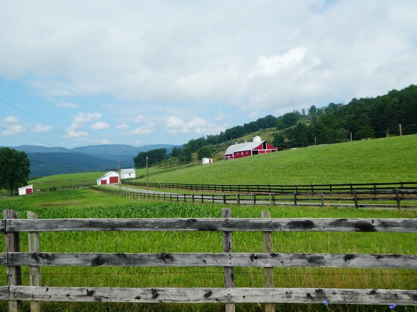
Ceci est une sortie régulière lors du week-end de camping d'automne du Mountain State Wheelers Bicycle Club au parc d'État de Watoga. Très pittoresque. Faites le court détour par la tour d'observation de Droop Mt. Il y a aussi une fontaine à eau à la tour.
Assaut sur Droop Mt.0.0 Départ du camping Beaver Creek - parc d'État de Watoga0.2 Tournez à droite en sortant du camping0.8 À gauche pour traverser le parc.3.0 À droite au lac7.3 Continuez à travers Seebert.9.6 À gauche sur 21910.9 À droite sur Lobelia Road à l'église Cooper Top à Hillsboro.12.3 Commencez la première montée de Droop.14.5 Sommet de la montée15.7 À droite pour aller à Lobelia. À gauche pour écourter la randonnée et passer par le parc d'État de Droop Mt. Battlefield.17.4 Commencez la courte montée raide.18.1 Centre-ville de Lobelia18.8 Commencez la courte montée raide de plus de 17%.20.0 Commencez la courte montée raide.20.4 Tenez-vous à gauche dans le virage aigu et continuez en descente.20.7 Commencez la courte montée raide.21.7 Tournez à gauche dans le virage aigu. Ne prenez pas Jacox Road.22.5 Commencez la deuxième montée de Droop Mt.23.9 À gauche sur US 21924.9 Prenez à gauche ici dans le parc pour aller à la tour d'observation de Droop Mountain. Faites le détour.26.5 À droite sur Locust Creek Rd. C'est un virage très aigu avant d'atteindre le bas de la colline.29.6 À gauche et un autre à gauche immédiat sur Co. 31/9 et commencez l'ascension. À droite de cette intersection se trouve le pont couvert de Locust Creek.Vous pouvez également continuer sur Co 31 à travers Denmar et revenir à la route.31.5 Continuez tout droit à l'intersection.35.2 À droite sur US 219 à Hillboro et commencez à retracer le parcours de retour au camping.46.5 Fin
- -:--
- Durée
- 74,8 km
- Distance
- 1 016 m
- Montée
- 1 016 m
- Descente
- ---
- Vit. moyenne
- ---
- Altitude max.
Qualité de l’itinéraire
Types de voies et surfaces le long de l’itinéraire
Types de routes
Route
38,2 km
(51 %)
Route tranquille
29,2 km
(39 %)
Indéfini
7,5 km
(10 %)
surfaces
Pavé
21,7 km
(29 %)
Non pavé
0,7 km
(1 %)
Asphalte
20,2 km
(27 %)
Pavé (non défini)
1,5 km
(2 %)
Continuer avec Bikemap
Utilise, modifie ou télécharge cet itinéraire vélo
Tu veux parcourir Assault on Droop Mountain - Mountain State Wheelers ou l’adapter à ton propre voyage ? Voici ce que tu peux faire avec cet itinéraire Bikemap :
Fonctionnalités gratuites
- Enregistre cet itinéraire comme favori ou dans une collection
- Copie et planifie ta propre version de cet itinéraire
- Synchronise ton itinéraire avec Garmin ou Wahoo
Fonctionnalités Premium
Essai gratuit de 3 jours, ou paiement unique. En savoir plus sur Bikemap Premium.
- Navigue sur cet itinéraire sur iOS et Android
- Exporter un fichier GPX / KML de cet itinéraire
- Crée ton impression personnalisée (essaie-la gratuitement)
- Télécharge cet itinéraire pour la navigation hors ligne
Découvre plus de fonctionnalités Premium.
Obtiens Bikemap PremiumDe notre communauté
Marlinton : Autres itinéraires populaires qui commencent ici
 Hillsboro-Lobelia Loop
- Distance
- 28,7 km
- Montée
- 571 m
- Descente
- 571 m
- Emplacement
- Marlinton, Virginie-Occidentale, États Unis
 Upper Scenic Highway Map
- Distance
- 39,7 km
- Montée
- 828 m
- Descente
- 828 m
- Emplacement
- Marlinton, Virginie-Occidentale, États Unis
 Marlinton Loop
- Distance
- 63,5 km
- Montée
- 1 209 m
- Descente
- 1 208 m
- Emplacement
- Marlinton, Virginie-Occidentale, États Unis
 Lobelia Loop
- Distance
- 39,3 km
- Montée
- 690 m
- Descente
- 690 m
- Emplacement
- Marlinton, Virginie-Occidentale, États Unis
 Clover Lick - Green Bank
- Distance
- 50,3 km
- Montée
- 546 m
- Descente
- 546 m
- Emplacement
- Marlinton, Virginie-Occidentale, États Unis
 Assault on Droop Mountain
- Distance
- 73,7 km
- Montée
- 1 053 m
- Descente
- 1 053 m
- Emplacement
- Marlinton, Virginie-Occidentale, États Unis
 Assault on Droop Mountain - Mountain State Wheelers
- Distance
- 74,8 km
- Montée
- 1 016 m
- Descente
- 1 016 m
- Emplacement
- Marlinton, Virginie-Occidentale, États Unis
 Marlinton-Cloverlick Loop
- Distance
- 62,8 km
- Montée
- 537 m
- Descente
- 537 m
- Emplacement
- Marlinton, Virginie-Occidentale, États Unis
Ouvre-la dans l’app


