

Burlington to Bellingham
Un itinéraire vélo au départ de Burlington, Washington, États Unis.
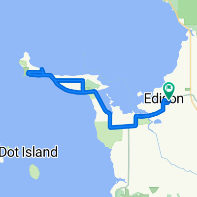
Vue d'ensemble
À propos du circuit
La première moitié à deux tiers de la balade était essentiellement plate à travers de belles zones agricoles. Après cette partie plate, nous avons emprunté Chuckanut Drive, qui est vraiment une belle route le long de la côte au sud de Bellingham, qui monte et descend plusieurs fois. Les seuls inconvénients sont un peu trop de circulation, bien que cela ne soit pas inconfortable pour nous, et l'absence d'accotement. Il y a quelques points de vue, mais avec les arbres sous ces points de vue qui ont poussé, la vue sur le Puget Sound était agréable, mais pas aussi panoramique qu'elle pourrait l'être autrement. Globalement, une super balade avec de bonnes conditions routières et de beaux paysages et panoramas.
- 4 h 27 min
- Durée
- 52,8 km
- Distance
- 635 m
- Montée
- 590 m
- Descente
- 11,9 km/h
- Vit. moyenne
- 98 m
- Altitude max.

Photos de l’itinéraire


Qualité de l’itinéraire
Types de voies et surfaces le long de l’itinéraire
Types de routes
Route
16,4 km
(31 %)
Route tranquille
3,2 km
(6 %)
surfaces
Pavé
31,7 km
(60 %)
Asphalte
30,1 km
(57 %)
Béton
1,6 km
(3 %)
Indéfini
21,1 km
(40 %)
Continuer avec Bikemap
Utilise, modifie ou télécharge cet itinéraire vélo
Tu veux parcourir Burlington to Bellingham ou l’adapter à ton propre voyage ? Voici ce que tu peux faire avec cet itinéraire Bikemap :
Fonctionnalités gratuites
- Enregistre cet itinéraire comme favori ou dans une collection
- Copie et planifie ta propre version de cet itinéraire
- Synchronise ton itinéraire avec Garmin ou Wahoo
Fonctionnalités Premium
Essai gratuit de 3 jours, ou paiement unique. En savoir plus sur Bikemap Premium.
- Navigue sur cet itinéraire sur iOS et Android
- Exporter un fichier GPX / KML de cet itinéraire
- Crée ton impression personnalisée (essaie-la gratuitement)
- Télécharge cet itinéraire pour la navigation hors ligne
Découvre plus de fonctionnalités Premium.
Obtiens Bikemap PremiumDe notre communauté
Burlington : Autres itinéraires populaires qui commencent ici
 Recording from September 18, 9:53 PM
- Distance
- 7,8 km
- Montée
- 8 m
- Descente
- 8 m
- Emplacement
- Burlington, Washington, États Unis
 Bow Cemetary-EdisonLoop
- Distance
- 25,4 km
- Montée
- 10 m
- Descente
- 10 m
- Emplacement
- Burlington, Washington, États Unis
 Mt. Constitution
- Distance
- 265 km
- Montée
- 682 m
- Descente
- 550 m
- Emplacement
- Burlington, Washington, États Unis
 5530 Chuckanut Dr, Bow to 14969 W Bow Hill Rd, Bow
- Distance
- 47,1 km
- Montée
- 761 m
- Descente
- 758 m
- Emplacement
- Burlington, Washington, États Unis
 Edison-SamishIsland20200728
- Distance
- 25 km
- Montée
- 119 m
- Descente
- 119 m
- Emplacement
- Burlington, Washington, États Unis
 2012 Skagit Spring Classic 45-Mile Route
- Distance
- 75,9 km
- Montée
- 254 m
- Descente
- 254 m
- Emplacement
- Burlington, Washington, États Unis
 Recording from September 18, 4:29 PM
- Distance
- 12,1 km
- Montée
- 0 m
- Descente
- 0 m
- Emplacement
- Burlington, Washington, États Unis
 EdisonSchool-SamishIsland
- Distance
- 20,5 km
- Montée
- 62 m
- Descente
- 63 m
- Emplacement
- Burlington, Washington, États Unis
Ouvre-la dans l’app