Hope to Sunshine Valley
Un itinéraire vélo au départ de Hope, Colombie-Britannique, Canada.
Vue d'ensemble
À propos du circuit
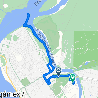
C'était une balade très lente, car à part le dernier kilomètre ou deux, c'était presque tout en montée sous la pluie. Sortir de Hope était une montée sur une autoroute très fréquentée, qui combine les autoroutes 5 et 3 de la Colombie-Britannique (et peut-être l'autoroute nationale 1 également). Finalement, après quelques kilomètres, nous avons quitté la route principale pour emprunter la route 3 et étions ravis du niveau de circulation beaucoup plus faible. (Il y avait encore plus de circulation et de bruit que ce que nous aurions souhaité, mais en comparaison, c'était beaucoup mieux.) Pendant toute la balade aujourd'hui, il y avait une bonne bande d'arrêt d'urgence, bien que parfois, dans la dernière partie de la montée, elle aurait pu être un peu plus large. En raison des nuages bas, nous n'avons pas pu voir beaucoup du paysage, mais ce que nous avons pu voir était merveilleux.
- 3 h 39 min
- Durée
- 23,5 km
- Distance
- 944 m
- Montée
- 307 m
- Descente
- 6,4 km/h
- Vit. moyenne
- 731 m
- Altitude max.
Photos de l’itinéraire
Continuer avec Bikemap
Utilise, modifie ou télécharge cet itinéraire vélo
Tu veux parcourir Hope to Sunshine Valley ou l’adapter à ton propre voyage ? Voici ce que tu peux faire avec cet itinéraire Bikemap :
Fonctionnalités gratuites
- Enregistre cet itinéraire comme favori ou dans une collection
- Copie et planifie ta propre version de cet itinéraire
- Synchronise ton itinéraire avec Garmin ou Wahoo
Fonctionnalités Premium
Essai gratuit de 3 jours, ou paiement unique. En savoir plus sur Bikemap Premium.
- Navigue sur cet itinéraire sur iOS et Android
- Exporter un fichier GPX / KML de cet itinéraire
- Crée ton impression personnalisée (essaie-la gratuitement)
- Télécharge cet itinéraire pour la navigation hors ligne
Découvre plus de fonctionnalités Premium.
Obtiens Bikemap PremiumDe notre communauté
Hope : Autres itinéraires populaires qui commencent ici
 Hope to Manning Park
- Distance
- 66,5 km
- Montée
- 1 546 m
- Descente
- 376 m
- Emplacement
- Hope, Colombie-Britannique, Canada
 Hope to Sunshine Valley
- Distance
- 23,5 km
- Montée
- 944 m
- Descente
- 307 m
- Emplacement
- Hope, Colombie-Britannique, Canada
 TCT Sectional/Hope to Coquihalla Lakes
- Distance
- 59,6 km
- Montée
- 1 347 m
- Descente
- 276 m
- Emplacement
- Hope, Colombie-Britannique, Canada
 740 River Parade, Hope to 800 Kawkawa Lake Rd, Hope
- Distance
- 6,4 km
- Montée
- 50 m
- Descente
- 49 m
- Emplacement
- Hope, Colombie-Britannique, Canada
 Home to Othello Tunnels
- Distance
- 18,2 km
- Montée
- 226 m
- Descente
- 226 m
- Emplacement
- Hope, Colombie-Britannique, Canada
 TBC day 11. Hope to Vancouver
- Distance
- 162,7 km
- Montée
- 732 m
- Descente
- 726 m
- Emplacement
- Hope, Colombie-Britannique, Canada
 End of Cross Canada Ride
- Distance
- 373,8 km
- Montée
- 2 781 m
- Descente
- 2 806 m
- Emplacement
- Hope, Colombie-Britannique, Canada
 Hope Othello Nicola Valley Trail vom 29. September, 10:31
- Distance
- 6,3 km
- Montée
- 343 m
- Descente
- 343 m
- Emplacement
- Hope, Colombie-Britannique, Canada
Ouvre-la dans l’app


