- 40,4 km
- 31 m
- 84 m
- Bangar, Temburong, Brunei
Bangar, bike and Bukit Patoi
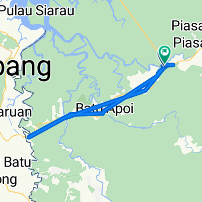
Un itinéraire vélo au départ de Bangar, Temburong, Brunei.
Vue d'ensemble
À propos du circuit
Ceci est une randonnée combinée à vélo et à pied, de Bangar à Bukit Patoi. La route est une excellente autoroute, principalement avec une large bande d'arrêt d'urgence, et la montée de 300 m jusqu'à Bukit Patoi suit un sentier très bien emprunté. Au pied de la montée, il y a des bâtiments, y compris des toilettes et de l'eau. Assurez-vous de boire souvent.
Il est préférable de le faire tôt le matin pour éviter la chaleur. Pourtant, vous allez beaucoup transpirer. Le trajet et la marche prennent chacun un peu plus d'une demi-heure, donc accordez-vous trois heures pour explorer et compléter.
Un sac à dos de jour avec une paire de bottes adhérentes et quelques bouteilles d'eau est une bonne idée. Le plus grand danger est les marches glissantes (peintes !) en béton au début de la montée. Gardez une main sur la rampe en descendant, car la pluie et la mousse rendent la situation pire.
- -:--
- Durée
- 16,1 km
- Distance
- 388 m
- Montée
- 109 m
- Descente
- ---
- Vit. moyenne
- ---
- Altitude max.
créé il y a 13 ans
Continuer avec Bikemap
Utilise, modifie ou télécharge cet itinéraire vélo
Tu veux parcourir Bangar, bike and Bukit Patoi ou l’adapter à ton propre voyage ? Voici ce que tu peux faire avec cet itinéraire Bikemap :
Fonctionnalités gratuites
- Enregistre cet itinéraire comme favori ou dans une collection
- Copie et planifie ta propre version de cet itinéraire
- Synchronise ton itinéraire avec Garmin ou Wahoo
Fonctionnalités Premium
Essai gratuit de 3 jours, ou paiement unique. En savoir plus sur Bikemap Premium.
- Navigue sur cet itinéraire sur iOS et Android
- Exporter un fichier GPX / KML de cet itinéraire
- Crée ton impression personnalisée (essaie-la gratuitement)
- Télécharge cet itinéraire pour la navigation hors ligne
Découvre plus de fonctionnalités Premium.
Obtiens Bikemap PremiumDe notre communauté
Bangar : Autres itinéraires populaires qui commencent ici
- Restful route
- Brunei, Bangar to Brunei, Bangar
- 2 km
- 12 m
- 12 m
- Bangar, Temburong, Brunei
- Bangar, bike and Bukit Patoi
- 16,1 km
- 388 m
- 109 m
- Bangar, Temburong, Brunei
- Temburong border to border
- 26,9 km
- 292 m
- 271 m
- Bangar, Temburong, Brunei
- Bangar back river cruise
- 29,1 km
- 69 m
- 72 m
- Bangar, Temburong, Brunei
- Temburong Practice Run
- 13 km
- 102 m
- 86 m
- Bangar, Temburong, Brunei
- app test
- 1,1 km
- 194 m
- 190 m
- Bangar, Temburong, Brunei
- Labu logging track
- 13,9 km
- 455 m
- 452 m
- Bangar, Temburong, Brunei
Ouvre-la dans l’app


