

(Map 2) The Laneways of Kogarah
Un itinéraire vélo au départ de Brighton-Le-Sands, Nouvelle-Galles du Sud, Australie.
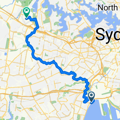
Vue d'ensemble
À propos du circuit
Les ruelles de Kogarah ont le potentiel d'offrir des liaisons de transport actif utiles autour du centre-ville de Kogarah.
Les ruelles accueillent peu de circulation automobile et croisent des cafés, des pubs, la bibliothèque et le surplomb de la Princess Highway qui sera relié au lien de transport actif M6 Stage 1 / Kamay Greenway via President Ave.
Dans leur état actuel, les ruelles dirigent les voitures dans une seule direction, mais espérons qu'à l'avenir, elles pourront être utilisées comme des pistes cyclables en contre-sens.
- 8 min
- Durée
- 2,2 km
- Distance
- 7 m
- Montée
- 8 m
- Descente
- 16 km/h
- Vit. moyenne
- 32 m
- Altitude max.

Continuer avec Bikemap
Utilise, modifie ou télécharge cet itinéraire vélo
Tu veux parcourir (Map 2) The Laneways of Kogarah ou l’adapter à ton propre voyage ? Voici ce que tu peux faire avec cet itinéraire Bikemap :
Fonctionnalités gratuites
- Enregistre cet itinéraire comme favori ou dans une collection
- Copie et planifie ta propre version de cet itinéraire
- Synchronise ton itinéraire avec Garmin ou Wahoo
Fonctionnalités Premium
Essai gratuit de 3 jours, ou paiement unique. En savoir plus sur Bikemap Premium.
- Navigue sur cet itinéraire sur iOS et Android
- Exporter un fichier GPX / KML de cet itinéraire
- Crée ton impression personnalisée (essaie-la gratuitement)
- Télécharge cet itinéraire pour la navigation hors ligne
Découvre plus de fonctionnalités Premium.
Obtiens Bikemap PremiumDe notre communauté
Brighton-Le-Sands : Autres itinéraires populaires qui commencent ici
 Cook Park Trail, Brighton-Le-Sands to Spark Lane, Wolli Creek
- Distance
- 7,6 km
- Montée
- 3 m
- Descente
- 6 m
- Emplacement
- Brighton-Le-Sands, Nouvelle-Galles du Sud, Australie
 2 Roslyn Avenue, Brighton-Le-Sands to 1A Roslyn Avenue, Brighton-Le-Sands
- Distance
- 12,2 km
- Montée
- 3 m
- Descente
- 10 m
- Emplacement
- Brighton-Le-Sands, Nouvelle-Galles du Sud, Australie
 The Grand Parade, Brighton-Le-Sands to 13-17 Coast Avenue, Cronulla
- Distance
- 16,6 km
- Montée
- 0 m
- Descente
- 6 m
- Emplacement
- Brighton-Le-Sands, Nouvelle-Galles du Sud, Australie
 Cook Park Trail, Brighton-Le-Sands to 9 Poole Street, Kingsgrove
- Distance
- 7,9 km
- Montée
- 0 m
- Descente
- 3 m
- Emplacement
- Brighton-Le-Sands, Nouvelle-Galles du Sud, Australie
 Cook Park Path, Kyeemagh to Sydney Olympic Park
- Distance
- 26,7 km
- Montée
- 141 m
- Descente
- 130 m
- Emplacement
- Brighton-Le-Sands, Nouvelle-Galles du Sud, Australie
 326 Bay St, Brighton-Le-Sands to 3-11 Primrose Ave, Rosebery
- Distance
- 10,8 km
- Montée
- 58 m
- Descente
- 44 m
- Emplacement
- Brighton-Le-Sands, Nouvelle-Galles du Sud, Australie
 1A Roslyn Avenue, Brighton-Le-Sands to 1A Roslyn Avenue, Brighton-Le-Sands
- Distance
- 13,3 km
- Montée
- 9 m
- Descente
- 17 m
- Emplacement
- Brighton-Le-Sands, Nouvelle-Galles du Sud, Australie
 Brighton-Le-sands to Sydney Olympic Park
- Distance
- 26,7 km
- Montée
- 89 m
- Descente
- 77 m
- Emplacement
- Brighton-Le-Sands, Nouvelle-Galles du Sud, Australie
Ouvre-la dans l’app