
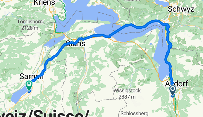
Vue d'ensemble
À propos du circuit
- 4 h 35 min
- Durée
- 60,3 km
- Distance
- 1 597 m
- Montée
- 1 602 m
- Descente
- 13,2 km/h
- Vit. moyenne
- 800 m
- Altitude max.
Partie de
2025_ALPX
8 étapes
Qualité de l’itinéraire
Types de voies et surfaces le long de l’itinéraire
Types de routes
Route tranquille
12,7 km
(21 %)
Route forestière
10,2 km
(17 %)
surfaces
Pavé
35 km
(58 %)
Non pavé
8,4 km
(14 %)
Asphalte
33,8 km
(56 %)
Gravier
8,4 km
(14 %)
Points forts de l’itinéraire
Points d’intérêt le long de l’itinéraire
Eau potable après 10,2 km
Eau potable après 13,5 km
Réparation vélo après 15,2 km
Ladestation
Eau potable après 15,2 km
Eau potable après 19,2 km
Eau potable après 28,2 km
Eau potable après 35,3 km
Eau potable après 54 km
Continuer avec Bikemap
Utilise, modifie ou télécharge cet itinéraire vélo
Tu veux parcourir V2_E03_ALPX_Schweiz ou l’adapter à ton propre voyage ? Voici ce que tu peux faire avec cet itinéraire Bikemap :
Fonctionnalités gratuites
- Enregistre cet itinéraire comme favori ou dans une collection
- Copie et planifie ta propre version de cet itinéraire
- Synchronise ton itinéraire avec Garmin ou Wahoo
Fonctionnalités Premium
Essai gratuit de 3 jours, ou paiement unique. En savoir plus sur Bikemap Premium.
- Navigue sur cet itinéraire sur iOS et Android
- Exporter un fichier GPX / KML de cet itinéraire
- Crée ton impression personnalisée (essaie-la gratuitement)
- Télécharge cet itinéraire pour la navigation hors ligne
Découvre plus de fonctionnalités Premium.
Obtiens Bikemap PremiumDe notre communauté
Attinghausen : Autres itinéraires populaires qui commencent ici
 Attinghausen - Erstfeld- Attingh.
- Distance
- 10,8 km
- Montée
- 284 m
- Descente
- 279 m
- Emplacement
- Attinghausen, Canton d’Uri, Suisse
 Schattdorf-Andermatt
- Distance
- 35,5 km
- Montée
- 1 043 m
- Descente
- 84 m
- Emplacement
- Attinghausen, Canton d’Uri, Suisse
 Attinghausen-Brüsti-Attinghausen
- Distance
- 18,2 km
- Montée
- 1 319 m
- Descente
- 1 320 m
- Emplacement
- Attinghausen, Canton d’Uri, Suisse
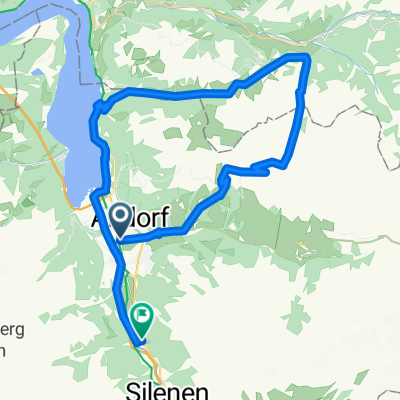
 Surenenpass-Erstfeld
- Distance
- 11,6 km
- Montée
- 77 m
- Descente
- 1 881 m
- Emplacement
- Attinghausen, Canton d’Uri, Suisse
 Obere Postmatte 1, Attinghausen to Obere Postmatte 1, Attinghausen
- Distance
- 26,1 km
- Montée
- 397 m
- Descente
- 385 m
- Emplacement
- Attinghausen, Canton d’Uri, Suisse
 Attinghausen-Klauenpass-Eggberge-Attinghausen
- Distance
- 58,9 km
- Montée
- 2 242 m
- Descente
- 2 240 m
- Emplacement
- Attinghausen, Canton d’Uri, Suisse
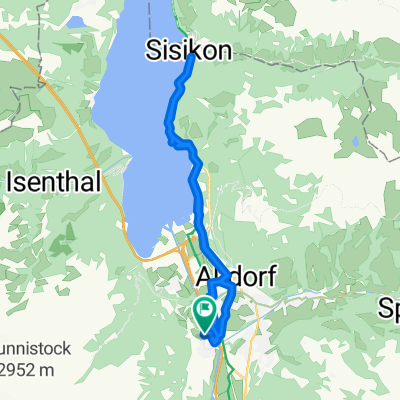
 V2_E03_ALPX_Schweiz
- Distance
- 60,3 km
- Montée
- 1 597 m
- Descente
- 1 602 m
- Emplacement
- Attinghausen, Canton d’Uri, Suisse
 Altdorf- Kinzig-Muothatal-Erstfeld
- Distance
- 50,3 km
- Montée
- 2 420 m
- Descente
- 2 399 m
- Emplacement
- Attinghausen, Canton d’Uri, Suisse
Ouvre-la dans l’app