Casa Grande to Scottsdale
Un itinéraire vélo au départ de Casa Grande, Arizona, États Unis.
Vue d'ensemble
À propos du circuit
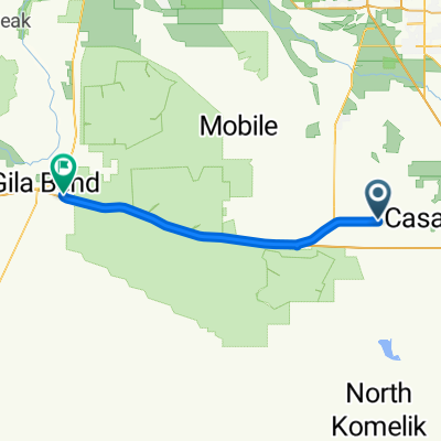
Dans l'ensemble, c'était un excellent itinéraire pour se rendre de Casa Grande à Scottsdale. Il y avait quelques routes à très faible circulation, mais la plupart des routes avec du trafic avaient de bonnes épaules. La portion le long de la SR87 avait un trafic très dense avec un bruit de route fort et désagréable, mais il y avait une large épaule qui était principalement de bonne qualité pendant tout le temps que nous étions sur la SR87.
Depuis que nous avons pris la direction du nord à travers Chandler, Mesa et Tempe pour atteindre Scottsdale, nous avons eu d'excellents pistes cyclables ou chemins pour vélos pendant environ 95 % du temps. Ces communautés sont très amicales envers les cyclistes malgré la forte dépendance de la région aux véhicules à moteur.
À Scottsdale même, il y avait une longue et excellente voie cyclable qui s'étendait sur des kilomètres.
Juste une chose à surveiller sur cet itinéraire. En passant par Sacaton, il y avait un tas de chiens en liberté qui sont venus dans la rue pour nous aboyer. Nous n'avons eu aucun problème avec l'un d'eux essayant de nous mordre ou de se mettre devant nos roues, mais c'était cependant légèrement perturbant.
- 7 h 39 min
- Durée
- 97 km
- Distance
- 127 m
- Montée
- 172 m
- Descente
- 12,7 km/h
- Vit. moyenne
- 481 m
- Altitude max.
Photos de l’itinéraire
Qualité de l’itinéraire
Types de voies et surfaces le long de l’itinéraire
Types de routes
Route
17,5 km
(18 %)
Piste cyclable
13,6 km
(14 %)
surfaces
Pavé
70,8 km
(73 %)
Asphalte
55,3 km
(57 %)
Béton
12,6 km
(13 %)
Continuer avec Bikemap
Utilise, modifie ou télécharge cet itinéraire vélo
Tu veux parcourir Casa Grande to Scottsdale ou l’adapter à ton propre voyage ? Voici ce que tu peux faire avec cet itinéraire Bikemap :
Fonctionnalités gratuites
- Enregistre cet itinéraire comme favori ou dans une collection
- Copie et planifie ta propre version de cet itinéraire
- Divise-le en étapes pour créer un tour sur plusieurs jours
- Synchronise ton itinéraire avec Garmin ou Wahoo
Fonctionnalités Premium
Essai gratuit de 3 jours, ou paiement unique. En savoir plus sur Bikemap Premium.
- Navigue sur cet itinéraire sur iOS et Android
- Exporter un fichier GPX / KML de cet itinéraire
- Crée ton impression personnalisée (essaie-la gratuitement)
- Télécharge cet itinéraire pour la navigation hors ligne
Découvre plus de fonctionnalités Premium.
Obtiens Bikemap PremiumDe notre communauté
Casa Grande : Autres itinéraires populaires qui commencent ici
 1101 E 11th St, Casa Grande to 1101 E 11th St, Casa Grande
- Distance
- 10,6 km
- Montée
- 1 712 m
- Descente
- 1 712 m
- Emplacement
- Casa Grande, Arizona, États Unis
 208 W Rock Creek Pl, Casa Grande to 226 W Rock Creek Pl, Casa Grande
- Distance
- 10,9 km
- Montée
- 29 m
- Descente
- 26 m
- Emplacement
- Casa Grande, Arizona, États Unis
 to clients house
- Distance
- 2,7 km
- Montée
- 0 m
- Descente
- 0 m
- Emplacement
- Casa Grande, Arizona, États Unis
 fist try
- Distance
- 0,6 km
- Montée
- 0 m
- Descente
- 3 m
- Emplacement
- Casa Grande, Arizona, États Unis
 E San Xavier Dr, Casa Grande to E San Xavier Dr, Casa Grande
- Distance
- 6,5 km
- Montée
- 7 m
- Descente
- 6 m
- Emplacement
- Casa Grande, Arizona, États Unis
 State Route 84 - South Butterfield Trail 3006
- Distance
- 72,7 km
- Montée
- 251 m
- Descente
- 396 m
- Emplacement
- Casa Grande, Arizona, États Unis
 720 W Oneil Dr, Casa Grande to 720 W Oneil Dr, Casa Grande
- Distance
- 36,2 km
- Montée
- 51 m
- Descente
- 50 m
- Emplacement
- Casa Grande, Arizona, États Unis
 East Avenida Grande 1102, Casa Grande to East Cordova Avenue 1148, Casa Grande
- Distance
- 6 km
- Montée
- 18 m
- Descente
- 17 m
- Emplacement
- Casa Grande, Arizona, États Unis
Ouvre-la dans l’app


