Austin - Circle Exploring Capitol and River
Un itinéraire vélo au départ de Rollingwood, Texas, États Unis.
Vue d'ensemble
À propos du circuit
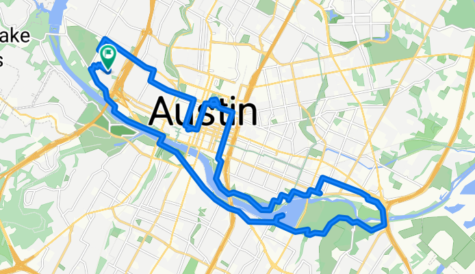
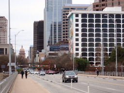
Nouveau à Austin, je suis sorti pour une courte balade afin d'explorer un peu autour du lac. Premièrement, cependant, je suis passé chez Rosen's Bagels pour en acheter quelques-uns afin de voir s'ils plaisent à ma femme. Ensuite, comme j'avais vu le dôme du Capitole de l'État en me rendant à la boutique de bagels, j'y suis allé pour voir de plus près. Bel bâtiment bien entretenu.
Depuis le Capitole, j'ai descendu jusqu'à la rivière Colorado (apparemment aussi appelée Lady Bird Lake) et j'ai tourné à l'est pour traverser un pont sur une piste cyclable afin de faire un cercle du côté ouest de la rivière. À certains endroits, j'ai utilisé le chemin de terre bien compacté, tandis qu'à d'autres, j'ai emprunté des routes pavées et des pistes cyclables parallèles au bord de la rivière. Le tronçon de sentier non pavé juste après le pont cycliste à l'extrémité est était quelques miles d'un chemin moins que bien compacté. Passable, mais de nombreux cyclistes de route seraient moins qu'enthousiastes à propos de cette portion.
Pour la plupart, c'était une belle balade le long et près de la rivière, bien que pour une bonne partie de la balade sur le côté sud, j'étais sur East et West Riverside Dr, qui étaient marqués comme une route cyclable sur la carte, mais qui ne devraient clairement pas l'être. Il y avait beaucoup de circulation et pas d'épaule. Je vous suggère d'utiliser d'autres routes ou le chemin cyclable le long de cette section. Je suppose que le chemin cyclable serait bien compacté, mais je ne l'ai pas encore emprunté pour le voir.
En revenant au pont piétonnier/de cycliste près du centre-ville, j'ai traversé et utilisé le chemin bien compacté pour me rapprocher de l'HEB à l'extrémité ouest de mon cercle pour faire quelques courses.
- 3 h
- Durée
- 31,2 km
- Distance
- 207 m
- Montée
- 207 m
- Descente
- 10,4 km/h
- Vit. moyenne
- 174 m
- Altitude max.
Photos de l’itinéraire
Qualité de l’itinéraire
Types de voies et surfaces le long de l’itinéraire
Types de routes
Piste cyclable
6,5 km
(21 %)
Route tranquille
5,9 km
(19 %)
surfaces
Pavé
20,3 km
(65 %)
Non pavé
4,4 km
(14 %)
Asphalte
15,6 km
(50 %)
Gravier meuble
3,1 km
(10 %)
Continuer avec Bikemap
Utilise, modifie ou télécharge cet itinéraire vélo
Tu veux parcourir Austin - Circle Exploring Capitol and River ou l’adapter à ton propre voyage ? Voici ce que tu peux faire avec cet itinéraire Bikemap :
Fonctionnalités gratuites
- Enregistre cet itinéraire comme favori ou dans une collection
- Copie et planifie ta propre version de cet itinéraire
- Synchronise ton itinéraire avec Garmin ou Wahoo
Fonctionnalités Premium
Essai gratuit de 3 jours, ou paiement unique. En savoir plus sur Bikemap Premium.
- Navigue sur cet itinéraire sur iOS et Android
- Exporter un fichier GPX / KML de cet itinéraire
- Crée ton impression personnalisée (essaie-la gratuitement)
- Télécharge cet itinéraire pour la navigation hors ligne
Découvre plus de fonctionnalités Premium.
Obtiens Bikemap PremiumDe notre communauté
Rollingwood : Autres itinéraires populaires qui commencent ici
 Austin - Circle to Bee Cave
- Distance
- 44,6 km
- Montée
- 562 m
- Descente
- 564 m
- Emplacement
- Rollingwood, Texas, États Unis
 Austin - Circle to McKinney Falls State Park
- Distance
- 40,3 km
- Montée
- 360 m
- Descente
- 355 m
- Emplacement
- Rollingwood, Texas, États Unis
 Austin - Circle thru Lost Creek Blvd to Barton Creek and Costco
- Distance
- 41,4 km
- Montée
- 572 m
- Descente
- 572 m
- Emplacement
- Rollingwood, Texas, États Unis
 Austin - Circle to MT Supermarket and Walnut Creek
- Distance
- 49,2 km
- Montée
- 414 m
- Descente
- 413 m
- Emplacement
- Rollingwood, Texas, États Unis
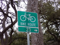 Austin - Circle to North Via Camp Mabry, Bike Rt 23, and Shoal Creek Blvd
- Distance
- 39,5 km
- Montée
- 515 m
- Descente
- 513 m
- Emplacement
- Rollingwood, Texas, États Unis
 Austin - Circle to Northeast
- Distance
- 36,4 km
- Montée
- 270 m
- Descente
- 276 m
- Emplacement
- Rollingwood, Texas, États Unis
 Austin - Random Riding in Neighborhood North of MUNY Golf Course
- Distance
- 18,7 km
- Montée
- 290 m
- Descente
- 290 m
- Emplacement
- Rollingwood, Texas, États Unis
 Buda loop - 37 mi
- Distance
- 60,2 km
- Montée
- 212 m
- Descente
- 213 m
- Emplacement
- Rollingwood, Texas, États Unis
Ouvre-la dans l’app

