

Victoria, Cadboro Bay to Youbou via Bike Paths
Un itinéraire vélo au départ de Lake Cowichan, Colombie-Britannique, Canada.
Vue d'ensemble
À propos du circuit
This is a route partially onroad, partially offroad from Victoria BC to Youbou BC.
The route follows the Saanich Centennial Trails (some bike path, some quiet roadway) and the TransCanada Trail (abandoned rail line, mostly non-paved but hard packed).
There is a section on roadway from Mill Bay to the TransCanada trail on roads. The Kinsol Trestle is currently not passable so there is a detour to join the TC Trail. Note, this is the only section of this trail I have not completed (please comment on the routing).
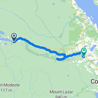
From the town of Lake Cowichan to Youbou this route follows paved roadway and then Hwy 18 to Youbou. Past Youbou is a gravel logging road (very dusty).
- -:--
- Durée
- 110,1 km
- Distance
- 770 m
- Montée
- 923 m
- Descente
- ---
- Vit. moyenne
- 218 m
- Altitude max.

Qualité de l’itinéraire
Types de voies et surfaces le long de l’itinéraire
Types de routes
Sentier
35,2 km
(32 %)
Route tranquille
17,6 km
(16 %)
surfaces
Pavé
49,5 km
(45 %)
Non pavé
41,8 km
(38 %)
Gravier
41,8 km
(38 %)
Asphalte
35,2 km
(32 %)
Continuer avec Bikemap
Utilise, modifie ou télécharge cet itinéraire vélo
Tu veux parcourir Victoria, Cadboro Bay to Youbou via Bike Paths ou l’adapter à ton propre voyage ? Voici ce que tu peux faire avec cet itinéraire Bikemap :
Fonctionnalités gratuites
- Enregistre cet itinéraire comme favori ou dans une collection
- Copie et planifie ta propre version de cet itinéraire
- Divise-le en étapes pour créer un tour sur plusieurs jours
- Synchronise ton itinéraire avec Garmin ou Wahoo
Fonctionnalités Premium
Essai gratuit de 3 jours, ou paiement unique. En savoir plus sur Bikemap Premium.
- Navigue sur cet itinéraire sur iOS et Android
- Exporter un fichier GPX / KML de cet itinéraire
- Crée ton impression personnalisée (essaie-la gratuitement)
- Télécharge cet itinéraire pour la navigation hors ligne
Découvre plus de fonctionnalités Premium.
Obtiens Bikemap PremiumDe notre communauté
Lake Cowichan : Autres itinéraires populaires qui commencent ici
 Greendale Road 205, Lake Cowichan to Quamichan Avenue 164, Lake Cowichan
- Distance
- 19,8 km
- Montée
- 631 m
- Descente
- 603 m
- Emplacement
- Lake Cowichan, Colombie-Britannique, Canada
 Around Cowichan Lake - Gordon Bay to Lake Cowichan
- Distance
- 63,3 km
- Montée
- 485 m
- Descente
- 454 m
- Emplacement
- Lake Cowichan, Colombie-Britannique, Canada
 Route from 217 Tal Rd, Lake Cowichan
- Distance
- 11,6 km
- Montée
- 116 m
- Descente
- 123 m
- Emplacement
- Lake Cowichan, Colombie-Britannique, Canada
 Cowichan Valley Trail
- Distance
- 55,8 km
- Montée
- 551 m
- Descente
- 553 m
- Emplacement
- Lake Cowichan, Colombie-Britannique, Canada
 cowichan to sooke
- Distance
- 124,8 km
- Montée
- 3 900 m
- Descente
- 4 049 m
- Emplacement
- Lake Cowichan, Colombie-Britannique, Canada
 Lake Cowichan to Cowichan Bay
- Distance
- 57,1 km
- Montée
- 267 m
- Descente
- 425 m
- Emplacement
- Lake Cowichan, Colombie-Britannique, Canada
 Lake Cowichan to Duncan
- Distance
- 39,4 km
- Montée
- 226 m
- Descente
- 374 m
- Emplacement
- Lake Cowichan, Colombie-Britannique, Canada
 Route to 83 Wellington Rd W, Lake Cowichan
- Distance
- 6,8 km
- Montée
- 75 m
- Descente
- 84 m
- Emplacement
- Lake Cowichan, Colombie-Britannique, Canada
Ouvre-la dans l’app