

Star Cycles - Ansteys Hill
Un itinéraire vélo au départ de Elizabeth, Australie-Méridionale, Australie.
Vue d'ensemble
À propos du circuit
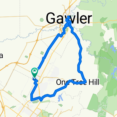
En quittant Star Cycles, nous descendons Bellchambers Rd sur West Av en passant par la base aérienne et à gauche sur Purling Av. À droite sur Commercial Rd et à gauche sur Bagsters Rd, que nous suivons jusqu'à Burton Rd où un autre virage à gauche nous amène à Martins Rd où nous tournons à droite. Puis à gauche sur Kings Rd, que nous traversons sur la MN Rd et montons sur McIntyre jusqu'à ce que nous tournions à gauche à Montague Rd. En tournant à droite sur Reservoir Rd, nous passons TTP et continuons sur Grand Junction Rd où nous tournons à gauche et nous dirigeons vers Ansteys Hill. Après la montée régulière, nous tournons à droite au sommet d'Ansteys et descendons la pittoresque Range Rd South jusqu'à Lower NE Rd où nous faisons une courte gauche avant de tourner à droite sur Range Rd North. Une montée régulière est suivie d'une descente rapide, mais attention au virage en épingle à cheveux à mi-chemin et au croisement en T à Seaview Rd où nous tournons à gauche et suivons cette route jusqu'à Yatala Vale Rd et à la boulangerie Prices à Golden Grove Village. Après notre pause, nous continuons sur Grove Way, traversons la MN Rd sur Saints Rd, Fenden Rd et à droite sur Ponton St. À droite sur Commercial Rd, puis encore à droite sur John Rice Av pour revenir à Elizabeth Way et Star Cycles.
- -:--
- Durée
- 58,8 km
- Distance
- 536 m
- Montée
- 542 m
- Descente
- ---
- Vit. moyenne
- ---
- Altitude max.
Qualité de l’itinéraire
Types de voies et surfaces le long de l’itinéraire
Types de routes
Route
17,6 km
(30 %)
Route tranquille
9,4 km
(16 %)
surfaces
Pavé
55,9 km
(95 %)
Asphalte
43,5 km
(74 %)
Pavé (non défini)
11,8 km
(20 %)
Continuer avec Bikemap
Utilise, modifie ou télécharge cet itinéraire vélo
Tu veux parcourir Star Cycles - Ansteys Hill ou l’adapter à ton propre voyage ? Voici ce que tu peux faire avec cet itinéraire Bikemap :
Fonctionnalités gratuites
- Enregistre cet itinéraire comme favori ou dans une collection
- Copie et planifie ta propre version de cet itinéraire
- Synchronise ton itinéraire avec Garmin ou Wahoo
Fonctionnalités Premium
Essai gratuit de 3 jours, ou paiement unique. En savoir plus sur Bikemap Premium.
- Navigue sur cet itinéraire sur iOS et Android
- Exporter un fichier GPX / KML de cet itinéraire
- Crée ton impression personnalisée (essaie-la gratuitement)
- Télécharge cet itinéraire pour la navigation hors ligne
Découvre plus de fonctionnalités Premium.
Obtiens Bikemap PremiumDe notre communauté
Elizabeth : Autres itinéraires populaires qui commencent ici
 Little Para River Trl, Salisbury Park to 12 Main St, Mawson Lakes
- Distance
- 12,3 km
- Montée
- 30 m
- Descente
- 70 m
- Emplacement
- Elizabeth, Australie-Méridionale, Australie
 One Tree Hill Scenic route Gawler
- Distance
- 57,1 km
- Montée
- 330 m
- Descente
- 330 m
- Emplacement
- Elizabeth, Australie-Méridionale, Australie
 Star Cycles Inglewood-COP-Kersbrook
- Distance
- 64 km
- Montée
- 717 m
- Descente
- 717 m
- Emplacement
- Elizabeth, Australie-Méridionale, Australie
 trip...
- Distance
- 11,6 km
- Montée
- 25 m
- Descente
- 56 m
- Emplacement
- Elizabeth, Australie-Méridionale, Australie
 Yorktown Road 32, Elizabeth East to McCormack Crescent 50, Salisbury North
- Distance
- 20,9 km
- Montée
- 255 m
- Descente
- 285 m
- Emplacement
- Elizabeth, Australie-Méridionale, Australie
 Elizabeth - Nuriootpa
- Distance
- 134,8 km
- Montée
- 960 m
- Descente
- 722 m
- Emplacement
- Elizabeth, Australie-Méridionale, Australie
 Star Cycles - Ansteys Hill
- Distance
- 58,8 km
- Montée
- 536 m
- Descente
- 542 m
- Emplacement
- Elizabeth, Australie-Méridionale, Australie
 Angaston to Handorf
- Distance
- 234,1 km
- Montée
- 1 334 m
- Descente
- 1 333 m
- Emplacement
- Elizabeth, Australie-Méridionale, Australie
Ouvre-la dans l’app