34km Ride – Gentle Hills and Peaceful Roads
Un itinéraire vélo au départ de Exeter, Angleterre, Royaume-Uni.
Vue d'ensemble
À propos du circuit
Profitez d'une balade de 34 km sur un mélange de routes paisibles et de pistes cyclables dédiées. Idéal pour les débutants, avec une navigation facile et des dénivelés progressifs. Un excellent choix pour les cyclistes novices comme expérimentés.
Commencez sur les pistes cyclables d'Exeter, en suivant la signalisation vers le "Science Park". Une fois passé le pont Redhayes au-dessus de la M5, suivez les panneaux vers l'aéroport.
Après Clyst Honiton, vous arriverez à un rond-point – assurez-vous de suivre la piste cyclable jusqu'au parking de l'aéroport pour éviter la route principale.
Si vous avez besoin d'un café, vous pouvez tourner à droite sur la piste cyclable partagée en sortant du parking et vous diriger vers "The Crusty Cob". Cela vous permettra d'interrompre la montée douce de 6 km entre Clyst Honiton et Aylesbeare. (Note : Crusty Cob est désormais fermé)
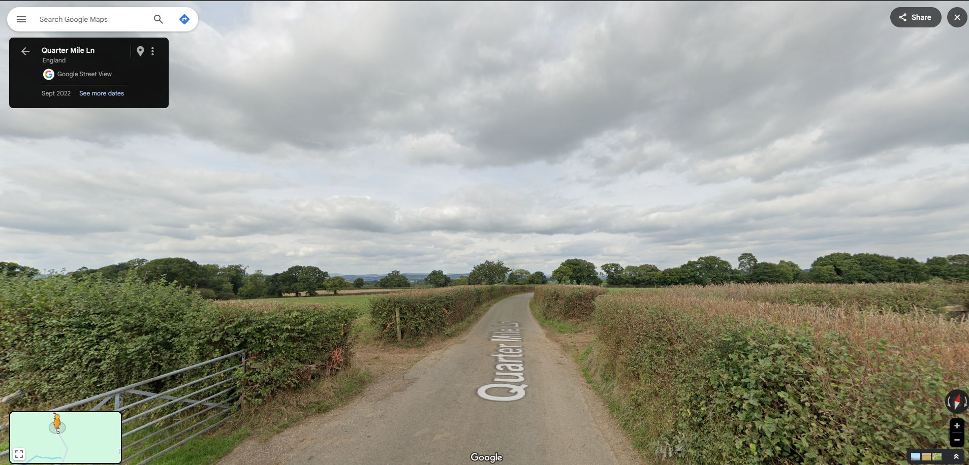
Si vous préférez continuer, quittez le parking de l'aéroport, traversez la route, puis passez l'entrée de l'aéroport pour rejoindre une route de campagne tranquille.
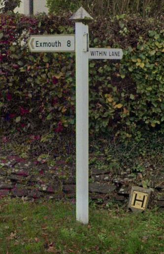
Après Westcott, suivez les panneaux vers Aylesbeare. En traversant Aylesbeare, il y a un panneau blanc à droite indiquant "Within Lane". Au bout de Within Lane, prenez à gauche.
Si vous voulez éviter une mauvaise qualité de route, tournez à droite puis à gauche au pub "The White Horse". Ceci est particulièrement recommandé si vous êtes sur un vélo de route ou si le temps est mauvais. Sinon, faites attention en traversant la route principale, continuez tout droit, puis tournez à droite au niveau du triangle.
Suivez les panneaux vers "Woodbury". À Woodbury, il y a un commerce local et un pub si vous avez besoin de rafraîchissements.
Près du centre de Woodbury, il y a un petit panneau en bois indiquant "Ebford, Exe Estuary Trail". Ce panneau peut facilement être manqué.
Au moment de la rédaction, en entrant à Ebford, la signalisation marron du "Exe Estuary Trail" est cassée. Assurez-vous de tourner à gauche dès que vous voyez les premières maisons d'Ebford.
Continuez à suivre les panneaux du "Exe Estuary Trail" jusqu'à voir les panneaux bleus pour "Topsham" ou "Exeter". Vers la fin de la balade, il y a de nombreuses opportunités pour manger et boire à Topsham et Exeter, ce qui constitue une halte parfaite après la sortie.
- 2 h 3 min
- Durée
- 34,1 km
- Distance
- 210 m
- Montée
- 212 m
- Descente
- 16,6 km/h
- Vit. moyenne
- 99 m
- Altitude max.
Photos de l’itinéraire
Qualité de l’itinéraire
Types de voies et surfaces le long de l’itinéraire
Types de routes
Route tranquille
18,1 km
(53 %)
Piste cyclable
10,9 km
(32 %)
surfaces
Pavé
20,1 km
(59 %)
Asphalte
19,8 km
(58 %)
Pavé (non défini)
0,3 km
(1 %)
Indéfini
14 km
(41 %)
Continuer avec Bikemap
Utilise, modifie ou télécharge cet itinéraire vélo
Tu veux parcourir 34km Ride – Gentle Hills and Peaceful Roads ou l’adapter à ton propre voyage ? Voici ce que tu peux faire avec cet itinéraire Bikemap :
Fonctionnalités gratuites
- Enregistre cet itinéraire comme favori ou dans une collection
- Copie et planifie ta propre version de cet itinéraire
- Synchronise ton itinéraire avec Garmin ou Wahoo
Fonctionnalités Premium
Essai gratuit de 3 jours, ou paiement unique. En savoir plus sur Bikemap Premium.
- Navigue sur cet itinéraire sur iOS et Android
- Exporter un fichier GPX / KML de cet itinéraire
- Crée ton impression personnalisée (essaie-la gratuitement)
- Télécharge cet itinéraire pour la navigation hors ligne
Découvre plus de fonctionnalités Premium.
Obtiens Bikemap PremiumDe notre communauté
Exeter : Autres itinéraires populaires qui commencent ici
 Feniton-Silverton
- Distance
- 57,9 km
- Montée
- 410 m
- Descente
- 410 m
- Emplacement
- Exeter, Angleterre, Royaume-Uni
 Fantasy Tour of Britain - Day 4
- Distance
- 184,7 km
- Montée
- 2 246 m
- Descente
- 1 776 m
- Emplacement
- Exeter, Angleterre, Royaume-Uni
 30 miles 2500ft
- Distance
- 52,7 km
- Montée
- 472 m
- Descente
- 486 m
- Emplacement
- Exeter, Angleterre, Royaume-Uni
 100 miles from the centre of exeter
- Distance
- 160,3 km
- Montée
- 695 m
- Descente
- 699 m
- Emplacement
- Exeter, Angleterre, Royaume-Uni
 Bikeroute for Sue
- Distance
- 32,6 km
- Montée
- 270 m
- Descente
- 216 m
- Emplacement
- Exeter, Angleterre, Royaume-Uni
 Fernworthy circuit from Exeter
- Distance
- 76,9 km
- Montée
- 871 m
- Descente
- 871 m
- Emplacement
- Exeter, Angleterre, Royaume-Uni
 Shobrooke loop
- Distance
- 33,4 km
- Montée
- 383 m
- Descente
- 387 m
- Emplacement
- Exeter, Angleterre, Royaume-Uni
 Exeter-Two Bridges-Chudleigh-Exeter
- Distance
- 98,3 km
- Montée
- 1 027 m
- Descente
- 1 032 m
- Emplacement
- Exeter, Angleterre, Royaume-Uni
Ouvre-la dans l’app


