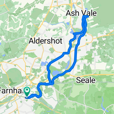
- 23,8 km
- 226 m
- 260 m
- Farnham, Angleterre, Royaume-Uni
Farnham Charity 50 miler
Un itinéraire vélo au départ de Farnham, Angleterre, Royaume-Uni.
Vue d'ensemble
À propos du circuit
Cette itinéraire est ma version de la route caritative de 50 miles de Farnham qu'ils font chaque année début juillet.
Bien qu'elle suive une bonne partie de l'originale, la principale différence est qu'elle s'étend jusqu'à Preston Candover, revenant ensuite par Alton pour rejoindre l'originale à Alice Holt après être passé par Bentley.
Personnellement, je pense qu'elle est globalement plus plate et donc plus facile à gérer pour une balade caritative.
- -:--
- Durée
- 80,6 km
- Distance
- 405 m
- Montée
- 405 m
- Descente
- ---
- Vit. moyenne
- ---
- Altitude max.
créé il y a 13 ans
Qualité de l’itinéraire
Types de voies et surfaces le long de l’itinéraire
Types de routes
Route
46,7 km
(58 %)
Route tranquille
25,8 km
(32 %)
Indéfini
8,1 km
(10 %)
surfaces
Pavé
80,6 km
(100 %)
Asphalte
80,6 km
(100 %)
Continuer avec Bikemap
Utilise, modifie ou télécharge cet itinéraire vélo
Tu veux parcourir Farnham Charity 50 miler ou l’adapter à ton propre voyage ? Voici ce que tu peux faire avec cet itinéraire Bikemap :
Fonctionnalités gratuites
- Enregistre cet itinéraire comme favori ou dans une collection
- Copie et planifie ta propre version de cet itinéraire
- Divise-le en étapes pour créer un tour sur plusieurs jours
- Synchronise ton itinéraire avec Garmin ou Wahoo
Fonctionnalités Premium
Essai gratuit de 3 jours, ou paiement unique. En savoir plus sur Bikemap Premium.
- Navigue sur cet itinéraire sur iOS et Android
- Exporter un fichier GPX / KML de cet itinéraire
- Crée ton impression personnalisée (essaie-la gratuitement)
- Télécharge cet itinéraire pour la navigation hors ligne
Découvre plus de fonctionnalités Premium.
Obtiens Bikemap PremiumDe notre communauté
Farnham : Autres itinéraires populaires qui commencent ici
- Farnham, Farnham to Kings Road, Guildford
- Relaxed route in Farnham
- 8,6 km
- 56 m
- 61 m
- Farnham, Angleterre, Royaume-Uni
- R-Crondall N Hants 32-260
- 32,3 km
- 247 m
- 246 m
- Farnham, Angleterre, Royaume-Uni
- Option 1
- 80 km
- 421 m
- 419 m
- Farnham, Angleterre, Royaume-Uni
- Menin Way, Farnham to Menin Way, Farnham
- 22,3 km
- 261 m
- 270 m
- Farnham, Angleterre, Royaume-Uni
- Alice Holt
- 22,3 km
- 225 m
- 209 m
- Farnham, Angleterre, Royaume-Uni
- Farnham Charity 50 miler
- 80,6 km
- 405 m
- 405 m
- Farnham, Angleterre, Royaume-Uni
- Around Farnham
- 31,7 km
- 311 m
- 311 m
- Farnham, Angleterre, Royaume-Uni
Ouvre-la dans l’app


