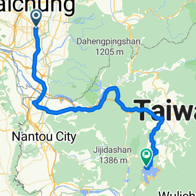
Day3:台中→嘉義(雲林北港)
Un itinéraire vélo au départ de Taichung, Taiwan, Taïwan.
Vue d'ensemble
À propos du circuit
★Distance: 98KM ★Difficulté: ★★ ★Itinéraire: Taichung → Tai 1 Yi → Gare de Chenggong (tout droit vers Zhuifen) → tourner à gauche sur la ligne Tai 1 → Jardin de l'autoroute de Tianwei → Pont de Xiluo de la route de comté 145 → tourner à gauche sur la route Daqiao → ligne Tai 1 → Ville de Chiayi ★ Attractions: Zhuifen Chenggong, Jardin de l'autoroute de Tianwei, Pont de Xiluo, Ville de Chiayi
- -:--
- Durée
- 98,1 km
- Distance
- 78 m
- Montée
- 126 m
- Descente
- ---
- Vit. moyenne
- ---
- Altitude max.
Points forts de l’itinéraire
Points d’intérêt le long de l’itinéraire
Point d'intérêt après 11,7 km
成功
Point d'intérêt après 12,5 km
追分
Point d'intérêt après 41,3 km
田尾公路花園
Continuer avec Bikemap
Utilise, modifie ou télécharge cet itinéraire vélo
Tu veux parcourir Day3:台中→嘉義(雲林北港) ou l’adapter à ton propre voyage ? Voici ce que tu peux faire avec cet itinéraire Bikemap :
Fonctionnalités gratuites
- Enregistre cet itinéraire comme favori ou dans une collection
- Copie et planifie ta propre version de cet itinéraire
- Divise-le en étapes pour créer un tour sur plusieurs jours
- Synchronise ton itinéraire avec Garmin ou Wahoo
Fonctionnalités Premium
Essai gratuit de 3 jours, ou paiement unique. En savoir plus sur Bikemap Premium.
- Navigue sur cet itinéraire sur iOS et Android
- Exporter un fichier GPX / KML de cet itinéraire
- Crée ton impression personnalisée (essaie-la gratuitement)
- Télécharge cet itinéraire pour la navigation hors ligne
Découvre plus de fonctionnalités Premium.
Obtiens Bikemap PremiumDe notre communauté
Taichung : Autres itinéraires populaires qui commencent ici
 太平_老鼠崎
- Distance
- 8,4 km
- Montée
- 473 m
- Descente
- 457 m
- Emplacement
- Taichung, Taiwan, Taïwan
 竹仔坑虹橋_牛角坑自行車道_後壁農路_光興路
- Distance
- 13,2 km
- Montée
- 615 m
- Descente
- 622 m
- Emplacement
- Taichung, Taiwan, Taïwan
 台中-日月潭
- Distance
- 72,4 km
- Montée
- 1 089 m
- Descente
- 559 m
- Emplacement
- Taichung, Taiwan, Taïwan
 台中-日月潭
- Distance
- 157,8 km
- Montée
- 1 048 m
- Descente
- 1 048 m
- Emplacement
- Taichung, Taiwan, Taïwan
 牛角坑大石壁
- Distance
- 12 km
- Montée
- 465 m
- Descente
- 463 m
- Emplacement
- Taichung, Taiwan, Taïwan
 傳說中的136
- Distance
- 19,2 km
- Montée
- 997 m
- Descente
- 961 m
- Emplacement
- Taichung, Taiwan, Taïwan
 日月潭 平易近人 路線
- Distance
- 149,1 km
- Montée
- 1 064 m
- Descente
- 1 062 m
- Emplacement
- Taichung, Taiwan, Taïwan
 環島路線-海線
- Distance
- 1 073 km
- Montée
- 1 095 m
- Descente
- 1 095 m
- Emplacement
- Taichung, Taiwan, Taïwan
Ouvre-la dans l’app


