

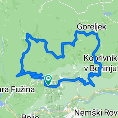
Pokljuka MTB
Un itinéraire vélo au départ de Bohinjska Bistrica, Municipalité de Bohinj, Slovénie.
Vue d'ensemble
À propos du circuit
- -:--
- Durée
- 22,9 km
- Distance
- 832 m
- Montée
- 835 m
- Descente
- ---
- Vit. moyenne
- 1 457 m
- Altitude max.

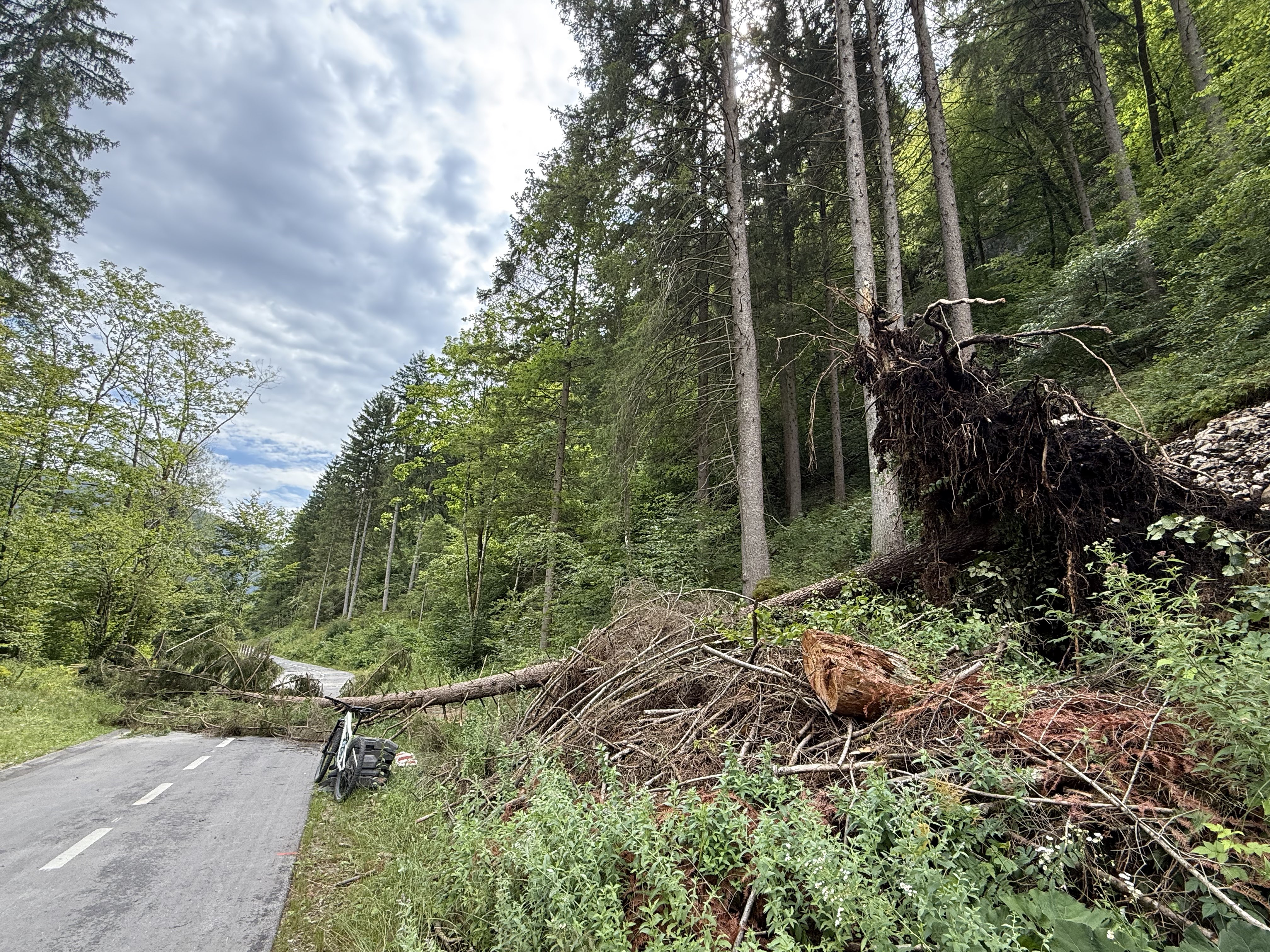
Photos de l’itinéraire


Continuer avec Bikemap
Utilise, modifie ou télécharge cet itinéraire vélo
Tu veux parcourir Pokljuka MTB ou l’adapter à ton propre voyage ? Voici ce que tu peux faire avec cet itinéraire Bikemap :
Fonctionnalités gratuites
- Enregistre cet itinéraire comme favori ou dans une collection
- Copie et planifie ta propre version de cet itinéraire
- Synchronise ton itinéraire avec Garmin ou Wahoo
Fonctionnalités Premium
Essai gratuit de 3 jours, ou paiement unique. En savoir plus sur Bikemap Premium.
- Navigue sur cet itinéraire sur iOS et Android
- Exporter un fichier GPX / KML de cet itinéraire
- Crée ton impression personnalisée (essaie-la gratuitement)
- Télécharge cet itinéraire pour la navigation hors ligne
Découvre plus de fonctionnalités Premium.
Obtiens Bikemap PremiumDe notre communauté
Bohinjska Bistrica : Autres itinéraires populaires qui commencent ici
 Kolesarski izlet na Uskovnico in mimo Zajamnikov do Goreljka
- Distance
- 31,7 km
- Montée
- 1 090 m
- Descente
- 1 092 m
- Emplacement
- Bohinjska Bistrica, Municipalité de Bohinj, Slovénie
 A tough one
- Distance
- 27,3 km
- Montée
- 1 099 m
- Descente
- 1 110 m
- Emplacement
- Bohinjska Bistrica, Municipalité de Bohinj, Slovénie
 Snail-like route in Bohinjska Bistrica
- Distance
- 20,1 km
- Montée
- 146 m
- Descente
- 155 m
- Emplacement
- Bohinjska Bistrica, Municipalité de Bohinj, Slovénie
 b.b- koprivnik-gorjuse-b.b
- Distance
- 46,6 km
- Montée
- 888 m
- Descente
- 889 m
- Emplacement
- Bohinjska Bistrica, Municipalité de Bohinj, Slovénie
 Letoviška ulica, Bohinjska Bistrica do Ribčev Laz, Bohinjsko Jezero
- Distance
- 8,3 km
- Montée
- 73 m
- Descente
- 67 m
- Emplacement
- Bohinjska Bistrica, Municipalité de Bohinj, Slovénie
- Pokljuka MTB
- Distance
- 22,9 km
- Montée
- 832 m
- Descente
- 835 m
- Emplacement
- Bohinjska Bistrica, Municipalité de Bohinj, Slovénie
 Bohinjska Bistrica - Železniki
- Distance
- 60,7 km
- Montée
- 1 256 m
- Descente
- 2 233 m
- Emplacement
- Bohinjska Bistrica, Municipalité de Bohinj, Slovénie
 Bohinjska Bistrica - Idrija - Branik
- Distance
- 133,5 km
- Montée
- 1 618 m
- Descente
- 2 054 m
- Emplacement
- Bohinjska Bistrica, Municipalité de Bohinj, Slovénie
Ouvre-la dans l’app