

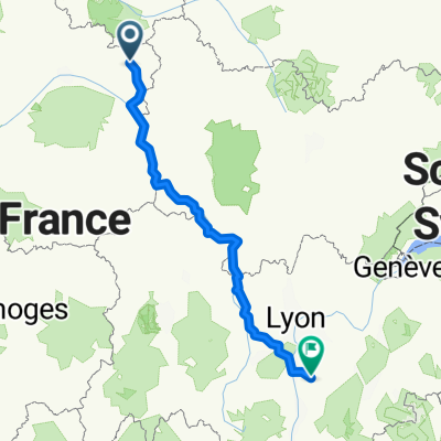
2009 Euro Tour -- Ride Day 18 — 13 July 2009 — 45200 Montargis to 28000 Chartres
Un itinéraire vélo au départ de Villemandeur, Centre-Val de Loire, France.
Vue d'ensemble
À propos du circuit
Although we’ve never ridden in Iowa, Kansas or Nebraska, today’s ride felt like we were in one of those states with its flat roads and endless fields of wheat. While there was some wind, it was mostly a crosswind that didn’t bother us particularly. So, despite the long 79 mile ride, it felt relatively easy. We were also lucky weather-wise. We rode under cloud cover the entire day and got lightly sprinkled on only once.
We passed through an area that felt like a forest of tall windmill electric generators. An informational sign where we stopped for a quick lunch said that the diameter of the blades is 80 meters and each weighs over 50 tons. They’re truly huge when seen up close. At one point, I counted and was able to see more than 50 of these giants at one time.
This has been a big trip for bee stings so far with two for me on previously days (hand and temple) and one for Helen today (just under her eye). Fortunately, no bad reactions from them—just some sharp pains.
During the day, we passed from the Loiret Department in the Centre Region into the Essonne department in the Île-de-France due to going through Angerville. We then passed to the Eure-et-Loir Department, which is back in the Centre Region.
Background:'
My wife and I have been doing self-supported tours in Western Europe (a majority in France) since 1993. This series of rides covers our 2009 4.5 month route through parts of France, Germany, Austria, Switzerland, and then back to France. Our beginning and ending point is near Chadurie (south of Angouleme) where our friends have a farm with Gites and Chambres d'Hotes.
We rode our Dawes touring bicycles purchased in 1993 heavily loaded with 700Cx32 tires. All of our riding was on paved roads, mostly with very little traffic. Pretty much the only unpaved sections were some bicycle paths in Germany and Austria. Sadly, that wasn't so great as Helen fell a number of times on the unpaved paths. Fortunately, though, no serious injury.
If any questions, feel free to email me at jeffkadet@netdiving.com
Jeff
- -:--
- Durée
- 120,5 km
- Distance
- 118 m
- Montée
- 58 m
- Descente
- ---
- Vit. moyenne
- ---
- Altitude max.

Qualité de l’itinéraire
Types de voies et surfaces le long de l’itinéraire
Types de routes
Route fréquentée
64,8 km
(54 %)
Route tranquille
26,1 km
(22 %)
surfaces
Pavé
25,3 km
(21 %)
Non pavé
2,7 km
(2 %)
Asphalte
25,3 km
(21 %)
Sol
2,6 km
(2 %)
Continuer avec Bikemap
Utilise, modifie ou télécharge cet itinéraire vélo
Tu veux parcourir 2009 Euro Tour -- Ride Day 18 — 13 July 2009 — 45200 Montargis to 28000 Chartres ou l’adapter à ton propre voyage ? Voici ce que tu peux faire avec cet itinéraire Bikemap :
Fonctionnalités gratuites
- Enregistre cet itinéraire comme favori ou dans une collection
- Copie et planifie ta propre version de cet itinéraire
- Divise-le en étapes pour créer un tour sur plusieurs jours
- Synchronise ton itinéraire avec Garmin ou Wahoo
Fonctionnalités Premium
Essai gratuit de 3 jours, ou paiement unique. En savoir plus sur Bikemap Premium.
- Navigue sur cet itinéraire sur iOS et Android
- Exporter un fichier GPX / KML de cet itinéraire
- Crée ton impression personnalisée (essaie-la gratuitement)
- Télécharge cet itinéraire pour la navigation hors ligne
Découvre plus de fonctionnalités Premium.
Obtiens Bikemap PremiumDe notre communauté
Villemandeur : Autres itinéraires populaires qui commencent ici
 2020 03 Montargis-Beaugency
- Distance
- 101 km
- Montée
- 98 m
- Descente
- 90 m
- Emplacement
- Villemandeur, Centre-Val de Loire, France
 Montargis-Nevers
- Distance
- 144,4 km
- Montée
- 450 m
- Descente
- 344 m
- Emplacement
- Villemandeur, Centre-Val de Loire, France
 Montargis - Combreux
- Distance
- 44,3 km
- Montée
- 137 m
- Descente
- 97 m
- Emplacement
- Villemandeur, Centre-Val de Loire, France
 2ème étape
- Distance
- 86,4 km
- Montée
- 77 m
- Descente
- 68 m
- Emplacement
- Villemandeur, Centre-Val de Loire, France
 ST2 Montargis sully sur loire 93km
- Distance
- 93,7 km
- Montée
- 145 m
- Descente
- 123 m
- Emplacement
- Villemandeur, Centre-Val de Loire, France
 6 ème étape : Montargis - Gueugnon : 227,5 km
- Distance
- 231,6 km
- Montée
- 906 m
- Descente
- 757 m
- Emplacement
- Villemandeur, Centre-Val de Loire, France
 2009 Euro Tour -- Ride Day 18 — 13 July 2009 — 45200 Montargis to 28000 Chartres
- Distance
- 120,5 km
- Montée
- 118 m
- Descente
- 58 m
- Emplacement
- Villemandeur, Centre-Val de Loire, France
 De Montargis à Hauterives
- Distance
- 509,2 km
- Montée
- 3 982 m
- Descente
- 3 769 m
- Emplacement
- Villemandeur, Centre-Val de Loire, France
Ouvre-la dans l’app