

2009 Euro Tour -- Ride Day 20 — 15 July 2009 — 27130 Verneuil-sur-Avre to 14100 Lisieux CLONED FROM ROUTE 1682062
Un itinéraire vélo au départ de Verneuil-sur-Avre, Normandie, France.
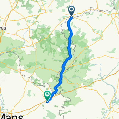
Vue d'ensemble
À propos du circuit
Belle sortie aujourd'hui même si nous avons eu de forts vents de face. Heureusement, dans la seconde moitié de la sortie, nous avons eu une variété de terrains et d'excellentes routes. La D137 avait une montée terrible qui méritait au moins deux flèches au lieu de l'unique flèche indiquée sur la carte. Juste après la montée, alors que nous pédalions le long de la D613 en direction de l'Etap, il a commencé à pleuvoir comme la veille juste avant d'arriver à notre destination. Au cours de la journée, nous avons traversé pendant de courtes périodes le département de l'Eure dans la région Haute-Normandie pour entrer dans le département de l'Orne dans la région Basse-Normandie. Finalement, nous avons quitté le département de l'Eure pour entrer dans le département du Calvados, qui se situe également en Basse-Normandie. Contexte : Ma femme et moi faisons des tours à vélo en autonomie en Europe de l'Ouest (principalement en France) depuis 1993. Cette série de sorties couvre notre itinéraire de 4,5 mois en 2009 à travers certaines régions de France, Allemagne, Autriche, Suisse, puis retour en France. Notre point de départ et d'arrivée se situe près de Chadurie (au sud d'Angoulême) où nos amis ont une ferme avec des Gîtes et Chambres d'Hôtes. Nous avons roulé sur nos vélos de tourisme Dawes achetés en 1993, lourdement chargés avec des pneus 700Cx32. Toute notre randonnée s'est déroulée sur des routes pavées, pour la plupart peu fréquentées. Pratiquement les seuls tronçons non pavés étaient quelques pistes cyclables en Allemagne et en Autriche. Malheureusement, ce n'était pas idéal car Helen est tombée plusieurs fois sur les chemins non pavés. Heureusement, aucune blessure grave. Pour toute question, n'hésitez pas à m'envoyer un e-mail à jeffkadet@netdiving.com. Jeff
- -:--
- Durée
- 80,4 km
- Distance
- 250 m
- Montée
- 281 m
- Descente
- ---
- Vit. moyenne
- ---
- Altitude max.

Qualité de l’itinéraire
Types de voies et surfaces le long de l’itinéraire
Types de routes
Route
18,5 km
(23 %)
Route tranquille
15,3 km
(19 %)
surfaces
Pavé
16,9 km
(21 %)
Non pavé
0,8 km
(1 %)
Asphalte
16,9 km
(21 %)
Sol
0,8 km
(1 %)
Indéfini
62,7 km
(78 %)
Continuer avec Bikemap
Utilise, modifie ou télécharge cet itinéraire vélo
Tu veux parcourir 2009 Euro Tour -- Ride Day 20 — 15 July 2009 — 27130 Verneuil-sur-Avre to 14100 Lisieux CLONED FROM ROUTE 1682062 ou l’adapter à ton propre voyage ? Voici ce que tu peux faire avec cet itinéraire Bikemap :
Fonctionnalités gratuites
- Enregistre cet itinéraire comme favori ou dans une collection
- Copie et planifie ta propre version de cet itinéraire
- Divise-le en étapes pour créer un tour sur plusieurs jours
- Synchronise ton itinéraire avec Garmin ou Wahoo
Fonctionnalités Premium
Essai gratuit de 3 jours, ou paiement unique. En savoir plus sur Bikemap Premium.
- Navigue sur cet itinéraire sur iOS et Android
- Exporter un fichier GPX / KML de cet itinéraire
- Crée ton impression personnalisée (essaie-la gratuitement)
- Télécharge cet itinéraire pour la navigation hors ligne
Découvre plus de fonctionnalités Premium.
Obtiens Bikemap PremiumDe notre communauté
Verneuil-sur-Avre : Autres itinéraires populaires qui commencent ici
 12–72 Route de Mortagne, Verneuil d'Avre et d'Iton à Les Barils
- Distance
- 9,3 km
- Montée
- 164 m
- Descente
- 142 m
- Emplacement
- Verneuil-sur-Avre, Normandie, France
 Verneuil sur Avre - La Fresnaie fayel
- Distance
- 63 km
- Montée
- 424 m
- Descente
- 397 m
- Emplacement
- Verneuil-sur-Avre, Normandie, France
 De Place Saint-Jean 151, Verneuil d'Avre et d'Iton à Grande Rue 47, Le Gault-Perche
- Distance
- 100,5 km
- Montée
- 879 m
- Descente
- 841 m
- Emplacement
- Verneuil-sur-Avre, Normandie, France
 V2 Verneuil-s-Arve / Paris 140km
- Distance
- 140,7 km
- Montée
- 361 m
- Descente
- 475 m
- Emplacement
- Verneuil-sur-Avre, Normandie, France
 Verneuil - Saint Sylvestre de Cormeilles
- Distance
- 93,5 km
- Montée
- 168 m
- Descente
- 203 m
- Emplacement
- Verneuil-sur-Avre, Normandie, France
 Verneuil-sur-Avre - Cherré
- Distance
- 84,4 km
- Montée
- 629 m
- Descente
- 705 m
- Emplacement
- Verneuil-sur-Avre, Normandie, France
 2009 Euro Tour -- Ride Day 20 — 15 July 2009 — 27130 Verneuil-sur-Avre to 14100 Lisieux CLONED FROM ROUTE 1682062
- Distance
- 80,4 km
- Montée
- 250 m
- Descente
- 281 m
- Emplacement
- Verneuil-sur-Avre, Normandie, France
 Verneuil-Irai
- Distance
- 24,9 km
- Montée
- 101 m
- Descente
- 43 m
- Emplacement
- Verneuil-sur-Avre, Normandie, France
Ouvre-la dans l’app