
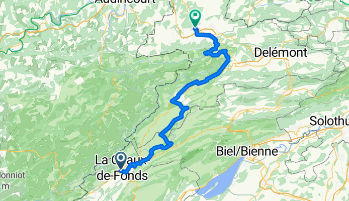
La Chaux-de-Fonds to Porrentruy
Un itinéraire vélo au départ de La Chaux-de-Fonds, Canton de Neuchâtel, Suisse.
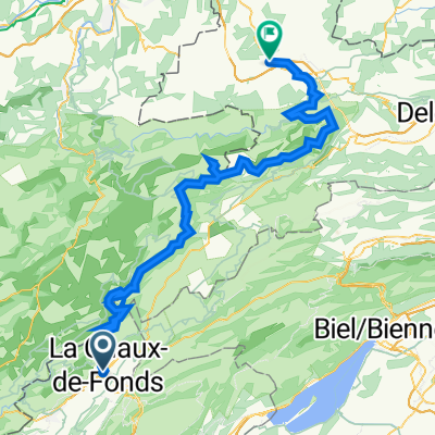
Vue d'ensemble
À propos du circuit
- 4 h 55 min
- Durée
- 81,2 km
- Distance
- 1 431 m
- Montée
- 1 997 m
- Descente
- 16,5 km/h
- Vit. moyenne
- 1 248 m
- Altitude max.

Photos de l’itinéraire

Qualité de l’itinéraire
Types de voies et surfaces le long de l’itinéraire
Types de routes
Route tranquille
52 km
(64 %)
Route
8,1 km
(10 %)
surfaces
Pavé
48,7 km
(60 %)
Non pavé
3,2 km
(4 %)
Asphalte
41,4 km
(51 %)
Pavé (non défini)
7,3 km
(9 %)
Points forts de l’itinéraire
Points d’intérêt le long de l’itinéraire
Point d'intérêt après 19,7 km
Observatoire Astronomique de Mont-Soleil
Point d'intérêt après 33,2 km
Etang de la Gruère
Point d'intérêt après 35,8 km
Etang des Royes
Point d'intérêt après 62,4 km
St-Ursanne
Point d'intérêt après 62,4 km
Cloître
Point d'intérêt après 62,5 km
Pont Saint-Jean The small town of St-Ursanne, which annually welcomes far more tourists than it has inhabitants, can be entered through three town gates. The entrance from the south over the bridge and through the Porte St-Jean is very impressive. A statue of St. John of Nepomuk, patron saint of all bridges, stands on one of the abutments. His many other «commitments» as patron saint of confessors, rafters, millers, priests and mariners may have led to the fact that not all bridges could be saved from destruction. A first bridge must have stood around 1440. It can be assumed that it was also built of wood, as was one known from an earlier 16th century depiction of the town. Chroniclers reported that the winter in 1670 was so cold that even the wine in the cellars froze. At that time the wooden bridge was destroyed by ice flowing down the Doubs. The bridge subsequently built in 1728/29 by master builder Brunet to plans by Advocate Humbert, was adorned by the figure of Nepomuk, who appears to gaze up river to the site of the former bridge.
Point d'intérêt après 62,6 km
Viewpoint
Point d'intérêt après 70,8 km
Col de la Croix
Continuer avec Bikemap
Utilise, modifie ou télécharge cet itinéraire vélo
Tu veux parcourir La Chaux-de-Fonds to Porrentruy ou l’adapter à ton propre voyage ? Voici ce que tu peux faire avec cet itinéraire Bikemap :
Fonctionnalités gratuites
- Enregistre cet itinéraire comme favori ou dans une collection
- Copie et planifie ta propre version de cet itinéraire
- Divise-le en étapes pour créer un tour sur plusieurs jours
- Synchronise ton itinéraire avec Garmin ou Wahoo
Fonctionnalités Premium
Essai gratuit de 3 jours, ou paiement unique. En savoir plus sur Bikemap Premium.
- Navigue sur cet itinéraire sur iOS et Android
- Exporter un fichier GPX / KML de cet itinéraire
- Crée ton impression personnalisée (essaie-la gratuitement)
- Télécharge cet itinéraire pour la navigation hors ligne
Découvre plus de fonctionnalités Premium.
Obtiens Bikemap PremiumDe notre communauté
La Chaux-de-Fonds : Autres itinéraires populaires qui commencent ici
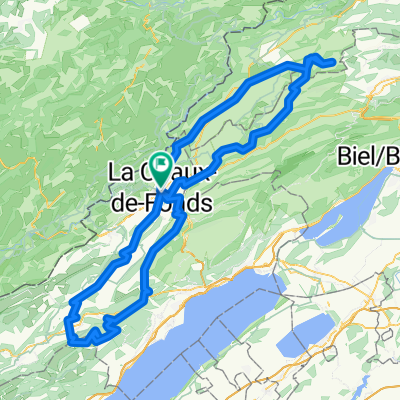
 petite tour du matin
- Distance
- 30,7 km
- Montée
- 1 163 m
- Descente
- 1 156 m
- Emplacement
- La Chaux-de-Fonds, Canton de Neuchâtel, Suisse
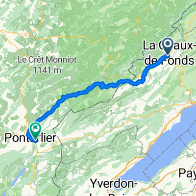 01 Route nach Pontarlier
- Distance
- 58,5 km
- Montée
- 1 054 m
- Descente
- 1 181 m
- Emplacement
- La Chaux-de-Fonds, Canton de Neuchâtel, Suisse
 La Chaux-de-Fonds -Creux du VAn
- Distance
- 156,3 km
- Montée
- 3 940 m
- Descente
- 3 940 m
- Emplacement
- La Chaux-de-Fonds, Canton de Neuchâtel, Suisse
 Route in La Chaux-de-Fonds
- Distance
- 90,8 km
- Montée
- 2 563 m
- Descente
- 2 565 m
- Emplacement
- La Chaux-de-Fonds, Canton de Neuchâtel, Suisse
 2021 La Chaux-de-Fonds - Porrentruy
- Distance
- 312 km
- Montée
- 495 m
- Descente
- 1 070 m
- Emplacement
- La Chaux-de-Fonds, Canton de Neuchâtel, Suisse
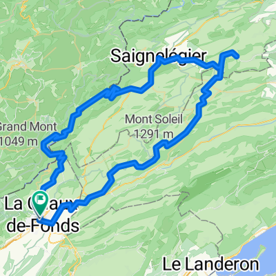
 La Chaux-de-Fonds - Tête-de-Ran
- Distance
- 19,5 km
- Montée
- 597 m
- Descente
- 597 m
- Emplacement
- La Chaux-de-Fonds, Canton de Neuchâtel, Suisse
 la Ferrière
- Distance
- 28,7 km
- Montée
- 519 m
- Descente
- 515 m
- Emplacement
- La Chaux-de-Fonds, Canton de Neuchâtel, Suisse
 La Chaux-des-Fonds nach Porountruy
- Distance
- 86,9 km
- Montée
- 1 912 m
- Descente
- 2 482 m
- Emplacement
- La Chaux-de-Fonds, Canton de Neuchâtel, Suisse
Ouvre-la dans l’app