
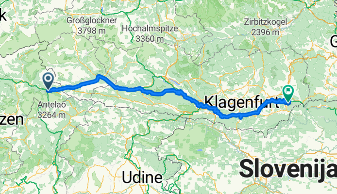

11 De Toblach a Lienz
- 55 km
- 491 m
- 1 020 m
- Dobbiaco, Trentin-Haut-Adige, Italie
Un itinéraire vélo au départ de Dobbiaco, Trentin-Haut-Adige, Italie.
Vue d'ensemble
More about the Drava Cycle Route:
https://www.cyclingthread.com/cycling-in-austria-drava-cycle-route-in-carinthia
The Drava Cycle Route (Drauradweg) is one of only four European routes awarded the top five-star rating by the ADFC, and its central section through Carinthia shows off some of Austrias most beautiful summer scenery. The full route stretches for about 510 kilometers from Dobbiaco in Italy via Lienz, Villach, Ferlach and Völkermarkt to Aich/Dob in Austria. In Carinthia you ride on well-maintained cycling roads, past lakes and rivers, with views of mountains and stops in historic towns. A highlight is the cycling path that runs 100 meters above the river under the Jauntalbrücke railway bridge. The infrastructure is excellent, with clear signage, bike-friendly accommodation and services coordinated by the Drava Route Hosts Association. Most of the route is easy and flat along the Drava valley, though sporty riders can add climbs like the Weissensee. Altogether the Drava Cycle Route combines scenery, comfort and variety, making it a great choice for a summer cycling trip.
créé il y a 7 mois


Qualité de l’itinéraire
Piste cyclable
106,7 km
37 %
Route forestière
63,4 km
22 %
Pavé
175,9 km
(61 %)
Non pavé
75 km
(26 %)
Asphalte
173 km
60 %
Gravier
54,8 km
19 %
Continuer avec Bikemap
Tu veux parcourir Drava Cycle Route - Toblach to Aich/Dob ou l’adapter à ton propre voyage ? Voici ce que tu peux faire avec cet itinéraire Bikemap :
Essai gratuit de 3 jours, ou paiement unique. En savoir plus sur Bikemap Premium.
Découvre plus de fonctionnalités Premium.
Obtiens Bikemap PremiumDe notre communauté
Ouvre-la dans l’app


