
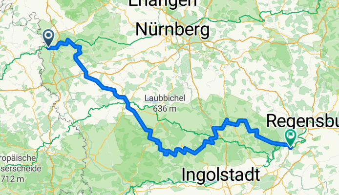
Tauber-Altmühl Cycle Route - Rothenburg ob der Tauber to Kelheim
Un itinéraire vélo au départ de Rothenburg ob der Tauber, Bavière, Allemagne.
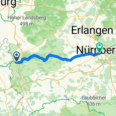
Vue d'ensemble
À propos du circuit
Plus d'informations sur le Tauber-Altmühl Radweg:
https://www.cyclingthread.com/franconia-and-tauber-altmuhl-radweg-perfect-german-getaway
Le Tauber-Altmühl Radweg en Franconie est l'un des itinéraires cyclables les plus fascinants d'Allemagne, traversant les vallées des rivières Tauber et Altmühl et les paysages rocheux du Jura franconien. Son atmosphère romantique est renforcée par des villes médiévales, Rothenburg ob der Tauber se distinguant comme l'une des principales attractions du pays. L'itinéraire commence à Wertheim, passe par Rothenburg et, après avoir franchi la ligne de partage des eaux européenne, suit l'Altmühl jusqu'à Kelheim, où la rivière rejoint le Danube. La section de la Tauber fait environ 100 km, tandis que l'Altmühl ajoute environ 250 km, offrant des expériences variées. Les surfaces vont de l'asphalte lisse à des chemins de gravier qui s'intègrent bien au paysage jurassien, bien qu'ils soient moins confortables. En chemin, les cyclistes peuvent observer des formations géologiques comme le Burgstein, des ponts historiques à Ornbau et le Musée du Jura dans la forteresse Willibaldsburg à Eichstätt. Dans l'ensemble, l'itinéraire combine paysages, histoire et bonne infrastructure, ce qui en fait un excellent choix pour un long week-end ou des vacances à vélo plus longues en Franconie.
- 15 h 43 min
- Durée
- 252,2 km
- Distance
- 1 118 m
- Montée
- 1 200 m
- Descente
- 16 km/h
- Vit. moyenne
- 510 m
- Altitude max.

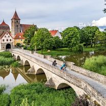
Photos de l’itinéraire


Continuer avec Bikemap
Utilise, modifie ou télécharge cet itinéraire vélo
Tu veux parcourir Tauber-Altmühl Cycle Route - Rothenburg ob der Tauber to Kelheim ou l’adapter à ton propre voyage ? Voici ce que tu peux faire avec cet itinéraire Bikemap :
Fonctionnalités gratuites
- Enregistre cet itinéraire comme favori ou dans une collection
- Copie et planifie ta propre version de cet itinéraire
- Divise-le en étapes pour créer un tour sur plusieurs jours
- Synchronise ton itinéraire avec Garmin ou Wahoo
Fonctionnalités Premium
Essai gratuit de 3 jours, ou paiement unique. En savoir plus sur Bikemap Premium.
- Navigue sur cet itinéraire sur iOS et Android
- Exporter un fichier GPX / KML de cet itinéraire
- Crée ton impression personnalisée (essaie-la gratuitement)
- Télécharge cet itinéraire pour la navigation hors ligne
Découvre plus de fonctionnalités Premium.
Obtiens Bikemap PremiumDe notre communauté
Rothenburg ob der Tauber : Autres itinéraires populaires qui commencent ici
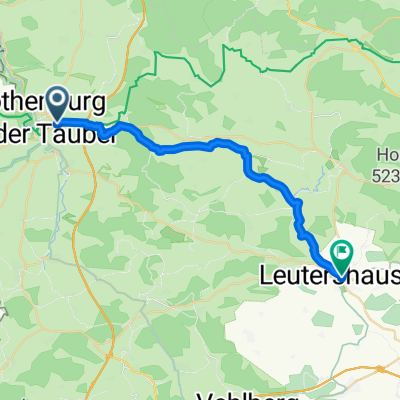 Rothenburg ob der Tauber nach Leutershausen
- Distance
- 23,3 km
- Montée
- 214 m
- Descente
- 211 m
- Emplacement
- Rothenburg ob der Tauber, Bavière, Allemagne
 Tauber-Altmühl Cycle Route - Rothenburg ob der Tauber to Kelheim
- Distance
- 252,2 km
- Montée
- 1 118 m
- Descente
- 1 200 m
- Emplacement
- Rothenburg ob der Tauber, Bavière, Allemagne
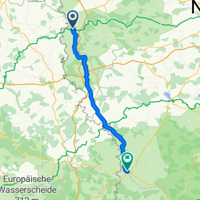
 altmühltal
- Distance
- 137,4 km
- Montée
- 496 m
- Descente
- 540 m
- Emplacement
- Rothenburg ob der Tauber, Bavière, Allemagne
 Rothenburg-Tauberquelle
- Distance
- 44,7 km
- Montée
- 278 m
- Descente
- 278 m
- Emplacement
- Rothenburg ob der Tauber, Bavière, Allemagne
 Rothenburg ob der Tauber - Nördlingen
- Distance
- 79,2 km
- Montée
- 541 m
- Descente
- 530 m
- Emplacement
- Rothenburg ob der Tauber, Bavière, Allemagne
 Sat. 16th
- Distance
- 81,5 km
- Montée
- 593 m
- Descente
- 701 m
- Emplacement
- Rothenburg ob der Tauber, Bavière, Allemagne
 Abendrunde über die Frankenhöhe
- Distance
- 18,2 km
- Montée
- 146 m
- Descente
- 170 m
- Emplacement
- Rothenburg ob der Tauber, Bavière, Allemagne
 Taubertal-Panorama
- Distance
- 52,4 km
- Montée
- 733 m
- Descente
- 895 m
- Emplacement
- Rothenburg ob der Tauber, Bavière, Allemagne
Ouvre-la dans l’app