
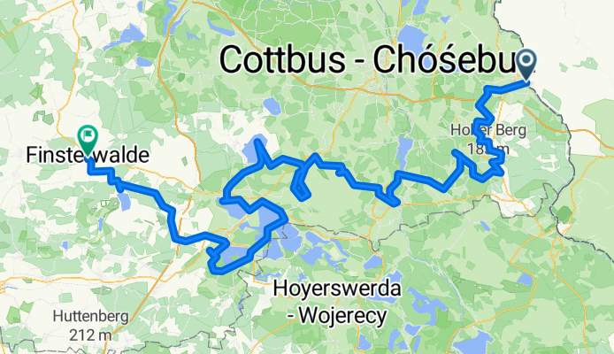
Lower Lusatia Mining Route - Forst to Finsterwalde
Un itinéraire vélo au départ de Brody, voïvodie de Lubusz, Pologne.
Vue d'ensemble
À propos du circuit
Le pays lacustre de Lusace, au sud du Brandebourg, est une ancienne zone d'extraction de lignite qui est désormais en train d'être transformée en région touristique avec des lacs artificiels et de nouveaux itinéraires cyclables. Au centre se trouve la Route minière de Basse-Lusace, une boucle cyclable de plus de 400 kilomètres qui traverse des paysages autrefois dominés par les mines à ciel ouvert. L'itinéraire relie des villes comme Forst, Spremberg, Großräschener See, Senftenberg et Finsterwalde, et la portion couverte en mai mesurait environ 200 kilomètres. En chemin, les cyclistes peuvent observer un mélange de patrimoine industriel et de nouvelle nature, des énormes machines d'extraction comme la F60 (pont convoyeur) aux points de vue modernes comme la tour 'Rusty Nail'. Il y a aussi des arrêts uniques, notamment le jardin de roses de Forst, une ancienne briqueterie et une chocolaterie artisanale. Les liaisons ferroviaires rendent le voyage flexible, avec des trains régionaux reliant des lieux comme Finsterwalde et Forst. Dans l'ensemble, la Route minière de Basse-Lusace offre une expérience particulière, montrant comment un paysage minier peut devenir un pays de lacs propice au vélo et aux loisirs.
- 12 h 16 min
- Durée
- 194,7 km
- Distance
- 1 210 m
- Montée
- 1 177 m
- Descente
- 15,9 km/h
- Vit. moyenne
- 176 m
- Altitude max.

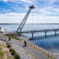
Photos de l’itinéraire


Continuer avec Bikemap
Utilise, modifie ou télécharge cet itinéraire vélo
Tu veux parcourir Lower Lusatia Mining Route - Forst to Finsterwalde ou l’adapter à ton propre voyage ? Voici ce que tu peux faire avec cet itinéraire Bikemap :
Fonctionnalités gratuites
- Enregistre cet itinéraire comme favori ou dans une collection
- Copie et planifie ta propre version de cet itinéraire
- Divise-le en étapes pour créer un tour sur plusieurs jours
- Synchronise ton itinéraire avec Garmin ou Wahoo
Fonctionnalités Premium
Essai gratuit de 3 jours, ou paiement unique. En savoir plus sur Bikemap Premium.
- Navigue sur cet itinéraire sur iOS et Android
- Exporter un fichier GPX / KML de cet itinéraire
- Crée ton impression personnalisée (essaie-la gratuitement)
- Télécharge cet itinéraire pour la navigation hors ligne
Découvre plus de fonctionnalités Premium.
Obtiens Bikemap PremiumDe notre communauté
Brody : Autres itinéraires populaires qui commencent ici
 Lower Lusatia Mining Route - Forst to Finsterwalde
- Distance
- 194,7 km
- Montée
- 1 210 m
- Descente
- 1 177 m
- Emplacement
- Brody, voïvodie de Lubusz, Pologne
 Skater Stecken Forst Lausitz am Kegeldamm
- Distance
- 1,2 km
- Montée
- 8 m
- Descente
- 8 m
- Emplacement
- Brody, voïvodie de Lubusz, Pologne
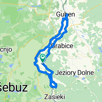 strzegów-forst-Gubin-strzegów CLONED FROM ROUTE 1417232
- Distance
- 58,8 km
- Montée
- 120 m
- Descente
- 118 m
- Emplacement
- Brody, voïvodie de Lubusz, Pologne
 Berlin - Prag Etappe 03 Brody - Klein Priebus
- Distance
- 49,3 km
- Montée
- 220 m
- Descente
- 164 m
- Emplacement
- Brody, voïvodie de Lubusz, Pologne
 Von Forst (Lausitz) bis Bad Muskau
- Distance
- 29,1 km
- Montée
- 223 m
- Descente
- 182 m
- Emplacement
- Brody, voïvodie de Lubusz, Pologne
 Oder-Neiße Part 2
- Distance
- 77,5 km
- Montée
- 80 m
- Descente
- 129 m
- Emplacement
- Brody, voïvodie de Lubusz, Pologne
 2012-10-18 Forst-Eisenhüttenstadt
- Distance
- 130,6 km
- Montée
- 100 m
- Descente
- 101 m
- Emplacement
- Brody, voïvodie de Lubusz, Pologne
 Skater-Strecke Forst Guben Tagestour hin und zurück
- Distance
- 33,4 km
- Montée
- 81 m
- Descente
- 116 m
- Emplacement
- Brody, voïvodie de Lubusz, Pologne
Ouvre-la dans l’app