
Chemin de la Maladrerie, Noé nach Rue Roger, Foix
Un itinéraire vélo au départ de Gourdan-Polignan, Occitanie, France.
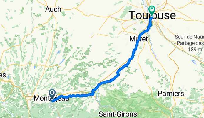
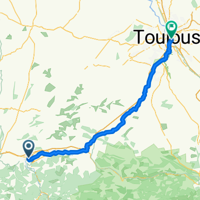
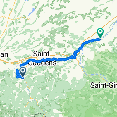
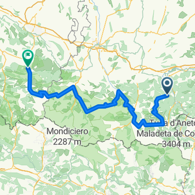
Vue d'ensemble
À propos du circuit
Embark on a scenic cycling adventure from Noé to Rue Roger in Foix. This route spans 117.6 km, offering a delightful mix of paved and unpaved surfaces. As you pedal, you'll ascend 1262 meters and descend 1066 meters, with the highest point reaching 518 meters.
The journey is dotted with a variety of terrains: enjoy the thrill of loose gravel paths, smooth asphalt roads, and rugged trails. A significant portion of the route follows the national bike network, providing a stable and reliable path for cyclists.
Whether you're a seasoned cyclist or a casual rider, this route promises a rewarding experience with its diverse landscapes and well-maintained paths. So gear up and set off on this exciting cycling escapade!
Généré par l’IA
- 7 h
- Durée
- 122,4 km
- Distance
- 373 m
- Montée
- 642 m
- Descente
- 17,5 km/h
- Vit. moyenne
- 433 m
- Altitude max.

Qualité de l’itinéraire
Types de voies et surfaces le long de l’itinéraire
Types de routes
Route tranquille
58,7 km
(48 %)
Route
39,2 km
(32 %)
surfaces
Pavé
58,7 km
(48 %)
Asphalte
52,6 km
(43 %)
Pavé (non défini)
4,9 km
(4 %)
Continuer avec Bikemap
Utilise, modifie ou télécharge cet itinéraire vélo
Tu veux parcourir Chemin de la Maladrerie, Noé nach Rue Roger, Foix ou l’adapter à ton propre voyage ? Voici ce que tu peux faire avec cet itinéraire Bikemap :
Fonctionnalités gratuites
- Enregistre cet itinéraire comme favori ou dans une collection
- Copie et planifie ta propre version de cet itinéraire
- Divise-le en étapes pour créer un tour sur plusieurs jours
- Synchronise ton itinéraire avec Garmin ou Wahoo
Fonctionnalités Premium
Essai gratuit de 3 jours, ou paiement unique. En savoir plus sur Bikemap Premium.
- Navigue sur cet itinéraire sur iOS et Android
- Exporter un fichier GPX / KML de cet itinéraire
- Crée ton impression personnalisée (essaie-la gratuitement)
- Télécharge cet itinéraire pour la navigation hors ligne
Découvre plus de fonctionnalités Premium.
Obtiens Bikemap PremiumDe notre communauté
Gourdan-Polignan : Autres itinéraires populaires qui commencent ici
 Chemin de la Maladrerie, Noé nach Rue Roger, Foix
- Distance
- 122,4 km
- Montée
- 373 m
- Descente
- 642 m
- Emplacement
- Gourdan-Polignan, Occitanie, France
 1-Barbazan-Bales-Bagneres-Barbazan
- Distance
- 89,8 km
- Montée
- 1 488 m
- Descente
- 1 487 m
- Emplacement
- Gourdan-Polignan, Occitanie, France
 Col des Ares Loop from Fronsac
- Distance
- 49,9 km
- Montée
- 673 m
- Descente
- 666 m
- Emplacement
- Gourdan-Polignan, Occitanie, France
 Gourdan-Polignan - Cazères
- Distance
- 70,5 km
- Montée
- 411 m
- Descente
- 625 m
- Emplacement
- Gourdan-Polignan, Occitanie, France
 Sortie13072017
- Distance
- 70,2 km
- Montée
- 1 347 m
- Descente
- 1 348 m
- Emplacement
- Gourdan-Polignan, Occitanie, France
 France Ultime : Arudy - Mauléon-Barousse
- Distance
- 218,2 km
- Montée
- 5 387 m
- Descente
- 5 573 m
- Emplacement
- Gourdan-Polignan, Occitanie, France
 1988 Motorrad Spanien
- Distance
- 5 326,8 km
- Montée
- 9 049 m
- Descente
- 9 476 m
- Emplacement
- Gourdan-Polignan, Occitanie, France
 cols mythiques des pyrénnées
- Distance
- 245,6 km
- Montée
- 5 213 m
- Descente
- 5 621 m
- Emplacement
- Gourdan-Polignan, Occitanie, France
Ouvre-la dans l’app