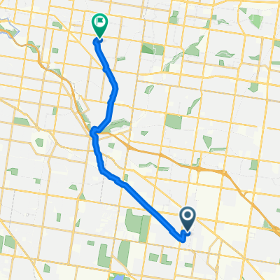
Clayton Rd, Clayton to Nepean Hwy, Moorabbin
- 10,6 km
- 43 m
- 72 m
- Clayton, Victoria, Australie
Un itinéraire vélo au départ de Clayton, Victoria, Australie.
Vue d'ensemble
Embark on a delightful cycling adventure along this scenic route that meanders through picturesque landscapes. As you begin your journey, the route gently ascends, offering a rewarding challenge with an elevation gain of just 44 meters. Enjoy the panoramic views as you navigate through rolling hills and open fields.
The route then transitions into a smooth descent of 72 meters, providing a welcome respite and a chance to soak in the serene surroundings. The terrain remains mostly flat, ensuring a comfortable ride for all levels of cyclists.
As you reach the peak, the elevation reaches a maximum of 70 meters, offering a brief moment of elevation before the route descends back towards the finish. This balanced mix of climbs and descents makes for an enjoyable and engaging ride, perfect for both leisurely rides and those looking for a moderate workout.
Whether you're cycling solo or with friends, this route promises a pleasant experience with its diverse terrain and scenic beauty.
Généré par l’IA
créé il y a 4 mois
Qualité de l’itinéraire
Route tranquille
6,7 km
60 %
Piste cyclable
1,1 km
10 %
Pavé
8,9 km
(79 %)
Non pavé
1,1 km
(10 %)
Pavé (non défini)
5,6 km
50 %
Asphalte
2,8 km
25 %
Continuer avec Bikemap
Tu veux parcourir Haughton Rd, Oakleigh to Nepean Hwy, Moorabbin ou l’adapter à ton propre voyage ? Voici ce que tu peux faire avec cet itinéraire Bikemap :
Essai gratuit de 3 jours, ou paiement unique. En savoir plus sur Bikemap Premium.
Découvre plus de fonctionnalités Premium.
Obtiens Bikemap PremiumDe notre communauté
Ouvre-la dans l’app